
Navigation
Install the app
How to install the app on iOS
Follow along with the video below to see how to install our site as a web app on your home screen.
Note: This feature may not be available in some browsers.
More options
-
Welcome to TalkWeather! We see you lurking around TalkWeather! Take the extra step and join us today to view attachments, see less ads and maybe even join the discussion. CLICK TO JOIN TALKWEATHER
You are using an out of date browser. It may not display this or other websites correctly.
You should upgrade or use an alternative browser.
You should upgrade or use an alternative browser.
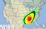
Severe WX Severe Threat 25 March 2021
- Thread starter MattPetrulli
- Start date
-
- Tags
- severe wx


KevinH
Member
I am going to need all of that to stay OUT of W central GA.Notwithstanding the differences in calculation of STP, there's a decent level of elevated parameters in North-Central Georgia (22Z Thursday).View attachment 7372View attachment 7370
Equus
Member
HRRR is ugly. This hasn't really been talked about as much as our other high end days, so really hope mets stress the situation tomorrow if things keep uptrending; afraid that 3/17 not dropping violent tors in big cities probably will make some people complacent with this one so soon after the strong wording of 3/17
happens every year at some point it feels likeHRRR is ugly. This hasn't really been talked about as much as our other high end days, so really hope mets stress the situation tomorrow if things keep uptrending; afraid that 3/17 not dropping violent tors in big cities probably will make some people complacent with this one so soon after the strong wording of 3/17
Shakespeare 2016
Member
Yes, it can make me so mad when a violent tornado is bearing down on a populated area and some people get mad because of a tornado warning or emergency cuts in on their TV program their watching. It is sad when these people end up dead because they were more concerned about their TV program instead of heeding the warning.happens every year at some point it feels like
Last edited:
MUSH
Member
Brad Travis explains in great detail......facebook. Very Good IMO
gangstonc
Member
Looking at north Alabama, do you guys think the atmosphere will be able to destabilize after the morning round of rain, or will the saturated atmosphere mean it will be rainy and relatively stable all day?
Equus
Member
Two moderate or higher risks in eight days and it's not even April. Yeesh.
Timhsv
Member
I noticed that the Euro this evening was about 5MB higher at the 00Z Friday time vs the 12Z run.
I guess I'm looking for fail modes vs looking at a serious, dreaded, tornadic event.
I guess I'm looking for fail modes vs looking at a serious, dreaded, tornadic event.
brianc33710
Member
Yeah, do we have 17 March part 2?Looking at north Alabama, do you guys think the atmosphere will be able to destabilize after the morning round of rain, or will the saturated atmosphere mean it will be rainy and relatively stable all day?
.png")


.png")
TuscWeathergrl
Member
After a super stressful week (unrelated to weather), I’m over here in Tuscaloosa trying to blow the threat back into Mississippi to give me a break lol. Anyways, I’m here to give people updates from this side of the state. AGAIN. It’s only been a week since the last tornado episode. This is giving me 2011 vibes (not the severity but the nonstop chaos). Explanation.. April 15th a tornado hit only a few miles from me, then obviously the 27th a way worse tornado (everyone knows so I’m not getting into specifics) hit even closer. Enough of my babbling, I’m going to actually read this thread now.
MetFromTheBlue
Member
This is by no means an attempt to hype things up but the 06z HRRR and 06z NAM 3km are imo the ceilings for this event. That is, long track, tornadic supercells arching from N MS/AL all the way to S IL. That is probably the ceiling. Now, will that verify? Time will tell. I don’t think it’s a stretch to say it could verify. Certainly guidance has been teetering on/off that kind of solution. The big picture view IMO says it is more than possible.
To the south, a plume of very steep lapse rates will over spread and likely partially cap off any convection prior to 17z. As the warm front surges northward, rapid destabilization will happen in its wake. Farther north, precip will likely hang around for longer. However the exceptionally strong dynamics of the upper level wave/jet will strongly cool the mid levels, leading to steep lapse rates aloft there as well. Wont need a lot of time or surface heating for recovery.
Rarely do setups go perfect like that, so I’m sure some part of the risk area will be modulated or even washed out. However, the potential is pretty sky high as overnight guidance is hinting.
The 06z NAM 3k and HRRR output pretty much just dropped my jaw to the floor. We’ll have to see how 12z model trends go, but we could be looking at some exceptionally strong instability-kinematic pairings over a much larger area than originally thought.
Equus
Member
06z HRRR, for what it's worth

Peter Griffin
Member
I think one possible factor will be the large amount of convection anticipated. You will probably have storms battling for space/environment and might choke each other out or congeal into a QLCS. The storms that are able to find themselves their own unhindered space are going to be problematic.
Not saying this is definitely how it will play out but a possibility. The situation looks very ugly regardless.
Not saying this is definitely how it will play out but a possibility. The situation looks very ugly regardless.
Last edited:
CheeselandSkies
Member
HRRR and 3K nam are printing very high ceiling events. What is the mitigating factors in this event to watch for? Last week the CAD won out, for north AL.
I would say the degree of convective "mess" in the warm sector, and whether the surface low deepens as much as some model runs have shown (the Euro, ironically, has backed off some AFTER the GFS started coming around to its earlier, deeper scenario).
Exact timing of the wave ejection still varies between models/runs, this will impact where/when storms fire and whether they can take advantage of the best parameter space. This in particular seems to have become a mitigating factor for most of our high-ceiling threats the last several years.
Last edited:
MetFromTheBlue
Member
If convection organizes north of the warm front you could reinforce the front, preventing northward retreat. If it persists south of the front (seems unlikely to me), you could dampen diurnal changes to instability.
I find both of those to be unlikely, but the northern half of the risk area will be cutting it close between end of precip and onset of dynamic forcing for ascent - the process of steepening lapse rates aloft and aiding the initiation of storms in the afternoon.
I find both of those to be unlikely, but the northern half of the risk area will be cutting it close between end of precip and onset of dynamic forcing for ascent - the process of steepening lapse rates aloft and aiding the initiation of storms in the afternoon.