
Yeah, the convection at the last frame entering NW AL just screams spin-ups.18z Euro View attachment 34293
Navigation
Install the app
How to install the app on iOS
Follow along with the video below to see how to install our site as a web app on your home screen.
Note: This feature may not be available in some browsers.
More options
-
Welcome to TalkWeather! We see you lurking around TalkWeather! Take the extra step and join us today to view attachments, see less ads and maybe even join the discussion. CLICK TO JOIN TALKWEATHER
You are using an out of date browser. It may not display this or other websites correctly.
You should upgrade or use an alternative browser.
You should upgrade or use an alternative browser.
00Z GFS remains mostly on-schedule, but after a day of slowing down and coming into alignment with the Euro, it's now speeding things up a bit. As a consequence, moisture gets more pinched off to the east. Who knows though, it'll probably flip 2 more times before things are said and done.

06z NAM first higher res model just about in range for the event...
Notably different trough progression to other models in that its a good few hours slower, especially compared to GFS. The timing is similar to the UKMET, which is arguably the highest end scenario of the global currently. The 06z run though, does seem to also develop the northern shortwave extending out the flow to the north, amplifying the trough - similar to the GFS but to a lesser degree. Still, the 300mb jet core is strong and impinges on the warm sector with close to zonal flow.

Warm sector is the largest of any model, probably due to the slower nature of the trough. Its only 18z, so hard to be sure, but this NAM run would likely end up being a higher-end outbreak with the potential for multiple intense tornadoes. Having said that, its a bit of an outlier - and the NAM has often in the past shown pretty aggressive D3-4 scenarios which end up not being exactly as modelled. So, is the beginning of a new trend in expected evolution, or the NAM doing the NAM things? We'll have to wait and see. Still at D4, plenty can and will change before the setup itself.
Notably different trough progression to other models in that its a good few hours slower, especially compared to GFS. The timing is similar to the UKMET, which is arguably the highest end scenario of the global currently. The 06z run though, does seem to also develop the northern shortwave extending out the flow to the north, amplifying the trough - similar to the GFS but to a lesser degree. Still, the 300mb jet core is strong and impinges on the warm sector with close to zonal flow.
Warm sector is the largest of any model, probably due to the slower nature of the trough. Its only 18z, so hard to be sure, but this NAM run would likely end up being a higher-end outbreak with the potential for multiple intense tornadoes. Having said that, its a bit of an outlier - and the NAM has often in the past shown pretty aggressive D3-4 scenarios which end up not being exactly as modelled. So, is the beginning of a new trend in expected evolution, or the NAM doing the NAM things? We'll have to wait and see. Still at D4, plenty can and will change before the setup itself.
.gif")
"Medium-range model output continues to indicate that strong
cyclogenesis will be underway to the lee of the Rockies by 12Z
Tuesday, as an intense mid/upper jet streak (probably including 100+
kt at 500 mb) noses northeast of the Texas Big Bend. The center of
an evolving broad and deep surface cyclone is generally forecast to
track from the central Great Plains through the lower Great Lakes
region by late Wednesday night, accompanied by a broad area of
intensifying lower-tropospheric wind fields. This probably will
include wind profiles characterized by strong deep-layer shear and
large, clockwise-curved low-level hodographs within the evolving
warm sector.
With guidance indicating an influx of lower/mid 60s F surface dew
points across at least the lower Mississippi Valley during the day
Tuesday, there appears considerable potential for sufficient
destabilization to support severe convection, including organizing
lines and supercells. However, uncertainties linger, perhaps
including some signal that some combination of low cloud cover,
limited surface heating and relatively warm, dry layers aloft with
modest lapse rates could impede destabilization. Variability among
the model output concerning the evolution of a number of synoptic
and sub-synoptic details could also considerably impact the extent
and location of stronger convective development.
In a broad sense, though, it still appears that the environment
centered across and just east of the lower Mississippi Valley will
become most conducive to thunderstorms potentially capable of
producing damaging straight-line winds and a few tornadoes Tuesday
into Tuesday night. This threat may wane by late Tuesday night
across the Tennessee Valley/eastern Gulf Coast states as Gulf
moisture return becomes cut off. However, an influx of low-level
moisture off the Atlantic might contribute to a rejuvenation strong
to severe thunderstorm potential ahead of an eastward advancing cold
front across parts of the southern and middle Atlantic Seaboard on
Wednesday."
tennessee storm chaser
Member
- Messages
- 1,877
- Reaction score
- 4,288
- Location
- jackson tennessee
- Special Affiliations
- SKYWARN® Volunteer
SPC gung ho keeping the better moisture back west …. See how that plays out

Justin Hindman
Member
- Messages
- 378
- Reaction score
- 1,165
- Location
- Gardendale Alabama
- Special Affiliations
- SKYWARN® Volunteer
- ARRL Member
12z nam has a rather robust paramter space over the ark/la/miss region.
3km SRH helicity at a whoppin 750-900 in East Lousianna with 1km at 450-500. Hodgraphs are massive. I don't really know the answer to this question but isn't there such a thing as too much shear?
3km SRH helicity at a whoppin 750-900 in East Lousianna with 1km at 450-500. Hodgraphs are massive. I don't really know the answer to this question but isn't there such a thing as too much shear?
Last edited:
tennessee storm chaser
Member
- Messages
- 1,877
- Reaction score
- 4,288
- Location
- jackson tennessee
- Special Affiliations
- SKYWARN® Volunteer
Yeah it can rip the storms apart actually12z nam has a rather robust paramter space over the ark/la/miss region.
3km SRH helicity at a whoppin 900 in East Lousianna with 1km at 500. Hodgraphs are massive. I don't really know the answer to this question but isn't there such a thing as too much shear?
Austin Dawg
Member
They just changed the forecast for severe weather here on Tuesday, with a 90% chance of storms. It is pretty rare for us for them to change the estimates this far in advance.
A fairly laterally constrained but robust environment depicted on the NAM. Don't 100% lean on it though, since NAM does weird things at that 84-hour range. However, of note is how far north the WS goes. CIPS values are just about as strong as I've ever seen them and really focus on lower MS. For AL and GA, big question is if dynamics will account for limited moisture return, and that remains to be seen. Would still play things on the safe side, especially in much of Alabama. In any case, could see this being a big problem-maker for parts of the Lower Mississippi Valley and Gulf Coast. JAN and LIX AFDs included below.


Tuesday: In response to Tuesday`s wave, a large low level jet will
overspread the area, accelerating Gulf moisture northward. While
there is some lingering dry air to the east of I-55, west of I-55
sees favorable trajectories from the south and higher dewpoints as a
result with dewpoints in the mid 60s. The aforementioned LLJ will
result in strong low level wind shear, with shear vectors out of the
SW around 50kts. This is more than ample for organized storms. The
strong wind fields result in large curved hodographs, favorable for
tornadoes. At this time, there is still a bit of uncertainty with
some failure modes. The primary limiting factor appears to be mode
with moisture tending to hug near the surface cold front and QLCS
mode favored. The pinched off warm sector could suppress discrete
supercell development ahead of the line. Should supercells develop,
they certainly would have a very favorable environment to tap into
to produce all hazards. Given the severe weather potential, there
has been an enhanced risk highlighted for areas west of I-55 with a
slight risk highlighted east. We continue to make adjustments as the
forecast evolves, so continue to check back for latest updates
We will focus more on the start of the new week coming. Monday,
skies will begin to fill with clouds once again as the old frontal
boundary over the gulf will kick back as a warm front and showers
form from moisture loading ahead of the next cold front. A weak sfc
low will follow the thermal boundary and decay as it moves east
Monday. There will be a few showers around Monday but not enough to
give more than a 10% chance of any one location getting wet. A very
strong upper trough will begin to dig southward Tue and this will
ignite a sfc low and frontal boundary with a line of strong/severe
storms all along it over central TX. This will evolve rapidly and
move east even faster. As we were discussing yesterday, timing is
the biggest issue with this system and models today did not
dissapoint in that arena. Models have sped this system up by 8 to 10
hours meaning it would come through much sooner than previously
thought. Timing continues to be the headache with this. This is the
only field that we have an issue with. All others carry high
confidence with them such as the speed of the line of storms being
25-30kt, a squall line of storms with severe potential weakening
southward along the line, and no flooding issues expected more than
ponding of the usual locations. The system will move fast enough to
be in and out relatively quick. Current timing brings the line of
storms into the CWA around or just after noon Tue, and yes this is a
lot different than midnight as it would put the line moving through
Baton Rouge during the early afternoon, New Orleans around sunset
and Pascagoula just after dark. Again, we will need to see this
remain for a few model runs and actually agree with most ensemble
members and other models before we can have a higher confidence
level with the timing. And this is yet another reason why one can`t
just pick any one model but instead look at all data, no matter how
crazy it may seem, to see how well it is initializing. The soonest
time that confidence will build in this system`s timing will be the
Sunday 12z model run. This is when the energy supporting this
feature will be sampled with the upper air network on the west coast
around southern Cali. We will continue to work on the timing since
this is the only real issue that continue to give the lowest
confidence levels at the moment. The other issue with this will be
winds ahead of the front. Confidence is very high with this too.
Southerly winds will be quite breezy Tue once the sun comes up and
mixing is acheived. Sustained winds could be 20-25mph with gusts 30-
35mph. We may issue a wind advisory for Tue since this is Mardi Gras
day and the height of the public being outdoors. These winds could
be an issue for some higher profiled "floats" that catch these winds
broad sided. These issues are especially heightened along streets of
cities between high rises due to the venturi effect causing winds to
speed up more than the average. High pressure will settle over the
area for the end of next week.
Euro downtrending for Tuesday, less instability.

Speeding up with too much convection in the warm sector.
tennessee storm chaser
Member
- Messages
- 1,877
- Reaction score
- 4,288
- Location
- jackson tennessee
- Special Affiliations
- SKYWARN® Volunteer
Yeah. I’m about ready search for the next one lolEuro downtrending for Tuesday, less instability.
tennessee storm chaser
Member
- Messages
- 1,877
- Reaction score
- 4,288
- Location
- jackson tennessee
- Special Affiliations
- SKYWARN® Volunteer
This pattern is way too progressive at the moment ….
Too early to go to the chopping block. If anything it'll still be a nasty high shear/low cape QLCS with spins ups for a some of our board members.Yeah. I’m about ready search for the next one lol


Needs to be colder aloft, unlike the 12z Euro, and more like the 12z GFS and NAM, to maximize potential here. The Euro's temperature aloft are pretty inhibitive of more substantial destabilization and some of it is due to too much convection.
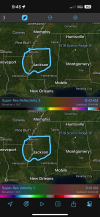
KevinH
Member
View attachment 34371
View attachment 34372
View attachment 34373
Needs to be colder aloft, unlike the 12z Euro, and more like the 12z GFS and NAM, to maximize potential here. The Euro's temperature aloft are pretty inhibitive of more substantial destabilization and some of it is due to too much convection.
I am sure it will flip flop again…
Tanner
Member
I’ve never been onboard with events with small windows for cellular activity and pinched off warm sectors. Hoping for the best outcome.
18z NAM is a bit weird lol. Two areas of convection prefrontals and a line I think...?