Equus
Member
Just crossed the North Little Rock path on I-40, narrow swath of shredded pines is pretty obvious

Follow along with the video below to see how to install our site as a web app on your home screen.
Note: This feature may not be available in some browsers.
Good lord those first two pictures.Very significant wind rowing feature for keota EF4. This thing was capable of doing something bad.
View attachment 19777View attachment 19778View attachment 19779View attachment 19780

We may have escaped a really significant outbreak with thankfully only one EF4View attachment 19782
Covington was high end
Very significant wind rowing feature for keota EF4. This thing was capable of doing something bad.
View attachment 19777View attachment 19778View attachment 19779View attachment 19780
Not sure I'd call that with so many surveys to go/preliminary.We may have escaped a really significant outbreak with thankfully only one EF4
Yeah…we’re still probably gonna see over 100 tornadoes by the end of it allNot sure I'd call that with so many surveys to go/preliminary.
Yeah, that’s a good point. I just re checked a few and some I thought were final were still preliminaryNot sure I'd call that with so many surveys to go/preliminary.
Major tornado damage near Purdy TN (McNairy Co.)
Asphalt scoured, homes completely demolished.
Major tornado damage near Purdy TN (McNairy Co.)
Asphalt scoured, homes completely demolished.
Looks like some additional small tornadoes will be added to the total up here. Will be intrigued by damage in Iowa county, since I was watching the radar pretty closely.
Depends on the condition of the road.What kind of winds does it take to rip asphalt from roads???
It was in a weird place radar wise, but I got a few screenshots off my phone when I was watching it on radar omega.DMX/DVN still have it all as one tornado all the way from Wapello County to northwest of Kalona in Johnson County. Hope it gets corrected soon...radar should tell the tale in addition to chaser video.
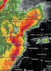
That reminds me, anyone save any radar grabs of the Iowa supercell? I neglected to do so in the heat of the moment.

It was in a weird place radar wise, but I got a few screenshots off my phone when I was watching it on radar omega.
View attachment 19785