• Welcome to TalkWeather!
    We see you lurking around TalkWeather! Take the extra step and join us today to view attachments, see less ads and maybe even join the discussion.
    CLICK TO JOIN TALKWEATHER
  • Current Tropical Systems
    Erin

Hurricane Erin

For a few hours, it was logging west-northwest like it was supposed to. The past hour, it's been moving due west again.
 
I feel like questions about EWRCs are hard to answer while the storm is happening and usually get answered when folks are able to see the whole track/system. We won't really know if it's failing or succeeding until the storm pulls together or weakens. Which isn't a very helpful answer, unfortunately.

That said, it looks like there's still plenty of convection where the new eyewall is trying to form, so it seems like it's still trying.

I'm just afraid it's converting all that intensity it had into a big, spread-out storm, which is why it's taking longer. But that's just based on my casual observations over time, not any real expertise or solid knowledge. But without land, colder water, or shear in the way, there shouldn't be too much to cause it to hiccough. Dry air, maybe? But I always struggle with telling dry air intrusion vs weirdness of EWRC.
 
What is with this EWRC taking this long? Is it actually failing somehow?
I'm not totally sure, but you're right, it is taking a long time. The radar and recon don't show a new eye wall taking over that I can tell, so it might indeed be failing.

EDIT: Also it looks to be wobbling south of west now. Again.

EDIT2: 2 AM advisory is out and Erin is now a CAT 3 at 125 mph.
 
Last edited:
The discussion on Erin this morning talks quite a bit about its structure and how the weakening is related to it trying to reorganize, rather than due to environmental issues. It's a really informative discussion, IMO:

Satellite and Doppler Radar data from San Juan indicate that Erin is going through some notable structural changes. The hurricane still has a small eye in radar images with a tight and closed eyewall. Beyond the small core, there are numerous convective rainbands that are expanding in all quadrants, with some indication of an outer eyewall beginning to take shape. Data from the Air Force Hurricane Hunters a few hours ago indicated that the peak winds have been decreasing, and the initial intensity is set at 110 kt using a blend of the latest satellite estimates. The outer bands to the south of the center are still affecting portions of the Virgin Islands, Puerto Rico, and the Dominican Republic. These bands are producing gusty winds and locally heavy rains. The Air Force and NOAA Hurricane Hunters are scheduled to investigate Erin again later this morning, and their data will provide a better assessment of the hurricane's intensity and structure.

Erin has been wobbling around, but it appears to be moving a little to the south of the previous track. The hurricane is still moving west-northwestward at 12 kt on the south side of a subtropical ridge. This ridge is expected to break down later today due to a series of troughs moving across the northwestern Atlantic. In response to the pattern change, Erin should gradually turn toward the north and eventually the northeast. This motion should take the core of Erin to the east of the Bahamas on Monday and then roughly midway between Bermuda and the east coast of the U.S. around the middle of the week. The NHC track forecast has been nudged to the west in the short term based on the initial motion and latest model guidance.

The quick weakening over the past 6 to 12 hours is associated with Erin's structural changes and not environmental conditions. Since the large-scale environment is expected to be favorable for about another day, re-strengthening is possible during that time period. However, it should be noted that predicting the intensity evolution from internal dynamics are challenging, and models often provide little reliability in their solutions. Beyond 24 to 36 hours, a broadening of the wind field and some increase in shear should cause a gradual decay in the peak winds. Regardless of the details, there is high confidence that Erin will remain a powerful hurricane during the next several days.

Erin is growing in size, and that trend is expected to continue over the next few days. The expanding wind field will result in rough ocean conditions over much of the western Atlantic. Given the track adjustments and increasing size, the government of the Bahamas has issued a Tropical Storm Warning for the Turks and Caicos Islands and a Tropical Storm Watch for the Southeast Bahamas.
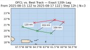
 
Some morning analysis.


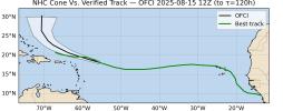
The Official track at a 5-day error is only 120 miles off currently, so we'll see if that continues. We can also see the steady WNW track now in place.

1755437425640.png


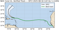
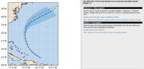
It's now outside the NHC Cone from 2 days ago to the south, which is likely why the Turks and Caicos now have tropical storm warnings.

1755437554245.png


It is hugging the south edge of the cone from yesterday morning as well. I imagine additional westward jogs are possible.
1755437624622.png


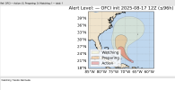
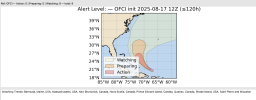
For Alert Levels, Bermuda should still be watching trends in 4 days, and on Day 5, places like the Northeast U.S. and Atlantic Canada need to watch trends as well, but not any strong chance of a direct hit.

1755437762321.png


1755437870282.png


Finally, a new graphic I've been working on. In the vein of the Alert Level, I wanted this to convey top-quality information but without all the numbers and bells and whistles. So here's what I cooked up. It uses a statistical clustering procedure to analyze and group the possible Pathways the model depicts and also shows any model outliers. The result is mostly numberless and doesn't use numeric probabilities openly and instead just conveys the message. I think this is key to public messaging.

As shown here, through 72 hours, the models are in great agreement on the path now (unlike a day or two ago). We'll see if any westward jogs are needed.

1755438038716.png
 
From the NHC discussion at 11 AM. North Carolina is now explicitly mentioned as needing to watch, and the key points say that strong winds and outcomes are possible there.

000
WTNT45 KNHC 171458
TCDAT5

Hurricane Erin Discussion Number 25
NWS National Hurricane Center Miami FL AL052025
1100 AM AST Sun Aug 17 2025

Erin's eye is no longer evident on satellite imagery and
observations from the Air Force Hurricane Hunters indicate that the
maximum winds are near 110 kt. The central pressure has risen a bit
this morning. This slight decrease in intensity is probably due to
an eyewall replacement in the inner core as reported by the
Hurricane Hunters and is likely a temporary short-term fluctuation.
The system remains a well-organized and dangerous major hurricane
with a impressively symmetric cloud pattern. Upper-level outflow is
strong over all quadrants of the system.

Based on fixes from the aircraft, San Juan radar, and satellite
images, the hurricane appears to be moving west-northwestward or
around 285/11 kt. The track forecast philosophy is about the same
as in previous advisories. Over the next couple of days, Erin is
expected to turn northward and move between two cells of the
mid-tropospheric subtropical high. The track guidance is in good
agreement on the northward turn but there are differences in how
close the hurricane will come to the U.S. east coast in the 72 hour
time frame. The new official forecast has been shifted a little to
the west at 3-4 days based on the model consensus. Some additional
adjustments to the forecast are possible in future advisories.

Erin should remain over very warm waters with moderate vertical wind
shear and in a moist low-to mid-level air mass during the next 48-72
hours. Therefore, some renewed increase in strength is expected
within the next couple of days. The NHC intensity forecast is in
good agreement with the latest corrected consensus model, HCCA, In
any event, Erin should remain a dangerous major hurricane through
the middle of this week.

Erin is growing in size, and that trend is expected to continue over
the next few days. The expanding wind field will result in rough
ocean conditions over much of the western Atlantic. It should be
noted that the 34- and 50-kt wind speed probabilities beyond 36
hours in the text and graphical products are likely underestimating
the risk of those winds occurring. This is because the forecast
wind field of Erin is considerably larger than average compared to
the wind field used to derive the wind speed probability product.

KEY MESSAGES:

1. Heavy rainfall will continue into Monday across Puerto Rico, but
is expected to diminish over the Virgin Islands later today.
Locally considerable flash and urban flooding, along with landslides
or mudslides, are possible.

2. Tropical storm conditions are expected in the Turks and Caicos
Islands and are possible in the Southeast Bahamas tonight and
Monday. Gusts to tropical storm force are possible in Erin's outer
rainbands in portions of Puerto Rico today and the central Bahamas
on Monday and Tuesday.

3. Erin is expected to produce life-threatening surf and rip
currents along the beaches of the Bahamas, much of the east coast of
the U.S., Bermuda, and Atlantic Canada during the next several days.

4. Interests along the North Carolina Outer Banks and Bermuda
should monitor the progress of Erin as there is a risk
of strong winds associated with the outer rainbands during the
middle part of the week.


FORECAST POSITIONS AND MAX WINDS

INIT 17/1500Z 21.0N 67.4W 110 KT 125 MPH
12H 18/0000Z 21.9N 68.8W 115 KT 130 MPH
24H 18/1200Z 23.1N 70.2W 125 KT 145 MPH
36H 19/0000Z 24.4N 71.3W 120 KT 140 MPH
48H 19/1200Z 25.9N 72.2W 115 KT 130 MPH
60H 20/0000Z 27.8N 72.6W 110 KT 125 MPH
72H 20/1200Z 30.0N 72.7W 105 KT 120 MPH
96H 21/1200Z 34.3N 70.4W 95 KT 110 MPH
120H 22/1200Z 39.0N 62.0W 85 KT 100 MPH

$$
Forecaster Pasch
 
Back
Top