Navigation
Install the app
How to install the app on iOS
Follow along with the video below to see how to install our site as a web app on your home screen.
Note: This feature may not be available in some browsers.
More options
-
Welcome to TalkWeather! We see you lurking around TalkWeather! Take the extra step and join us today to view attachments, see less ads and maybe even join the discussion. CLICK TO JOIN TALKWEATHER
You are using an out of date browser. It may not display this or other websites correctly.
You should upgrade or use an alternative browser.
You should upgrade or use an alternative browser.
Hurricane Erin
- Thread starter wx_guy
- Start date
TornadoFan
Member
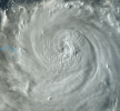
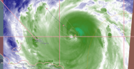
Looks like a new eye is trying to pop out.View attachment 46142
I always love the vis shots as the sun is going down. You can see so much structure.
KakashiHatake2000
Member
majorhurricane1703
Member
This system does not want to move north much as shifts continue west. I’m really wondering if models will get the timing of the northeast trough wrong if the northward turn delays by any amount. They struggled with how fast the trough in the northeast Atlantic lifted out having to adjust so any delay in that and if Erin is close to the Outer banks can easily bring impacts to the northeast. I think the model errors are getting overlooked some. I mean the shape of the trough could easily be less sharp as well. Yes as we know it is a very improbable scenario, but I argue if there is going to ever come a time where a system does something completely shocking against common thought and modeling, this is going to be it.
tornado examiner
Member
Erin the beautiful. Gonna turn into an annular major cane I hope while still avoiding everything.
- Thread starter
- #287
wx_guy
Member
- Messages
- 1,202
- Reaction score
- 4,315
- Location
- United States
- HAM Callsign
- KO4ZGH
- Special Affiliations
- SKYWARN® Volunteer
- ARRL Member
Looks like we won't get recon in tonight as Erin restrengthens. The one plane going in turned around and went back for some reason.
majorhurricane1703
Member
It went back because Erin scared them from a 200 mile shift west lol .Looks like we won't get recon in tonight as Erin restrengthens. The one plane going in turned around and went back for some reason.
KakashiHatake2000
Member
sak
Member
"mandatory" evacuation for dare county seems a little much. imo. i get it... there can be coastal flooding even if the thing stays well off shore...but....still...
lake.effect
Member
It's about to leave the forecast cone entirely...again.
Kds86z
Member
Ozonelayer
Member
First time watching the tropics. And wooh boy this is a heck of a first storm to watch.
Erin keeps tracking more westwardly than excpected. This (Obviously) puts the mainland United States at a higher risk. But is there a chance that it does make landfall? I don't know too much about hurricames, I'm more knowledgable about tornadoes.
Erin keeps tracking more westwardly than excpected. This (Obviously) puts the mainland United States at a higher risk. But is there a chance that it does make landfall? I don't know too much about hurricames, I'm more knowledgable about tornadoes.
majorhurricane1703
Member
First time watching the tropics. And wooh boy this is a heck of a first storm to watch.
Erin keeps tracking more westwardly than excpected. This (Obviously) puts the mainland United States at a higher risk. But is there a chance that it does make landfall? I don't know too much about hurricames, I'm more knowledgable about tornadoes.
Probably not directly, but I’m going to say this. There are some things that raise red flags on satellite I’m looking at that bears close watching.
First that trough in the mid Atlantic is not digging down far enough south as of yet nor amplifying like the models expect. Second the dry air stream you see to the north of Erin is currently creating a stronger area of high pressure than what models are thinking at this current time. In the very unlikely event this continues where the trough doesn’t amplify or continues to delay digging down for another 12-24 hours, the U.S. (in particular the northeast especially) could have problems.
Last edited:
akt1985
Member
Mandatory Evacuation issued for parts of Hyde County, NC

 www.witn.com

State of emergency and mandatory evacuation issued for Ocracoke Island due to Hurricane Erin
Officials say dangerous waves, 20 feet or more, will likely destroy protective dune structures along the highway.
TornadoFan
Member
tornado examiner
Member
Erin’s doing number’s
KakashiHatake2000
Member
tornado examiner
Member
Erin has just started spinning faster in this last hour. Intensifying once more and might actually attempt some level of rapid intensification.


