
Navigation
Install the app
How to install the app on iOS
Follow along with the video below to see how to install our site as a web app on your home screen.
Note: This feature may not be available in some browsers.
More options
-
Welcome to TalkWeather! We see you lurking around TalkWeather! Take the extra step and join us today to view attachments, see less ads and maybe even join the discussion. CLICK TO JOIN TALKWEATHER
You are using an out of date browser. It may not display this or other websites correctly.
You should upgrade or use an alternative browser.
You should upgrade or use an alternative browser.
Archive Former Major Hurricane Irma
- Thread starter JayF
- Start date
- Messages
- 275
- Reaction score
- 244
- Location
- Foscoe, NC; Elevation 3600ft
- Special Affiliations
- SKYWARN® Volunteer
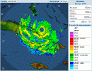
She's having big troubles right now with dry air. Hurricane Hunters only finding winds to 140MPH and she's awfully close to making landfall.
You know it's a big storm when you stick the word "only" in front of 140MPH.
You know it's a big storm when you stick the word "only" in front of 140MPH.
Is she doing another eyewall replacement cycleShe's having big troubles right now. Hurricane Hunters only finding winds to 140MPH and she's awfully close to making landfall.
MikeP
Member
Feeling the effects of Cuba.....
MikeP
Member
Just saw where the 'new' forecast calls for landfall as a cat5 on CNN?? Is NHC going with the GFS?
- Messages
- 275
- Reaction score
- 244
- Location
- Foscoe, NC; Elevation 3600ft
- Special Affiliations
- SKYWARN® Volunteer
Last couple sat images she seems to be overcoming the dry air. Seeing deep reds all around the center again which she had lost in spectacular fashion earlier.
TuckerTerry
Member
Just saw where the 'new' forecast calls for landfall as a cat5 on CNN?? Is NHC going with the GFS?
Yes, they all seem to be going with that. I've been in and out shopping and prepping, so haven't seen any model runs today. Only what the TV is telling me.
MikeP
Member
Flight level winds of 170 @ 10k feet NW quadrant. 150-155 at the surface.
- Messages
- 275
- Reaction score
- 244
- Location
- Foscoe, NC; Elevation 3600ft
- Special Affiliations
- SKYWARN® Volunteer
She's chewed up that dry air pretty good now.Flight level winds of 170 @ 10k feet NW quadrant. 150-155 at the surface.
MikeP
Member
COC getting really close to Cuba now. Can't tell if it is undergoing a ERC as well or just feeling the the effects of land a bit......
barcncpt44
Member
NWS Key West sent out a very strongly worded tweet.
MikeP
Member
Cuba might be the saving grace here???????
bingcrosbyb
Member
SouthernStorms
Member
Hopefully Cuba chews her up a bit.
Im a bit concerned with all the westward movements. Makes you want to ask when is it going to stop?
They say its not goin intp the gulf but they arecissuing storm surge watches for Tampa.....
Im a bit concerned with all the westward movements. Makes you want to ask when is it going to stop?
They say its not goin intp the gulf but they arecissuing storm surge watches for Tampa.....
MikeP
Member
Curious as to SST's in the Florida straits. If it can bounce off Cuba, we might see some rapid intensification....
Looks like the shift continues west on some of the early 00z models. Will be a couple hours until the global models start coming in.
My gut says this thing just skirts the west coast of Florida and makes landfall somewhere around east of Apalachicola, perhaps due south of Tallahassee.
My gut says this thing just skirts the west coast of Florida and makes landfall somewhere around east of Apalachicola, perhaps due south of Tallahassee.
TuckerTerry
Member
Looks like the shift continues west on some of the early 00z models. Will be a couple hours until the global models start coming in.
My gut says this thing just skirts the west coast of Florida and makes landfall somewhere around east of Apalachicola, perhaps due south of Tallahassee.
And does what? North or turn? I've been fretting this scenario.
MikeP
Member
COC coming ashore in Cuba.....
barcncpt44
Member
That would make the impacts in Alabama MUCH stronger. Higher winds and rain, especially if it makes the NW jog like on the current track.And does what? North or turn? I've been fretting this scenario.