CheeselandSkies
Member
How so?
Broad warm sector stretching from eastern IA all the way across southern Lower MI/northern IN/NW OH with >100kt jet max and hodographs favorable for significant tornadoes across the entire region.
Follow along with the video below to see how to install our site as a web app on your home screen.
Note: This feature may not be available in some browsers.
How so?
This is relevant in terms of HRRR forecasts for tomorrow and its degree of mixing + high LFCs/LCLs.
Does this mean HRRR is showing lower Dew points vs the RTMA? And the real time obs are showing higher which could result in those LCL issues you previously discussed
Awesome thanks both of you for answering my probably “noobish” questionsHigher dewpoints would mitigate the potential LCL issues.
I know there were several tornado warnings in SE AL and SW GA, but I dunno if any tornadoes actually touched down.Was there any severe weather today? I missed it lol
2 tornadoes reports in Southeast Alabama. Otherwise, just 37 damaging wind reports and 10 hail reports.Was there any severe weather today? I missed it lol
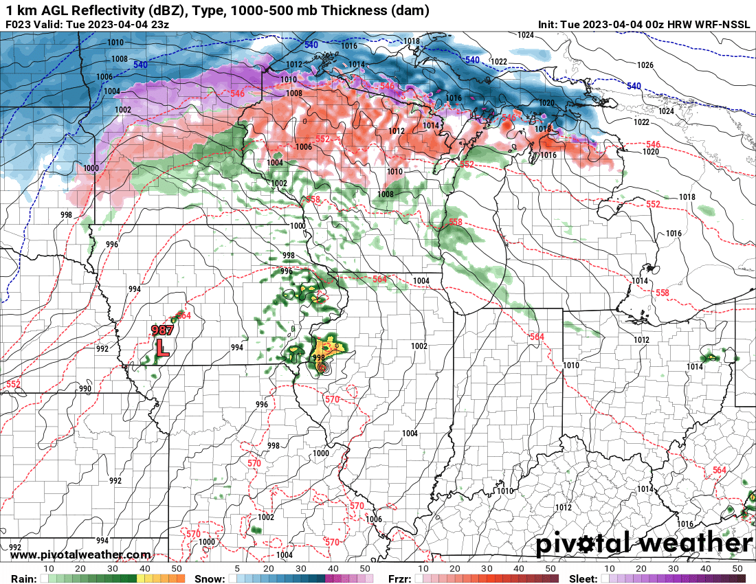
Honestly, I can't remember seeing a short range model depicting a supercell that well.Both the NSSL and ARW have a monster supercell tracking from NE MO into W IL tomorrow afternoon in an incredible parameter space.
NSSL explicitly resolving a hook echo and intense mesocyclone.
You can literally see the hook on the supercell in the model guidance. How often does that happen?Both the NSSL and ARW have a monster supercell tracking from NE MO into W IL tomorrow afternoon in an incredible parameter space.
NSSL explicitly resolving a hook echo and intense mesocyclone.
Both the NSSL and ARW have a monster supercell tracking from NE MO into W IL tomorrow afternoon in an incredible parameter space.
NSSL explicitly resolving a hook echo and intense mesocyclone.
RRFS chose violence.