• Welcome to TalkWeather!
    We see you lurking around TalkWeather! Take the extra step and join us today to view attachments, see less ads and maybe even join the discussion.
    CLICK TO JOIN TALKWEATHER

Severe WX April 1-2 (overnight) Severe Weather Event

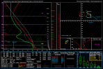
Haven't looked to closely at the model runs for Wednesday, but ceiling looks alarmingly high.
Does anyone see any possible failure modes for Wednesday? What's the probable ceiling for this event?

Northern portion of the risk area gets borked by morning convection and the southern part by veered low-level flow (similar to yesterday).

Certainly potential there but a lot of question marks remain. However the same was true for March 14 at this juncture.
 
^Given these parameters, it seems a high risk is definitely on the table for Wednesday for a pretty large area. Although forcing and capping may cause initiation issues farther west.

Hype surrounding this event (and the subsequent days, which also look significant) seems lower than the March 15th event. Curious about why that is, since to my eyes this could be on par with that event in terms of magnitude.

Farther east, around the mid South / Ohio Valley, forcing is not an issue but there is a relatively moderate cap which may influence initiation...but not likely given the modeled LIs and instability...and will likely help keep storms relatively discrete for a good period of time.

Overall, I'd say there's a conditional mod/high risk for central OK/north-central TX and a probable mod/high for the mid south.

Pros, what do you think?
 
^Given these parameters, it seems a high risk is definitely on the table for Wednesday for a pretty large area. Although forcing and capping may cause initiation issues farther west.

Hype surrounding this event (and the subsequent days, which also look significant) seems lower than the March 15th event. Curious about why that is, since to my eyes this could be on par with that event in terms of magnitude.

Farther east, around the mid South / Ohio Valley, forcing is not an issue but there is a relatively moderate cap which may influence initiation...but not likely given the modeled LIs and instability.

Overall, I'd say there's a conditional mod/high risk for central OK/north-central TX and a probable mod/high for the mid south.

Pros, what do you think?
Part of that is 3/14-3/15 was our first big system of the year, but also was impacting the location of many users on here. We have a lot of people from Alabama and Mississippi, which was the main area on 3/15. We also had an event yesterday while the week leading up to 3/14-3/15 we didn’t have any.
 
Haven't looked to closely at the model runs for Wednesday, but ceiling looks alarmingly high.
Does anyone see any possible failure modes for Wednesday? What's the probable ceiling for this event?
Storm mode is a big one. Especially with parallel shear vectors. You kind of saw this in action yesterday, cells immediately congealing or destructive mergers the moment they reached maturity. Here is the portion in the outlook that caught my eye:

Some boundary parallel flow is likely suggesting a mixed mode of cellular and bowing segments


You can have all the parameters in the world, but if storm mode doesn’t cooperate it can really cap the ceiling of an event.
I guess we root for no or little parallel flow for a bigger event, amongst other things also lol
 
Back
Top