
- Thread starter
- #1,141
Navigation
Install the app
How to install the app on iOS
Follow along with the video below to see how to install our site as a web app on your home screen.
Note: This feature may not be available in some browsers.
More options
-
Welcome to TalkWeather! We see you lurking around TalkWeather! Take the extra step and join us today to view attachments, see less ads and maybe even join the discussion. CLICK TO JOIN TALKWEATHER
You are using an out of date browser. It may not display this or other websites correctly.
You should upgrade or use an alternative browser.
You should upgrade or use an alternative browser.
2025 Global Tropical Cyclone Season Discussion
- Thread starter Atlantic
- Start date
- Thread starter
- #1,142
The invest is now at a high chance of development by the JTWC.An invest the JTWC has been tracking for several days has entered the Philippines area of responsibility and has been designated Tropical Depression Ramil by PAGASA.
The next international name in the Western Pacific is Fengshen

WTPN21 PGTW 170300
MSGID/GENADMIN/JOINT TYPHOON WRNCEN PEARL HARBOR HI//
SUBJ/TROPICAL CYCLONE FORMATION ALERT (INVEST 96W)//
RMKS/
1. FORMATION OF A SIGNIFICANT TROPICAL CYCLONE IS POSSIBLE WITHIN
140 NM EITHER SIDE OF A LINE FROM 13.8N 131.2E TO 15.3N 124.1E
WITHIN THE NEXT 12 TO 24 HOURS. AVAILABLE DATA DOES NOT JUSTIFY
ISSUANCE OF NUMBERED TROPICAL CYCLONE WARNINGS AT THIS TIME.
WINDS IN THE AREA ARE ESTIMATED TO BE 18 TO 23 KNOTS. METSAT
IMAGERY AT 170000Z INDICATES THAT A CIRCULATION CENTER IS LOCATED
NEAR 13.8N 131.0E. THE SYSTEM IS MOVING WEST-SOUTHWESTWARD AT 05
KNOTS.
2. REMARKS: THE AREA OF CONVECTION (INVEST 96W) PREVIOUSLY LOCATED NEAR
13.9N 131.5E IS NOW LOCATED NEAR 13.8N 131.0E, APPROXIMATELY 489 NM EAST
OF LEGAZPI, PHILIPPINES. ANIMATED MULTISPECTRAL SATELLITE IMAGERY (MSI)
DEPICTS A CONSOLIDATING LOW-LEVEL CIRCULATION CENTER (LLCC) EMBEDDED
WITHIN PERSISTENT CONVECTION. ENVIRONMENTAL ANALYSIS REVEALS MARGINALLY
FAVORABLE CONDITIONS FOR DEVELOPMENT WITH GOOD RADIAL OUTFLOW, WARM SEA
SURFACE TEMPERATURES (30-31 C), AND LOW NORTHWESTERLY VERTICAL WIND
SHEAR (10-15 KTS). GLOBAL DETERMINISTIC AND ENSEMBLE MODELS ARE IN GOOD
AGREEMENT THAT INVEST 96W WILL STEADILY CONSOLIDATE OVER THE NEXT 24
HOURS WHILE TRACKING NORTHWESTWARD. MAXIMUM SUSTAINED SURFACE WINDS ARE
ESTIMATED AT 18 TO 23 KNOTS. MINIMUM SEA LEVEL PRESSURE IS ESTIMATED TO
BE NEAR 1005 MB. THE POTENTIAL FOR THE DEVELOPMENT OF A SIGNIFICANT
TROPICAL CYCLONE WITHIN THE NEXT 24 HOURS IS HIGH.
3. THIS ALERT WILL BE REISSUED, UPGRADED TO WARNING OR CANCELLED BY
180300Z.//
NNNN
Attachments
- Thread starter
- #1,143
The Southern Hemisphere has done it again, with another high chance invest despite it not being November yet. It is Invest 94S.

WTXS21 PGTW 171800
MSGID/GENADMIN/JOINT TYPHOON WRNCEN PEARL HARBOR HI//
SUBJ/TROPICAL CYCLONE FORMATION ALERT (INVEST 94S)//
RMKS/
1. FORMATION OF A SIGNIFICANT TROPICAL CYCLONE IS POSSIBLE WITHIN 150 NM
EITHER SIDE OF A LINE FROM 6.9S 75.9E TO 9.5S 68.8E WITHIN THE NEXT 12
TO 24 HOURS. AVAILABLE DATA DOES NOT JUSTIFY ISSUANCE OF NUMBERED
TROPICAL CYCLONE WARNINGS AT THIS TIME. WINDS IN THE AREA ARE ESTIMATED
TO BE 25 TO 30 KNOTS. METSAT IMAGERY AT 171730Z INDICATES THAT A
CIRCULATION CENTER IS LOCATED NEAR 7.0S 75.4E. THE SYSTEM IS MOVING
WEST-SOUTHWESTWARD AT 12 KNOTS.
2. REMARKS: THE AREA OF CONVECTION (INVEST 94S) PREVIOUSLY LOCATED NEAR
7.0S 77.0E IS NOW LOCATED NEAR 7.0S 75.4E, APPROXIMATELY 175 NM EAST OF
DIEGO GARCIA. ANIMATED ENHANCED INFRARED SATELLITE IMAGERY AND A 171241Z
WSFM 37GHZ COLOR COMPOSITE MICROWAVE IMAGE DEPICT A CONSOLIDATING LOW-
LEVEL CIRCULATION CENTER (LLCC) WITH IMPROVED FRAGMENTED CONVECTIVE
BANDING. A 171632Z ASCAT-B IMAGE SHOWS AN ELONGATED CIRCULATION WITH 25-
30 KT WINDS OVER THE NORTHEASTERN QUADRANT, AND PATCHY 35 KT WINDS
DISPLACED 100 NM TO THE SOUTH. UPPER-LEVEL ANALYSIS INDICATES A
FAVORABLE ENVIRONMENT, CHARACTERIZED BY ENHANCED POLEWARD OUTFLOW INTO
THE WESTERLIES TO THE SOUTH AND IMPROVING EQUATORWARD OUTFLOW, WARM (27-
28 C) SEA SURFACE TEMPERATURES, LOW (10-15 KTS) VERTICAL WIND SHEAR.
GLOBAL DETERMINISTIC MODELS ARE IN GOOD AGREEMENT THAT 94S WILL CONTINUE
TO CONSOLIDATE AND INTENSIFY OVER THE NEXT 24-48 HOURS WITH A GENERALLY
WEST-SOUTHWESTWARD TRACK. THE SYSTEM IS EXPECTED TO TRACK SOUTH OF DIEGO
GARCIA BUT COULD PRODUCE 25-30 KT SUSTAINED WESTERLIES DURING THE
180000Z-190000Z TIMEFRAME. MAXIMUM SUSTAINED SURFACE WINDS ARE ESTIMATED
AT 25 TO 30 KNOTS. MINIMUM SEA LEVEL PRESSURE IS ESTIMATED TO BE NEAR
1005 MB. THE POTENTIAL FOR THE DEVELOPMENT OF A SIGNIFICANT TROPICAL
CYCLONE WITHIN THE NEXT 24 HOURS IS HIGH.
3. THIS ALERT WILL BE REISSUED, UPGRADED TO WARNING OR CANCELLED BY
181800Z.//
NNNN
Last edited:
- Thread starter
- #1,144
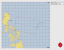
The JTWC hasn’t upgraded it to a TC yet, but JMA has declared it Tropical Storm Fengshen.The invest is now at a high chance of development by the JTWC.
View attachment 47455
WTPN21 PGTW 170300
MSGID/GENADMIN/JOINT TYPHOON WRNCEN PEARL HARBOR HI//
SUBJ/TROPICAL CYCLONE FORMATION ALERT (INVEST 96W)//
RMKS/
1. FORMATION OF A SIGNIFICANT TROPICAL CYCLONE IS POSSIBLE WITHIN
140 NM EITHER SIDE OF A LINE FROM 13.8N 131.2E TO 15.3N 124.1E
WITHIN THE NEXT 12 TO 24 HOURS. AVAILABLE DATA DOES NOT JUSTIFY
ISSUANCE OF NUMBERED TROPICAL CYCLONE WARNINGS AT THIS TIME.
WINDS IN THE AREA ARE ESTIMATED TO BE 18 TO 23 KNOTS. METSAT
IMAGERY AT 170000Z INDICATES THAT A CIRCULATION CENTER IS LOCATED
NEAR 13.8N 131.0E. THE SYSTEM IS MOVING WEST-SOUTHWESTWARD AT 05
KNOTS.
2. REMARKS: THE AREA OF CONVECTION (INVEST 96W) PREVIOUSLY LOCATED NEAR
13.9N 131.5E IS NOW LOCATED NEAR 13.8N 131.0E, APPROXIMATELY 489 NM EAST
OF LEGAZPI, PHILIPPINES. ANIMATED MULTISPECTRAL SATELLITE IMAGERY (MSI)
DEPICTS A CONSOLIDATING LOW-LEVEL CIRCULATION CENTER (LLCC) EMBEDDED
WITHIN PERSISTENT CONVECTION. ENVIRONMENTAL ANALYSIS REVEALS MARGINALLY
FAVORABLE CONDITIONS FOR DEVELOPMENT WITH GOOD RADIAL OUTFLOW, WARM SEA
SURFACE TEMPERATURES (30-31 C), AND LOW NORTHWESTERLY VERTICAL WIND
SHEAR (10-15 KTS). GLOBAL DETERMINISTIC AND ENSEMBLE MODELS ARE IN GOOD
AGREEMENT THAT INVEST 96W WILL STEADILY CONSOLIDATE OVER THE NEXT 24
HOURS WHILE TRACKING NORTHWESTWARD. MAXIMUM SUSTAINED SURFACE WINDS ARE
ESTIMATED AT 18 TO 23 KNOTS. MINIMUM SEA LEVEL PRESSURE IS ESTIMATED TO
BE NEAR 1005 MB. THE POTENTIAL FOR THE DEVELOPMENT OF A SIGNIFICANT
TROPICAL CYCLONE WITHIN THE NEXT 24 HOURS IS HIGH.
3. THIS ALERT WILL BE REISSUED, UPGRADED TO WARNING OR CANCELLED BY
180300Z.//
NNNN

| T2524(Fengshen) Issued at 2025/10/17 19:30 UTC Analysis at 10/17 18 UTC Grade TS Scale - Intensity - Center position N12°55′ (12.9°) E127°25′ (127.4°) Direction and speed of movement W 25 km/h (13 kt) Central pressure 1000 hPa Maximum sustained wind speed near center 18 m/s (35 kt) Maximum wind gust speed 25 m/s (50 kt) Radius of 30-kt wind area 220 km (120 |
- Thread starter
- #1,145
And just like that, every preseason month in the SHEM (July, August, September and October) have had a storm. July had 01S, August had Awo, September had Blossom and October now has 04S
This is the first time since the 1996-97 that every pre-season month has had a storm

This is the first time since the 1996-97 that every pre-season month has had a storm
- Thread starter
- #1,146
Meteo-France has designated this as Moderate Tropical Storm Chenge. The official season in the SWIO doesn’t even start until November 15th, and yet we are at the “C” storm already.And just like that, every preseason month in the SHEM (July, August, September and October) have had a storm. July had 01S, August had Awo, September had Blossom and October now has 04S
This is the first time since the 1996-97 that every pre-season month has had a storm
View attachment 47483
A WWB (Westerly-Wind Burst) over the IO has contributed to Chenge’s formation and to the disturbances Invest 95S well to the east of Chenge in the SHEM and to Invest 92A and Invest 93B on either side of India in the NIO north of the equator.
Kds86z
Member
- Thread starter
- #1,148
Invest 97W originated from a cold surge in the Western Pacific. It has a name from the Philippines right now as Tropical Depression Salome. It is seemingly unlikely to form though, so I thought I would just note it here so everyone would know that I have covered it.
- Thread starter
- #1,149
- Thread starter
- #1,150

- Thread starter
- #1,151
Been busy tracking the insane Hurricane Melissa, but here is a brief update of the tropics outside of the Atlantic:
Montha has intensified to 45 kts now in the Bay of Bengal.
Sonia is struggling against falling SSTs and increasing dry air
Invest 92A is still an uncertain puzzle piece on the board on the other side of India from Montha.
Montha has intensified to 45 kts now in the Bay of Bengal.
Sonia is struggling against falling SSTs and increasing dry air
Invest 92A is still an uncertain puzzle piece on the board on the other side of India from Montha.
- Thread starter
- #1,152
A little something I’ve been working on with the Atlantic that I got from someone else on Discord while I still had it.
——————————————————
I go by the rankings of the SSHWS so here’s an example, with points for each final ranking of every TC for the Atlantic from 1991-2024.
TS - 1 point
C1 - 2 points
C2 - 3 points
C3 - 4 points
C4 - 5 points
C5 - 6 points
Red is above average, Gray is average and Blue is below average
——————————-
1991-2020 average for the Atlantic = 31 points
——————————-
2024 - 49 (+18)
2023 - 39 (+8)
2022 - 30 (-1)
2021 - 38 (+7)
2020 - 65 (+34)
2019 - 35 (+4)
2018 - 33 (+2)
2017 - 47 (+16)
2016 - 33 (+2)
2015 - 20 (-11)
2014 - 20 (-11)
2013 - 16 (-15)
2012 - 36 (+5)
2011 - 36 (+5)
2010 - 48 (+17)
2009 - 18 (-13)
2008 - 39 (+8)
2007 - 29 (-2)
2006 - 18 (-13)
2005 - 67 (+36)
2004 - 42 (+11)
2003 - 31 (0)
2002 - 21 (-10)
2001 - 33 (+2)
2000 - 32 (+1)
1999 - 38 (+7)
1998 - 37 (+6)
1997 - 13 (-18)
1996 - 36 (+5)
1995 - 46 (+15)
1994 - 11 (-20)
1993 - 15 (-16)
1992 - 17 (-14)
1991 - 18 (-13)
- Thread starter
- #1,153
- Thread starter
- #1,154
Kalmaegi is likely to receive the Philippine name Tino soon, though PAGASA has been warning on it as an at-this-time to them unnamed tropical depression.A system in the Western Pacific has become Tropical Depression 31W by the JTWC, and it was recently upgraded to Tropical Storm Kalmaegi by JMA, making Kalmaegi the 25th named storm of this year’s WPAC season.
Kds86z
Member
- Thread starter
- #1,156

- Thread starter
- #1,157
That’s a ominous shrimp look… Tropical Depression Kalmaegi (JTWC intensity)
 JTWC thinks Kalmaegi will have a first peak before landfall in the Central Philippines at 85 kts (100 mph) before moving into the SCS and reaching a stronger peak of 105 kts (120 mph). I think Kalmaegi will be stronger than 85 kts by the time it reaches the Philippines based off of the shrimp look above.
JTWC thinks Kalmaegi will have a first peak before landfall in the Central Philippines at 85 kts (100 mph) before moving into the SCS and reaching a stronger peak of 105 kts (120 mph). I think Kalmaegi will be stronger than 85 kts by the time it reaches the Philippines based off of the shrimp look above.- Thread starter
- #1,158
I don’t like the look of now Typhoon Kalmaegi, with that large band in front of it similar to storms like Super Typhoon Mike 1990 and Super Typhoon Haiyan 2013. Currently Kalmaegi’s intensity is 70 kts (80 mph):

It’s very unlikely that it will be as strong as those storms mentioned above, but still Kalmaegi has me concerned regardless.
It’s very unlikely that it will be as strong as those storms mentioned above, but still Kalmaegi has me concerned regardless.
- Thread starter
- #1,159
Well I’m gone for a day to take a break, and we got Tropical Depression 32W out of Invest 90W in the WPAC
It could become a very intense typhoon in the near future and the northern Philippines should be watching this storm closely
It could become a very intense typhoon in the near future and the northern Philippines should be watching this storm closely
- Thread starter
- #1,160
The 1981-2010 average is 26 points, but I used the 1991-2020 average for all of the years above.A little something I’ve been working on with the Atlantic that I got from someone else on Discord while I still had it.
——————————————————
I go by the rankings of the SSHWS so here’s an example, with points for each final ranking of every TC for the Atlantic from 1991-2024.
TS - 1 point
C1 - 2 points
C2 - 3 points
C3 - 4 points
C4 - 5 points
C5 - 6 points
Red is above average, Gray is average and Blue is below average
——————————-
1991-2020 average for the Atlantic = 31 points
——————————-
2024 - 49 (+18)
2023 - 39 (+8)
2022 - 30 (-1)
2021 - 38 (+7)
2020 - 65 (+34)
2019 - 35 (+4)
2018 - 33 (+2)
2017 - 47 (+16)
2016 - 33 (+2)
2015 - 20 (-11)
2014 - 20 (-11)
2013 - 16 (-15)
2012 - 36 (+5)
2011 - 36 (+5)
2010 - 48 (+17)
2009 - 18 (-13)
2008 - 39 (+8)
2007 - 29 (-2)
2006 - 18 (-13)
2005 - 67 (+36)
2004 - 42 (+11)
2003 - 31 (0)
2002 - 21 (-10)
2001 - 33 (+2)
2000 - 32 (+1)
1999 - 38 (+7)
1998 - 37 (+6)
1997 - 13 (-18)
1996 - 36 (+5)
1995 - 46 (+15)
1994 - 11 (-20)
1993 - 15 (-16)
1992 - 17 (-14)
1991 - 18 (-13)
I am modifying the years 2011-2020 to match the 1981-2010 average below:
2011 - 36 (+10)
2012 - 36 (+10)
2013 - 16 (-10)
2014 - 20 (-6)
2015 - 20 (-6)
2016 - 33 (+7)
2017 - 47 (+21)
2018 - 33 (+7)
2019 - 35 (+9)
2020 - 65 (+39)