Yep. The Ensembles, though not consistent with it, have been hinting a lot about the Gulf/Western Caribbean next month. Which makes sense.I told @Kds86z the same thing I’m about to tell you about October.
I won’t be surprised if October was a decently active to very active month after seeing what the end of September had in store.
Navigation
Install the app
How to install the app on iOS
Follow along with the video below to see how to install our site as a web app on your home screen.
Note: This feature may not be available in some browsers.
More options
-
Welcome to TalkWeather! We see you lurking around TalkWeather! Take the extra step and join us today to view attachments, see less ads and maybe even join the discussion. CLICK TO JOIN TALKWEATHER -
Current Tropical Systems Melissa
You are using an out of date browser. It may not display this or other websites correctly.
You should upgrade or use an alternative browser.
You should upgrade or use an alternative browser.
2025 Global Tropical Cyclone Season Discussion
- Thread starter Atlantic
- Start date
- Thread starter
- #1,102
It’s been a week that rivals the October 2023 group of tropical cyclones this week (in a week or so of October 23’ we had Otis, Bolaven, Tej, Hamoon, Lola and Tammy)
This week had Ragasa, Neoguri, Gabrielle and Humberto (two Category 5 cyclones in a week)
This week had Ragasa, Neoguri, Gabrielle and Humberto (two Category 5 cyclones in a week)
Kds86z
Member
It’s been a week that rivals the October 2023 group of tropical cyclones this week (in a week or so of October 23’ we had Otis, Bolaven, Tej, Hamoon, Lola and Tammy)
This week had Ragasa, Neoguri, Gabrielle and Humberto (two Category 5 cyclones in a week)
Dude True
just last Saturday ragasa the monster
- Thread starter
- #1,104
lol! When we thought that Neoguri was done basically after falling all the way back from Category 4-equivalent status back to a Tropical Storm, we all thought it was over. Nah- it’s not.
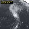
Say hello to Neoguri almost being a major typhoon again coming all the way back from a tropical storm. 95 kts right now.
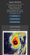
Say hello to Neoguri almost being a major typhoon again coming all the way back from a tropical storm. 95 kts right now.

- Thread starter
- #1,105
- Thread starter
- #1,106
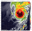
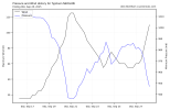
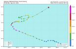
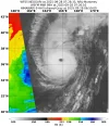
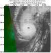
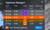
Neoguri has nearly managed to regain its old intensity of 125 kts (145 mph) at a ridiculously high latitude of almost 40N, which is nearly unheard of for the WPAC.
Current intensity is 110 kts (125 mph) according to the JTWC.

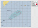
The JTWC says that Neoguri has a few hours left to reach an intensity a little higher than 110 kts before very unfavorable conditions set in.
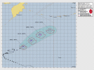
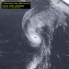
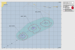
Since this is a rare breed of Western Pacific tropical cyclone, I am going to post everything the JTWC warning has on Neoguri:
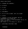
And the Dvorak Satellite Fix Bulletin on Neoguri:
Current intensity is 110 kts (125 mph) according to the JTWC.


The JTWC says that Neoguri has a few hours left to reach an intensity a little higher than 110 kts before very unfavorable conditions set in.
Since this is a rare breed of Western Pacific tropical cyclone, I am going to post everything the JTWC warning has on Neoguri:
WDPN33 PGTW 280900
MSGID/GENADMIN/JOINT TYPHOON WRNCEN PEARL HARBOR HI//
SUBJ/PROGNOSTIC REASONING FOR TYPHOON 25W (NEOGURI) WARNING NR 040//
RMKS/
1. FOR METEOROLOGISTS.
2. 6 HOUR SUMMARY AND ANALYSIS.
SUMMARY:
INITIAL POSITION: 35.8N 164.8E
INITIAL INTENSITY: 110 KTS
GEOGRAPHIC REFERENCE: 893 NM NORTHEAST OF MINAMI TORI SHIMA
MOVEMENT PAST 6 HOURS: NORTHEASTWARD AT 25 KTS
SIGNIFICANT WAVE HEIGHT: 44 FEET
SATELLITE ANALYSIS, INITIAL POSITION AND INTENSITY DISCUSSION:
ANIMATED MULTISPECTRAL SATELLITE IMAGERY (MSI) DEPICTS A NEARLY
PERFECTLY ROUND EYE FEATURE OF TYPHOON (TY) 25W (NEOGURI) AS IT IS
ACCELERATING ON A NORTHEASTWARD TRACK. DESPITE ITS CURRENT MID-
LATITUDE POSITION, THE SYSTEM HAS RAPIDLY INTENSIFIED AT AN
IMPRESSIVE RATE OF 40 KTS IN THE LAST 24 HOURS. AS A RESULT, IT NOW
FEATURES A NEARLY SYMMETRICAL CONVECTIVE CANOPY, SURROUNDING THE 20
NM WIDE EYE. ENVIRONMENTAL ANALYSIS REVEALS A ROBUST POLEWARD OUTFLOW
ENHANCED BY AN UPPER-LEVEL SHORTWAVE TROUGH. ADDITIONALLY, THE LAST
MOMENTS OF MARGINALLY FAVORABLE CONDITIONS INCLUDE BORDERLINE (26-27
C) SEA SURFACE TEMPERATURES (SST). THESE FACTORS ARE OFFSET HOWEVER
BY SIGNIFICANTLY AND RAPIDLY INCREASING VERTICAL WIND SHEAR,
CURRENTLY ASSESSED AT 20-25 KTS, AS WELL AS DRY AIR PRESSING OVER THE
WESTERN PORTION OF THE CIRCULATION. THE INITIAL POSITION IS PLACED
WITH HIGH CONFIDENCE BASED ON THE EASILY IDENTIFIABLE EYE FEATURE,
WHILE THE INITIAL INTENSITY OF 110 KTS IS ALSO ASSESSED WITH HIGH
CONFIDENCE BASED ON A COMBINATION OF AGENCY DVORAK AND OBJECTIVE
ESTIMATES LISTED BELOW.
INITIAL WIND RADII BASIS: PERSISTENCE
CURRENT STEERING MECHANISM: SUBTROPICAL RIDGE (STR) TO THE EAST
AGENCY DVORAK AND AUTOMATED FIXES:
PGTW: T5.5 - 102 KTS
RJTD: T6.0 - 115 KTS
RCTP: T5.5 - 102 KTS
KNES: T6.0 - 115 KTS
CIMSS SATCON: 102 KTS AT 280200Z
CIMSS ADT: 109 KTS AT 280530Z
CIMSS AIDT: 108 KTS AT 280530Z
CIMSS D-MINT: 97 KTS AT 280200Z
CIMSS D-PRINT: 102 KTS AT 280700Z
FORECASTER ASSESSMENT OF CURRENT ENVIRONMENT: MARGINALLY FAVORABLE
VWS: 20-25 KTS
SST: 26-27 CELSIUS
OUTFLOW: STRONG POLEWARD
ANALYSIS CONFIDENCE:
INITIAL POSITION: HIGH
INITIAL INTENSITY: HIGH
INITIAL WIND RADII: LOW
3. FORECAST REASONING.
SIGNIFICANT FORECAST CHANGES: THERE ARE NO SIGNIFICANT CHANGES TO
THE FORECAST FROM THE PREVIOUS WARNING.
FORECAST DISCUSSION: TY 25W IS FORECAST TO CONTINUE ACCELERATING,
WHILE TRACKING ALONG THE WESTERN PERIPHERY OF A DEEP-LAYER STR TO
THE EAST. AS THE SYSTEM IS CURRENTLY ROUNDING THE AXIS OF THE
RIDGE, IT IS EXPECTED TO SOON BEGIN ITS EXTRATROPICAL TRANSITION
(ETT). RAPIDLY COOLING SSTS AND INCREASING VERTICAL WIND SHEAR ARE
EXPECTED TO RESULT IN DECAPITATION AND QUICK SHALLOWING OF THE
CONVECTIVE STRUCTURE OF THE SYSTEM. UNTIL THEN, TY NEOGURI STILL
HAS A FEW HOURS TO REACH A SHORT-LIVED PEAK SLIGHTLY BEYOND
CURRENTLY ASSESSED 110 KTS. AFTER THAT, ONSET OF AFOREMENTIONED
UNFAVORABLE ENVIRONMENTAL CONDITIONS, AMPLIFIED BY SIGNIFICANT DRY
AIR INTRUSION FROM THE WEST WILL ALL RESULT IN RAPID DETERIORATION
OF TY 25W, PAIRED WITH SIMULTANEOUS AND QUICK COMPLETION OF THE ETT
BY TAU 24.
MODEL DISCUSSION: BOTH NUMERICAL TRACK AND INTENSITY MODEL GUIDANCE
ARE IN VERY GOOD AGREEMENT THROUGHOUT THE FORECAST PERIOD,
RESULTING IN HIGH CONFIDENCE OF THE OFFICIAL JTWC FORECAST. TRACK
ASSESSMENT IS LAID CLOSE TO THE MULTI-MODEL CONSENSUS, WHILE
INTENSITY PREDICTION IS PLACED CLOSE TO THAT OF HAFS-A, WHICH IS ON
THE HIGHER END OF THE CURRENT MULTI-MODEL CONSENSUS SPREAD.
FORECAST CONFIDENCE:
TRACK 00-72 HR: HIGH
INTENSITY 00-72 HR: HIGH//
NNNN
WTPN33 PGTW 280900
MSGID/GENADMIN/JOINT TYPHOON WRNCEN PEARL HARBOR HI//
SUBJ/TYPHOON 25W (NEOGURI) WARNING NR 040//
RMKS/
1. TYPHOON 25W (NEOGURI) WARNING NR 040
02 ACTIVE TROPICAL CYCLONES IN NORTHWESTPAC
MAX SUSTAINED WINDS BASED ON ONE-MINUTE AVERAGE
WIND RADII VALID OVER OPEN WATER ONLY
---
WARNING POSITION:
280600Z --- NEAR 35.8N 164.8E
MOVEMENT PAST SIX HOURS - 050 DEGREES AT 25 KTS
POSITION ACCURATE TO WITHIN 015 NM
POSITION BASED ON EYE FIXED BY SATELLITE
PRESENT WIND DISTRIBUTION:
MAX SUSTAINED WINDS - 110 KT, GUSTS 135 KT
WIND RADII VALID OVER OPEN WATER ONLY
RADIUS OF 064 KT WINDS - 000 NM NORTHEAST QUADRANT
020 NM SOUTHEAST QUADRANT
020 NM SOUTHWEST QUADRANT
000 NM NORTHWEST QUADRANT
RADIUS OF 050 KT WINDS - 035 NM NORTHEAST QUADRANT
065 NM SOUTHEAST QUADRANT
065 NM SOUTHWEST QUADRANT
030 NM NORTHWEST QUADRANT
RADIUS OF 034 KT WINDS - 065 NM NORTHEAST QUADRANT
105 NM SOUTHEAST QUADRANT
090 NM SOUTHWEST QUADRANT
055 NM NORTHWEST QUADRANT
REPEAT POSIT: 35.8N 164.8E
---
FORECASTS:
12 HRS, VALID AT:
281800Z --- 39.6N 169.7E
MAX SUSTAINED WINDS - 100 KT, GUSTS 125 KT
WIND RADII VALID OVER OPEN WATER ONLY
BECOMING EXTRATROPICAL
RADIUS OF 064 KT WINDS - 010 NM NORTHEAST QUADRANT
020 NM SOUTHEAST QUADRANT
020 NM SOUTHWEST QUADRANT
010 NM NORTHWEST QUADRANT
RADIUS OF 050 KT WINDS - 040 NM NORTHEAST QUADRANT
060 NM SOUTHEAST QUADRANT
050 NM SOUTHWEST QUADRANT
030 NM NORTHWEST QUADRANT
RADIUS OF 034 KT WINDS - 090 NM NORTHEAST QUADRANT
140 NM SOUTHEAST QUADRANT
100 NM SOUTHWEST QUADRANT
080 NM NORTHWEST QUADRANT
VECTOR TO 24 HR POSIT: 050 DEG/ 26 KTS
---
24 HRS, VALID AT:
290600Z --- 42.9N 175.1E
MAX SUSTAINED WINDS - 060 KT, GUSTS 075 KT
WIND RADII VALID OVER OPEN WATER ONLY
EXTRATROPICAL
RADIUS OF 050 KT WINDS - 020 NM NORTHEAST QUADRANT
030 NM SOUTHEAST QUADRANT
040 NM SOUTHWEST QUADRANT
020 NM NORTHWEST QUADRANT
RADIUS OF 034 KT WINDS - 080 NM NORTHEAST QUADRANT
130 NM SOUTHEAST QUADRANT
120 NM SOUTHWEST QUADRANT
070 NM NORTHWEST QUADRANT
---
REMARKS:
280900Z POSITION NEAR 36.7N 166.0E.
28SEP25. TYPHOON 25W (NEOGURI), LOCATED APPROXIMATELY 893 NM
NORTHEAST OF MINAMI TORI SHIMA, HAS TRACKED NORTHEASTWARD AT 25
KNOTS OVER THE PAST SIX HOURS.
MINIMUM CENTRAL PRESSURE AT 280600Z IS 947 MB. MAXIMUM
SIGNIFICANT WAVE HEIGHT AT 280600Z IS 44 FEET. NEXT WARNINGS AT
281500Z, 282100Z AND 290300Z.
REFER TO TYPHOON 26W (BUALOI) WARNINGS (WTPN31 PGTW)
FOR SIX-HOURLY UPDATES.
//
NNNN
And the Dvorak Satellite Fix Bulletin on Neoguri:
- Thread starter
- #1,107
- Thread starter
- #1,108
- Thread starter
- #1,109
- Thread starter
- #1,110
It’s over. The beautiful storm Neoguri’s final warning is out;
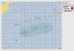
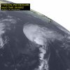
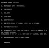
WTPN33 PGTW 290300
MSGID/GENADMIN/JOINT TYPHOON WRNCEN PEARL HARBOR HI//
SUBJ/TYPHOON 25W (NEOGURI) WARNING NR 043//
RMKS/
1. TYPHOON 25W (NEOGURI) WARNING NR 043
02 ACTIVE TROPICAL CYCLONES IN NORTHWESTPAC
MAX SUSTAINED WINDS BASED ON ONE-MINUTE AVERAGE
WIND RADII VALID OVER OPEN WATER ONLY
---
WARNING POSITION:
290000Z --- NEAR 42.4N 172.4E
MOVEMENT PAST SIX HOURS - 045 DEGREES AT 28 KTS
POSITION ACCURATE TO WITHIN 060 NM
POSITION BASED ON CENTER LOCATED BY SATELLITE
PRESENT WIND DISTRIBUTION:
MAX SUSTAINED WINDS - 090 KT, GUSTS 110 KT
WIND RADII VALID OVER OPEN WATER ONLY
BECOMING EXTRATROPICAL
RADIUS OF 064 KT WINDS - 030 NM NORTHEAST QUADRANT
055 NM SOUTHEAST QUADRANT
050 NM SOUTHWEST QUADRANT
025 NM NORTHWEST QUADRANT
RADIUS OF 050 KT WINDS - 040 NM NORTHEAST QUADRANT
060 NM SOUTHEAST QUADRANT
065 NM SOUTHWEST QUADRANT
040 NM NORTHWEST QUADRANT
RADIUS OF 034 KT WINDS - 090 NM NORTHEAST QUADRANT
150 NM SOUTHEAST QUADRANT
100 NM SOUTHWEST QUADRANT
075 NM NORTHWEST QUADRANT
REPEAT POSIT: 42.4N 172.4E
---
FORECASTS:
12 HRS, VALID AT:
291200Z --- 44.6N 178.2E
MAX SUSTAINED WINDS - 070 KT, GUSTS 085 KT
WIND RADII VALID OVER OPEN WATER ONLY
EXTRATROPICAL
RADIUS OF 064 KT WINDS - 025 NM NORTHEAST QUADRANT
045 NM SOUTHEAST QUADRANT
035 NM SOUTHWEST QUADRANT
000 NM NORTHWEST QUADRANT
RADIUS OF 050 KT WINDS - 050 NM NORTHEAST QUADRANT
060 NM SOUTHEAST QUADRANT
060 NM SOUTHWEST QUADRANT
030 NM NORTHWEST QUADRANT
RADIUS OF 034 KT WINDS - 100 NM NORTHEAST QUADRANT
150 NM SOUTHEAST QUADRANT
110 NM SOUTHWEST QUADRANT
070 NM NORTHWEST QUADRANT
VECTOR TO 24 HR POSIT: 080 DEG/ 23 KTS
---
24 HRS, VALID AT:
300000Z --- 45.3N 175.5W
MAX SUSTAINED WINDS - 050 KT, GUSTS 065 KT
WIND RADII VALID OVER OPEN WATER ONLY
EXTRATROPICAL
RADIUS OF 050 KT WINDS - 000 NM NORTHEAST QUADRANT
040 NM SOUTHEAST QUADRANT
010 NM SOUTHWEST QUADRANT
000 NM NORTHWEST QUADRANT
RADIUS OF 034 KT WINDS - 080 NM NORTHEAST QUADRANT
130 NM SOUTHEAST QUADRANT
100 NM SOUTHWEST QUADRANT
050 NM NORTHWEST QUADRANT
---
REMARKS:
290300Z POSITION NEAR 42.9N 173.9E.
29SEP25. TYPHOON 25W (NEOGURI), LOCATED APPROXIMATELY 1417 NM
NORTH OF WAKE ISLAND, HAS TRACKED NORTHEASTWARD AT 28 KNOTS OVER
THE PAST SIX HOURS. TYPHOON 25W HAS PUT ON AN AMAZING SHOW OVER THE
LAST COUPLE OF DAYS, BUT IT IS TIME TO TURN OFF THE LIGHTS, THE PARTY
IS OVER. JUST IN THE LAST SIX TO EIGHT HOURS, THE SYSTEM HAS CHANGED
REMARKABLY, GOING FROM A FULLY COUPLED VORTEX WITH A 20NM WIDE EYE,
TO A RAPIDLY DECOUPLING VORTEX AND CLEAR FRONTOGENESIS. A 282257Z
ASCAT-C PASS REVEALED AN ELONGATED LOW LEVEL CIRCULATION CENTER
(LLCC), WITH A VERY SHARP WARM FRONTAL REGION EXTENDING TO THE
NORTHEAST AND A MORE DIFFUSE COLD FRONT EXTENDING TO THE SOUTH OF THE
LLCC. MAXIMUM WINDS IN THE SCATTEROMETER WERE PEGGED AT 65 KNOTS,
PARTICULARLY IN THE NORTHWESTERN QUADRANT, LIKELY REFLECTING THE
PRESENCE OF A STING JET IN THAT REGION. THE INITIAL POSITION WAS
ASSESSED WITH HIGH CONFIDENCE BASED ON THE ASCAT DATA. THE INITIAL
INTENSITY WAS ASSESSED WITH MEDIUM CONFIDENCE BASED ON DVORAK CURRENT
INTENSITY ESTIMATES OF T5.0 FROM MULTIPLE AGENCIES, AS WELL AS
OBJECTIVE ESTIMATES BETWEEN 77-88 KTS. THE SYSTEM IS UNDERGOING RAPID
EXTRATROPICAL TRANSITION (ETT) AND WILL FULLY TRANSITION TO A STORM
FORCE EXTRATROPICAL LOW WITHIN THE NEXT 12 HOURS AS IT PASSES SOUTH
OF THE ALEUTIAN ISLANDS. THIS IS THE FINAL WARNING ON THIS SYSTEM BY
THE JOINT TYPHOON WRNCEN PEARL HARBOR HI. THE SYSTEM WILL BE CLOSELY
MONITORED FOR SIGNS OF REGENERATION. MINIMUM CENTRAL PRESSURE AT
290000Z IS 962 MB. MAXIMUM SIGNIFICANT WAVE HEIGHT AT 290000Z IS 38
FEET. REFER TO TYPHOON 26W (BUALOI) FINAL WARNING (WTPN31 PGTW).
//
NNNN

Neoguri (Japanese Typhoon Number 19) is located 2624 km north of Wake Island, and has tracked northeastward at 52 km/h (28 knots) over the past 6 hours. Minimum central pressure at 29/00:00 UTC is 962 hPa. Maximum significant wave height is 11.6 meters (38 feet).
Neoguri has put on an amazing show over the last couple of days, but it is time to turn off the lights, the party is over. Just in the last six to eight hours, the system has changed remarkably, going from a fully coupled vortex with a 37 km wide eye, to a rapidly decoupling vortex and clear frontogenesis.
A 28/22:57 UTC ASCAT-C pass revealed an elongated low-level circulation center (LLCC), with a very sharp warm frontal region extending to the northeast and a more diffuse cold front extending to the south of the LLCC.
Maximum winds in the scatterometer were pegged at 120 km/h (65 knots), particularly in the northwestern quadrant, likely reflecting the presence of a sting jet in that region.
The initial position was assessed with high confidence based on the ASCAT data. The initial intensity was assessed with medium confidence based on Dvorak current intensity estimates of T5.0 from multiple agencies, as well as objective estimates between 145–165 km/h (77–88 knots).
The system is undergoing rapid extratropical transition (ETT) and will fully transition to a storm force extratropical low within the next 12 hours as it passes south of the Aleutian Islands.
This is the final warning on this system by JTWC. The system will be closely monitored for signs of regeneration.
Warning Number 43. Information provided by the Joint Typhoon Warning Center (JTWC


- Thread starter
- #1,111
We have Invest 98E in the Eastern Pacific. It could become a TC soon. The NHC gives it a 70/90 shot that it’ll become a TC within the next few days.
Invest 90A was designated just offshore of Western India last night, and models think it could become a brief, short-lived TC in the Arabian Sea
We also have Invest 93W to monitor for the potential to impact or landfall in the Philippines within the next week or so.
Invest 90A was designated just offshore of Western India last night, and models think it could become a brief, short-lived TC in the Arabian Sea
We also have Invest 93W to monitor for the potential to impact or landfall in the Philippines within the next week or so.
Kds86z
Member
- Thread starter
- #1,113
- Thread starter
- #1,114
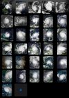
Which one is your favorite, @Kds86z?Every Atlantic Category 5 Hurricane since the satellite era started (31 Category 5 hurricanes have occurred)
View attachment 46838
You can screenshot it or something and just post it here if you want.
- Thread starter
- #1,115
Invest 98E in the Eastern Pacific has become Tropical Depression Fifteen-E.
We still have Invest 93W in the Western Pacific, Invest 90A in the Arabian Sea, now joined on the other side of India by Invest 91B.
Another disturbance behind 15E could become the next TC in the Eastern Pacific.
We still have Invest 93W in the Western Pacific, Invest 90A in the Arabian Sea, now joined on the other side of India by Invest 91B.
Another disturbance behind 15E could become the next TC in the Eastern Pacific.
- Thread starter
- #1,116
- Thread starter
- #1,117
Ladies and gentlemen, please welcome the first TCFA of the 2025 North Indian Ocean Cyclone Season.
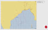

WTIO21 PGTW 301800
MSGID/GENADMIN/JOINT TYPHOON WRNCEN PEARL HARBOR HI//
SUBJ/TROPICAL CYCLONE FORMATION ALERT (INVEST 91B)//
RMKS/
1. FORMATION OF A SIGNIFICANT TROPICAL CYCLONE IS POSSIBLE WITHIN
150 NM EITHER SIDE OF A LINE FROM 14.0N 87.0E TO 20.0N 84.8E
WITHIN THE NEXT 12 TO 24 HOURS. AVAILABLE DATA DOES NOT JUSTIFY
ISSUANCE OF NUMBERED TROPICAL CYCLONE WARNINGS AT THIS TIME.
WINDS IN THE AREA ARE ESTIMATED TO BE 25 TO 30 KNOTS. METSAT
IMAGERY AT 301730Z INDICATES THAT A CIRCULATION CENTER IS LOCATED
NEAR 14.8N 86.7E. THE SYSTEM IS MOVING WEST-NORTHWESTWARD AT 05
KNOTS.
2. REMARKS: THE AREA OF CONVECTION (INVEST 91B) PREVIOUSLY LOCATED NEAR
15.6N 89.6E IS NOW LOCATED NEAR 14.8N 86.7E, APPROXIMATELY 265 NM
SOUTHEAST OF VISAKHAPATNAM. ANIMATED MULTISPECTRAL SATELLITE IMAGERY
REVEALS A CONSOLIDATING LOW LEVEL CIRCULATION (LLC) WITH IMPROVED
CONVECTIVE BANDING. A 301546Z ASCAT-B PASS INDICATES A SWATH OF 35 KNOT
NORTHERLY WINDS NEAR THE WESTERN PERIPHERY. ENVIRONMENTAL ANALYSIS SHOWS
A FAVORABLE ENVIRONMENT FOR DEVELOPMENT WITH LOW VERTICAL WIND SHEAR OF
5-10 KNOTS, EQUATORWARD UPPER-LEVEL OUTFLOW, AND WARM SEA SURFACE
TEMPERATURES OF 28-29 C. GLOBAL MODELS AGREE ON THE SYSTEM HAVING A
GENERAL NORTH-NORTHWESTWARD TRACK WITH STEADY DEVELOPMENT AND
INTENSIFICATION IN THE NEXT 12-36 HOURS. MAXIMUM SUSTAINED SURFACE WINDS
ARE ESTIMATED AT 25 TO 30 KNOTS. MINIMUM SEA LEVEL PRESSURE IS ESTIMATED
TO BE NEAR 998 MB. THE POTENTIAL FOR THE DEVELOPMENT OF A SIGNIFICANT
TROPICAL CYCLONE WITHIN THE NEXT 24 HOURS IS HIGH.
3. THIS ALERT WILL BE REISSUED, UPGRADED TO WARNING OR CANCELLED BY
011800Z.//
NNNN
KakashiHatake2000
Member
- Thread starter
- #1,119
Invest 91B became Cyclonic Storm 01B according to the JTWC this morning, and the NIO has finally unofficially by JTWC standards produced its first tropical cyclone. It is expected to remain weak and possibly dissipate without making landfall.
Invest 93W had a TCFA this morning that I didn’t post, but soon after it became Tropical Depression 27W, and it has now intensified into a currently unnamed tropical storm as Tropical Storm 27W. 27W is also known as Tropical Depression Paolo in the Philippines.
Invest 90A on the other side of India from 01B is up to a Medium chance of becoming a TC within the next 24-48 hours in the Arabian Sea.
The Eastern Pacific has a disturbance that is at 30% in 2 days/80% in the next 7 days.
The next name in the Eastern Pacific is Priscilla.
The next Philippine name is Quedan.
The next international name in the Western Pacific is Matmo.
The next North Indian Ocean name is Shakhti.
- Thread starter
- #1,120
27W upgraded
JMA upgrades to TS MATMO.
T2521(Matmo)
Issued at 2025/10/02 01:05 UTC
Analysis at 10/02 00 UTC
Grade TS
Scale -
Intensity -
Center position N14°35′ (14.6°)
E127°35′ (127.6°)
Direction and speed of movement W 20 km/h (10 kt)
Central pressure 1000 hPa
Maximum sustained wind speed near center 18 m/s (35 kt)
Maximum wind gust speed 25 m/s (50 kt)
Radius of 30-kt wind area 280 km (150 NM)

