2023 Tropical Weather

Messages
535
Reaction score
475
Location
Northern Europe
@JPWX You mentioned your dream(s) and its portentous implication(s). Well, since we are talking about esoteric factors, here are mine. I was born and once resided in South Florida and have experienced a few coincidences of my own:
  • I was born exactly twenty-four hours after Hurricane Andrew (1992) made landfall near Homestead, down to the very minute
  • On my thirteenth birthday, Hurricane Katrina made landfall on South Florida, and later on Wilma’s eye passed over my home
Over the years I have been obsessed with historical South-Florida hurricanes, particularly the 1926 Miami hurricane. Strangely, 1926 becomes 1992 if one flips the second six and alternates places with the two. Until this year I had never noticed this. Personally I do not believe in numerological (or astrological) import, but again, we are talking about esotericism here, so I may as well mention this. Now comes the part about a “dream,” if indeed I dreamed. Understandably, it probably accounts for my obsession with the next “big one” and the reasons behind Southeast Florida’s recent good fortune.

My memory is very impressionistic, so I could be wrong about this, but I distinctly recall “dreaming” many years ago about a Category-5 hurricane impacting my old hometown, which was just north of Fort Lauderdale, miles inland from the coast. In the “dream” the eye passed overhead and tremendous damage was observed after the “storm.” Based on various details this storm was probably on the order of 155+ knots (180+ mph) at landfall and continued across South Florida, eventually entering the Gulf of Mexico. In the “dream” I never actually “saw” the second landfall, but for some reason I “feel” as though the “storm” made a second Cat-4+ impact on either New Orleans or Houston/Galveston, most probably the latter.

The “dream” occurred at latest in the second half of the 1990s or in the very early 2000s, but almost certainly at least some years prior to 2003, when, to my recollection, I first began investigating meteorology online. I actually do not know whether I dreamed of this or collated details from various experiences and/or interests, but I’ve decided to mention it. I don’t know whether my “dream” holds any validity, for it occurred some decades ago, and the “scenario” that it outlined has not transpired...yet. But then again, one of your dreams took about a decade to verify...

Personally, I suspect that the lack of high-end, Category-4+ hits on Greater Miami since 1992, and especially since 2016, might hint that the next such impact, if and when it arrives, may be absolutely historic, in terms of size, intensity, and/or impact. The exact date obviously cannot be determined, and I could be wrong here (I have incorrectly anticipated just such an impact in several previous seasons and have been proven wrong), but it is worth pondering, perhaps. In light of your own portents, could 2023 feature a storm that combines features of mine and yours? Who knows?
 
Last edited:
Messages
535
Reaction score
475
Location
Northern Europe
I made some interesting calculations that adjusted the paths of several recent “close calls” and came up with some startling solutions:
  • Had 2016’s Matthew tracked just ~85 n mi farther west, it would have hit Palm Beach as a Category 4. Several models at the time actually predicted just this solution for several cycles, well within two or three days.
  • Had 2017’s Irma tracked the same distance farther east, it would have missed Cuba and hit Miami as a Category 5. Only a few days out this was in fact the consensus among reliable global models.
  • Had 2018’s Michael tracked no more than ~350 n mi farther east, it would have made its Category-5 landfall on Key West and/or Tampa Bay instead of Mexico Beach. Some of the earliest runs suggested this, I think.
  • Had 2019’s Dorian tracked ~175 n mi farther west, it would have continued into Palm Beach as a Category 5. A few days in advance reliable global models depicted just this scenario.
  • Had last year’s Ian tracked the same distance farther east, it would have tracked over Miami and the rest of metropolitan Southeastern Florida as a Category 4 or stronger.
All these distances are minuscule in light of average potential errors. They are well within the range of deviation.

One thing in particular stands out: the fact that at least three of these storms were actually forecast by both reliable models and the National Hurricane Center (NHC) to make Category-4+ landfalls only a few days out. At one or more points within forty-eight hours of impact the NHC’s package(s) indicated powerful landfalls on metropolitan Southeastern Florida. (Incidentally, the same situation occurred with 2004’s Frances, which was expected to hit Jupiter as a strong Category 4 only a few days out. It ultimately weakened and made landfall farther north as a Category 2.)

Since 1900, never has metropolitan Southeast Florida seen so many “close calls” in such a short period of time without getting hit at least once. From 1926–69 virtually every Category-4+ hurricane that passed within 350 n mi of Greater Miami eventually hit metropolitan Southeast Florida or made landfall nearby. Another interesting aspect: the fact that all five of the recent cases were moving generally north-northwestward at their times of closest approach. Had they tracked over Greater Miami, on such angles they would have taken “worst-case” tracks over Lake Okeechobee, Orlando, and Jacksonville.
 
Messages
300
Reaction score
866
Location
Oxford, Mississippi
floop-gdps-2023080300.850hv.watl (1).gif

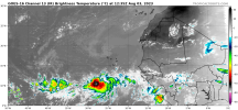
Canadian has been consistently developing this wave near Cape Verde. Last 3 runs of GFS have developed same low near Bahamas/South Gulf around same time frame. Around August 13th or 14th. If this wave can survive being ripped to shreds from dry air/shear over next 10 day, this one looks like it could have some potential.

Here is our wave.

1691082244623.png
 

Taylor Campbell

Moderator
Moderator
PerryW Project Supporter
Messages
2,138
Reaction score
2,242
Location
Wedowee, AL
Special Affiliations
  1. SKYWARN® Volunteer
I think the EURO has the only logical forecast.
 
Last edited:
Messages
300
Reaction score
866
Location
Oxford, Mississippi
Even on the latest Euro it shows a vorticity blob over Bahamas around same time frame.

I believe it will be a disorganized mess, but if it can maintain a little juice all the way to the Bahamas/Florida Straits...it may have the potential to organize into a TS in the Gulf.
 

Austin Dawg

Member
Sustaining Member
Messages
900
Reaction score
1,394
Location
Leander, Texas
00z Euro Ensemble showing my dream back on April 23rd of a category 5 in the Gulf.

Before you say that's just a dream, I dreamed 10 years ago about the EF3 that hit Amory MS this past March. Few years prior to the Smithville MS EF5 tornado on April 27th 2011, I dreamed about a tornado going right in front of my house in Smithville on hwy 25 North. I lived right off the highway. Literally right in front of it.
That's funny. I was already in Texas but I kept having a similar dream in the months getting up to that F5 when I haven't lived in Smithville since 1993. I never had another one after it hit. Strange.

I never had another dream about a tornado until this January and February just before the Amory storm but they were nowhere as intense as the dreams I had before the Smithville tornado hit.
 

Taylor Campbell

Moderator
Moderator
PerryW Project Supporter
Messages
2,138
Reaction score
2,242
Location
Wedowee, AL
Special Affiliations
  1. SKYWARN® Volunteer
I love how Hurricane Dora doesn't care what the NHC calls for intensity wise. Multiple times they have called for its weakening, but each time it's continued its major status ramping up significantly and more so this time than any other at 942mb. She is gorgeous!

gorgeousdoran.jpg
 
Last edited:

Taylor Campbell

Moderator
Moderator
PerryW Project Supporter
Messages
2,138
Reaction score
2,242
Location
Wedowee, AL
Special Affiliations
  1. SKYWARN® Volunteer
Also, it's been wild watching the evolution of Typhoon Khanun. When I first looked at it with model forecast at around the 140hr mark they were enthused the storm was going into east China, and the JMA called for it to hit there too. However, it had different plans and reversed back over these islands and has been crushing them for days.

reverse.jpg
 

JPWX

Member
Messages
1,583
Reaction score
4,307
Location
Smithville MS
I love how Hurricane Dora doesn't care what the NHC calls for intensity wise. Multiple times they have called for its weakening, but each time it's continued its major status ramping up significantly and more so this time than any other at 942mb. She is gorgeous!

View attachment 21244
Reminds me of Epsilon in 2005. Kept calling for weakening and yet it kept persisting.
 
Messages
535
Reaction score
475
Location
Northern Europe
While vertical wind shear looks to remain relatively low east of the Lesser Antilles, models continue to indicate widespread stability through at least mid-August. As a result, global ensembles show few signs of development. If there are no signs of development by late August, the high-end (“hyperactive”) and even the above-average seasonal forecasts are likely to fail, given the onset of El Niño’s effects in September and October. As I mentioned previously, I suspect that a lot of the dry air is related to the fact that the subtropical is still warmer than the tropical Atlantic, even though both regions are technically above average SST-wise. Ironically, if the remainder of August remains quiet, dry air―not Niño-related, TUTT-induced shear―looks to be the primary culprit. The Niño-related shear may be delayed until September, at which point it will offset seasonal increases in instability.
 

Taylor Campbell

Moderator
Moderator
PerryW Project Supporter
Messages
2,138
Reaction score
2,242
Location
Wedowee, AL
Special Affiliations
  1. SKYWARN® Volunteer
While vertical wind shear looks to remain relatively low east of the Lesser Antilles, models continue to indicate widespread stability through at least mid-August. As a result, global ensembles show few signs of development. If there are no signs of development by late August, the high-end (“hyperactive”) and even the above-average seasonal forecasts are likely to fail, given the onset of El Niño’s effects in September and October. As I mentioned previously, I suspect that a lot of the dry air is related to the fact that the subtropical is still warmer than the tropical Atlantic, even though both regions are technically above average SST-wise. Ironically, if the remainder of August remains quiet, dry air―not Niño-related, TUTT-induced shear―looks to be the primary culprit. The Niño-related shear may be delayed until September, at which point it will offset seasonal increases in instability.

The EURO gets things going potentially as early as next week.
 
Messages
535
Reaction score
475
Location
Northern Europe
The EURO gets things going potentially as early as next week.
The period of 14–19 August in particular looks to be potentially dangerous insofar as impacts to the Southeastern CONUS are concerned. During this timeframe the EPS depicts a west-based -NAO with an extended western-Atlantic ridge (WAR) and retrogressive cutoff low near the westernmost Great Lakes—a configuration that is known to favour potential TC impacts. However, global models have consistently tended to delay development over the past few weeks, owing to stable air. The latest GEFS already develops the next few waves in the EPAC instead of the Atlantic. So at this rate I am rather skeptical of the prospects of TC genesis before late August. Moreover, by the time TC activity picks up in late August or early September, the landfall-friendly mid-level pattern will likely have changed.


^ Note that the operational ECMWF shows little or no development, despite a favourably-timed CCKW passage during the next five days.
 
Last edited:
Messages
535
Reaction score
475
Location
Northern Europe
201322-ASOSSTAchange.png

201322-ASOH7-RHchange.png

201322-ASOprecipchange.png


^ The above three graphics illustrate how a warmer subtropical Atlantic since 2012 has led to a drier, less humid, more hostile MDR and Caribbean.
 
Messages
535
Reaction score
475
Location
Northern Europe
Dora is very similar to past such systems as Erick (2019), Douglas (2020), Felicia (2021), and Darby (2022): likely Cat-5s that were not classified appropriately, due to constraints on Dvorak. All these systems were and are quite compact, a few of which displayed annular-type characteristics, along with spectacular stadium-effect and symmetry. A good counterpart in the Atlantic basin is 2003’s Isabel, which may have been even more intense than satellite indicated, based on data from reconnaissance. If these C/EPAC systems were to be reclassified as Cat-5s, recent seasons in the Atlantic would look less impressive. (Incidentally, satellite-derived data also suggest that plenty of other C/EPAC systems were underestimated as late as the early 1990s.)
 

JBishopwx

Member
Sustaining Member
Messages
938
Reaction score
2,134
Location
Ackerman, MS
Special Affiliations
  1. SKYWARN® Volunteer
Dora is very similar to past such systems as Erick (2019), Douglas (2020), Felicia (2021), and Darby (2022): likely Cat-5s that were not classified appropriately, due to constraints on Dvorak. All these systems were and are quite compact, a few of which displayed annular-type characteristics, along with spectacular stadium-effect and symmetry. A good counterpart in the Atlantic basin is 2003’s Isabel, which may have been even more intense than satellite indicated, based on data from reconnaissance. If these C/EPAC systems were to be reclassified as Cat-5s, recent seasons in the Atlantic would look less impressive. (Incidentally, satellite-derived data also suggest that plenty of other C/EPAC systems were underestimated as late as the early 1990s.)
We have different opinions on some things, but I completely agree with you on this.
 
Messages
535
Reaction score
475
Location
Northern Europe
I will say this: over the next four days and during the period of 14–19 August, everything would seemingly favour activity in the MDR. Among the factors that do are:
  • weaker-than-average vertical wind shear;
  • below-normal MSLP, as depicted by the CFSv2;
  • twin CCKW passages;
  • well-above-average SSTA;
  • climatology;
  • the ongoing -PDO/-PMM configuration, which offsets +ENSO to some extent
If we do not manage to see at least one TC, if not more, in the MDR by mid-August, then I think this season will end up being much more inactive than currently forecast by several agencies. El Niño’s effects have been remarkably absent to date, but will begin to affect the season by early September. Already the SOI is turning sharply negative, indicating +ENSO-like oceanic-atmospheric coupling. So the Atlantic has just a limited window before +ENSO-related feedback interferes. The fact that models are generally bearish through mid-August, showing 2022-like dry air, suggests that a neglected factor—likely the warmer-than-average subtropical Atlantic—is once again causing issues with stability, despite very different conditions at work this year from those of last season.

Also, if nothing forms in the MDR by mid-August, future systems will be less likely to take advantage of a landfall-friendly mid-level pattern. That might be good news.
 
Messages
535
Reaction score
475
Location
Northern Europe
^ My personal prediction, based on the above:
  • The warm subtropical Atlantic means that stability will plague the MDR before September.
  • There will be no development in the MDR until the last week of August, at the very earliest.
  • By that time, steering currents will shift and no longer be favourable for U.S. landfalls.
  • By early September, El Niño will take hold and effectively “shut down” the season.
2023-MDRSeason-Cancel.png


Unless the models are wrong, I think there is a better-than-average chance of “season cancel”. I’m not going to definitively state that the season will be canceled, but rather that indicators suggest that the odds favour such an outcome. Hopefully this will be the case.

2023-Excess-Warmth.jpg


^ As we saw last season, this kind of SSTA configuration is serving to kill yet another Atlantic hurricane season, albeit under different parameters.


By the time deep-tropics instability increases in September, El Niño will have already entrenched itself, meaning “goodbye” to an active season.

Very Important Disclaimer: regardless of the outcome, be prepared, as always!
 
Last edited:
Back
Top