• Welcome to TalkWeather!
    We see you lurking around TalkWeather! Take the extra step and join us today to view attachments, see less ads and maybe even join the discussion.
    CLICK TO JOIN TALKWEATHER

2017 Hurricane Season Discussion

Taylor Campbell

Moderator
Moderator
PerryW Project Supporter
Messages
2,102
Reaction score
2,189
Location
Wedowee, AL
Special Affiliations
  1. SKYWARN® Volunteer
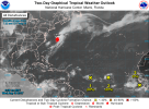
NAVGEM, and CMC picking up on two storms.

GFS appears to be the most aggressive in strength with this tropical wave now coming off Africa. It shows a storm in about 48 hours.

Similar to last time (i.e. Invest 99L) the operational EURO is kinda blah compared to all the other models.

Though definitely plenty of activity to watch for development.

easternatlanticsatellite.gif
 

Taylor Campbell

Moderator
Moderator
PerryW Project Supporter
Messages
2,102
Reaction score
2,189
Location
Wedowee, AL
Special Affiliations
  1. SKYWARN® Volunteer
Satellite imagery doesn't show much more than a very broad, and disorganized area of storms. There's a lot of work to be done if we are going to see a storm soon. Also, a pretty sheared environment sits to the west so if nothing can get its act together in a big way then it'll have more troubles doing so later. So far.... everything looks, and feels like this is just another 99L. But, I see better potential in anything that comes of this to be a US threat.


The area is looking better today. Two distinct spins with Invest 91L, and 92L. Still there is some SAL dust around, and wind shear out to the west. If you look medium to long range, the unfavorable wind shear is eventually forecast to subside.
 

JayF

Technical Administrator
Staff member
Administrator
Moderator
Sustaining Member
Technical Admin
Messages
1,624
Reaction score
878
Location
Hartselle, al
HAM Callsign
KB4JCS
Busy day in the Atlantic today.
 

Attachments

  • two_atl_2d0.png
    two_atl_2d0.png
    189.4 KB · Views: 0

WesL

"Bill, I'm talkin' imminent rueage"
Staff member
Administrator
Moderator
Sustaining Member
Messages
3,344
Reaction score
2,614
Location
Fayetteville, AR
Special Affiliations
  1. SKYWARN® Volunteer
Euro says what....
DIlEaZ2UMAAwlPW.jpg:large
 
  • Like
Reactions: KoD

JayF

Technical Administrator
Staff member
Administrator
Moderator
Sustaining Member
Technical Admin
Messages
1,624
Reaction score
878
Location
Hartselle, al
HAM Callsign
KB4JCS
That would be IRMA and the storm that is forming off the coast of Africa right now. Going to be a busy September.


Euro says what....
DIlEaZ2UMAAwlPW.jpg:large
 
  • Like
Reactions: KoD

Mike S

Administrator
Staff member
Administrator
Moderator
PerryW Project Supporter
Messages
1,991
Reaction score
1,115
Location
Meridianville, Al
Special Affiliations
  1. SKYWARN® Volunteer
So yeah, to say the tropics have woken up after a very long slumber is an understatement.
 

KoD

Moderator
Staff member
Moderator
PerryW Project Supporter
Messages
1,380
Reaction score
697
Location
Huntsville, AL
I know the weather channel needs their ad revenue but I can't stand watching it when 65% is commercial.
 

Mike S

Administrator
Staff member
Administrator
Moderator
PerryW Project Supporter
Messages
1,991
Reaction score
1,115
Location
Meridianville, Al
Special Affiliations
  1. SKYWARN® Volunteer
1. Updated: A small area of low pressure has developed over the
central Atlantic Ocean almost a thousand miles east-southeast of
Bermuda. The low is producing a concentrated area of showers and
thunderstorms, although the circulation appears somewhat elongated.
Some additional development of this system is possible during the
next few days while it moves slowly northward through early next
week.
* Formation chance through 48 hours...low...30 percent.
* Formation chance through 5 days...medium...40 percent.

Forecaster Berg/Blake
 

Brent

Member
Messages
118
Reaction score
18
Location
DFW Texas
A large area of cloudiness and showers extending from the
northwestern Caribbean Sea across Cuba to the Bahamas is associated
with a surface trough interacting with an upper-level low. An area
of low pressure is likely to form from this weather system while it
moves northward across Cuba and near the east coast of the Florida
peninsula during the next few days, and environmental conditions
appear conducive for development before upper-level winds become
less favorable early next week. Regardless of development, this
system is likely to produce locally heavy rainfall over portions of
Cuba, southern Florida, the Florida Keys, and the Bahamas during the
next several days.
* Formation chance through 48 hours...low...20 percent.
* Formation chance through 5 days...medium...40 percent.


This will probably be mostly a rainmaker

But there are strong hints of a hurricane coming from the Yucatan/Cuba area in the LR towards the Gulf.
 

WesL

"Bill, I'm talkin' imminent rueage"
Staff member
Administrator
Moderator
Sustaining Member
Messages
3,344
Reaction score
2,614
Location
Fayetteville, AR
Special Affiliations
  1. SKYWARN® Volunteer
two_atl_2d0.png


Ugh.
 

WesL

"Bill, I'm talkin' imminent rueage"
Staff member
Administrator
Moderator
Sustaining Member
Messages
3,344
Reaction score
2,614
Location
Fayetteville, AR
Special Affiliations
  1. SKYWARN® Volunteer
Tried to be funny-ish but hey look at the Florida straights...


JayF

Technical Administrator
Staff member
Administrator
Moderator
Sustaining Member
Technical Admin
Messages
1,624
Reaction score
878
Location
Hartselle, al
HAM Callsign
KB4JCS
Possible New Formation in the next 5 days.

two_atl_5d0.png
 
Logo 468x120
Back
Top