- Moderator
- #261
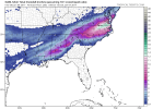
This is going to be fun. Radar is looking good. Top CIPS analog for tomorrow is January 28th, 2014. Going to be plenty of moisture tomorrow I just hope a good bit of it falls as snow and less sleet. I think we can definitely get an inch or two here in Wedowee, AL.