barcncpt44
Member
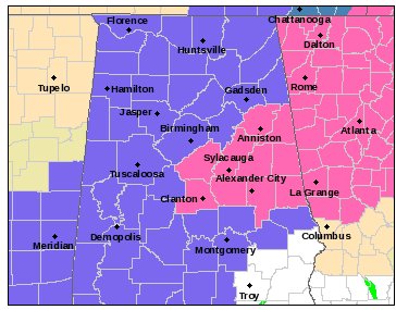
Here is the warning map from NWS Peachtree City.

Follow along with the video below to see how to install our site as a web app on your home screen.
Note: This feature may not be available in some browsers.
OH NAM!
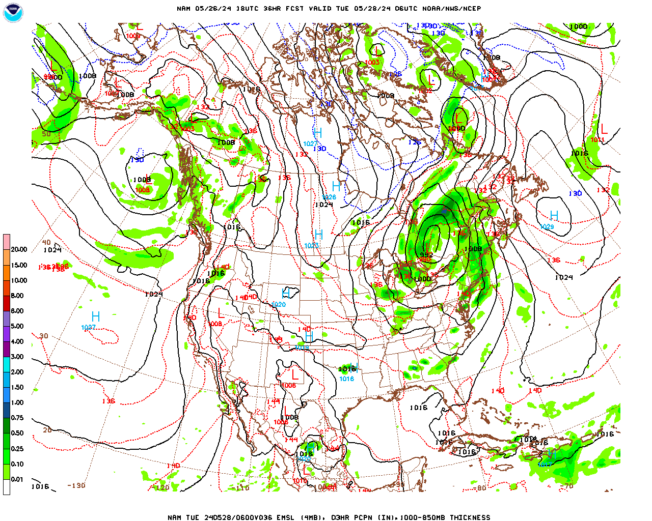

All I can tell right now is a nice northward expansion of precip field modeled.Does that look like it's nosing back south & west with the accum map? Looks like the heavier axis is along I-85.
Thanks! I like the look of that!
You've been calling it for several days now Richard....bring it home!NAM is finally catching on...I still think the heaviest precipitation could be a little further north...but the trend is clear.


Richard, it seems the associated low in the Gulf develops closer to the coast and comes inland a little steeper than past runs. Don't know if this helps my location much since I think most of what we potentially see will be from overrunning. Your thoughts are appreciated.NAM is finally catching on...I still think the heaviest precipitation could be a little further north...but the trend is clear.
Really a bogus map, 850s a scorching for most of the precip except for far north AL. Otherwise it's pretty much a dusting for most of us unless you get some ZR/IP.
In other terms, not a good run except if you live in Huntsville.