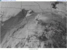
Here's what I see tomorrow for North MS:
1. Slight Risk gets expanded south and east with upgrade to Enhanced Risk. 00z and 12z RRFS-A model were nasty looking.
2. North MS could get upgraded to a Moderate Risk for Excessive Rainfall. Going back to the RRFS-A model (particularly the 12z run), it showed storms training over the same areas with total rainfall amounts between 3-5 inches over Central/Northern Monroe County, MS. The last thing that Amory and Smithville need is flash flooding. Unfortunately, those amounts are on the table.
Not much has been said about tomorrow's threat further south.

