sak
Member
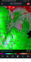
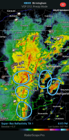
Really? I'm looking at it the radar across eastern MS and west central AL and am having a hard time envisioning a really bad outcome, especially given how worked over north and central AL are from prior rainfall and a general lack of instability.I have seen lines like this in this kind of setup have very bad outcomes.