Kory
Member
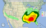
That storm is headed for Pickens Co...the tornado magnet of Alabama.Moderate maintained
And still not tornado watch for whatever reason despite a tornado warning two counties from the state line
Follow along with the video below to see how to install our site as a web app on your home screen.
Note: This feature may not be available in some browsers.
That storm is headed for Pickens Co...the tornado magnet of Alabama.Moderate maintained
And still not tornado watch for whatever reason despite a tornado warning two counties from the state line
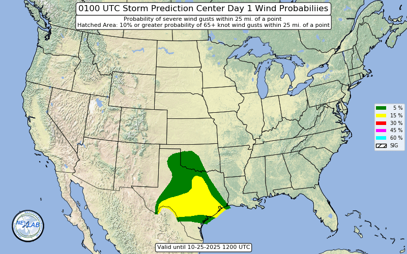
moderate pulled back out of southern Tennessee
Spann says tornado watch finally incoming; really should've been issued an hour ago
Yep. A few cells now getting a look to them. The McComb MS cell is moving right into max STP parameters.Definitely keep an eye on the large cell moving northeastward from McComb, MS. Isolated, lots of open parameter space to work with, and velocity shows increasing rotation with each scan.

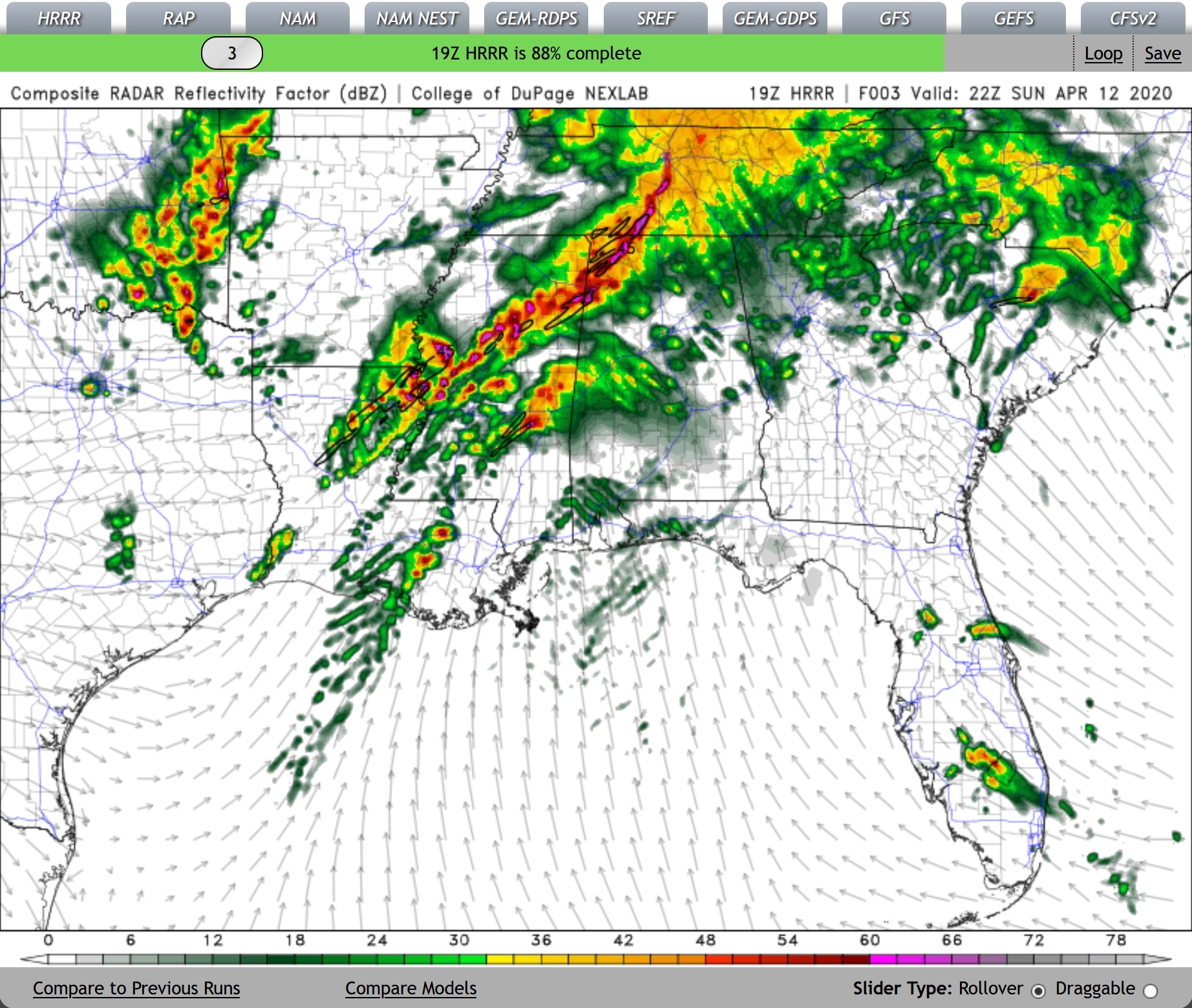
Really starting to hook now, and velocity is starting to look pretty concerning.Columbus cell is increasing rotating as well. Riding the thermal boundary right into Pickens...