
That's rare that they do that.SPC just did a day 3 upgrade to enhanced with hatched sig threat for LA/MS.
Navigation
Install the app
How to install the app on iOS
Follow along with the video below to see how to install our site as a web app on your home screen.
Note: This feature may not be available in some browsers.
More options
-
Welcome to TalkWeather! We see you lurking around TalkWeather! Take the extra step and join us today to view attachments, see less ads and maybe even join the discussion. CLICK TO JOIN TALKWEATHER
You are using an out of date browser. It may not display this or other websites correctly.
You should upgrade or use an alternative browser.
You should upgrade or use an alternative browser.
Severe WX Wednesday/Thursday/Friday April 17th-19th Severe Threat
- Thread starter Darklordsuperstorm
- Start date
-
- Tags
- severe
Kory
Member
Last time they did that for that area was 2/23/16 outbreak.That's rare that they do that.
CheeselandSkies
Member
That's rare that they do that.
Wow. That's just about unheard of. I was just looking over the NAM and 3k NAM and thinking LA might get the big long track tornado on Thursday that they didn't on Saturday.
Kory
Member
It's difficult for Louisiana to get those. With the close proximity to the Gulf, too much forcing blows up into a mess. I think W/WNW flow events work well for them. See 2/7/2017 with the Akers and New Orleans tornado.Wow. That's just about unheard of. I was just looking over the NAM and 3k NAM and thinking LA might get the big long track tornado on Thursday that they didn't on Saturday.
CheeselandSkies
Member
It's difficult for Louisiana to get those. With the close proximity to the Gulf, too much forcing blows up into a mess. I think W/WNW flow events work well for them. See 2/7/2017 with the Akers and New Orleans tornado.
Yeah, that's why high risking them is silly which SPC seems to have finally caught on to.
Kory
Member
If we get instability values to come in a touch higher on the Euro, it would mean big problems with shear values like such.
warneagle
Member
I agree with the day 3 enhanced upgrade. That area looked particularly volatile on the NAM without the VBV issues that look likely further west on Wednesday and with shear vectors that favor a more cellular mode. The 3km NAM pops some PDS TOR hazard types down there unsurprisingly.
looking at the 3k NAM, it has the highest td's in central Alabama, topping out around 66°n 69° in west Alabama, if that is correct, there will be trouble. I have seen this model overplay this before, but typically during the winter. We are well into April and with the warm temps, it isn't going to be as difficult to get the higher theta e air further north...especially if there is any kind of delay of just a couple of hours.
If there is a surface low around HWY 278, that may actually cause the Td's be lower as surface winds will be more easterly....looks like there is a fine line for all of this to come together in Alabama, but if it did, it would be trouble.
If there is a surface low around HWY 278, that may actually cause the Td's be lower as surface winds will be more easterly....looks like there is a fine line for all of this to come together in Alabama, but if it did, it would be trouble.
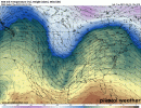
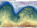
Also, there are considerable timing differences in when exactly the south and north troughs phase...on the GFS it happens earlier, that would allow more time for the higher td's to move northward, also allow cold temps aloft to come in before the squall line. Will be interesting to see if the GFS folds to the NAM or the opposite happens. These two gifs are for the same time period
Attachments
Last edited:
Kory
Member
The NAM has a tendency to be slow.
Gail
Member
I'm waving the white flag for Mississippi. We've had enough fun with severe weather for this season! Bring me the sunny, 90+ days of summer with occasional afternoon showers/storms.


gangstonc
Member
Is that our secondary low?
Yes, instability is still in questionIs that our secondary low?
gangstonc
Member
Are the models or converging yet? It looks like lower level temps will be there. Is moisture return a problem, or will the mid and upper levels be warm and saturated?Yes, instability is still in question
MattW
Member
- Messages
- 387
- Reaction score
- 379
- Location
- Decatur, GA
- HAM Callsign
- KG4GUF
- Special Affiliations
- SKYWARN® Volunteer
Does anyone see this being a problem for Georgia on Friday morning? I'm not seeing that there's good conditions for severe weather, just strongish thunderstorms, but I'm also not nearly as experienced as others here.
Does anyone see this being a problem for Georgia on Friday morning? I'm not seeing that there's good conditions for severe weather, just strongish thunderstorms, but I'm also not nearly as experienced as others here.
I see it as a problem for areas south of I-20.....so for South/Central GA. Could see a line with a damaging wind and isolated tornado threat Friday AM
I am a bit surprised to see this 
kcyalater
Member
What is the SPC seeing that we aren't?
Kory
Member
Mesoscale models working in about 1000-1200 J/KG CAPE ahead of the main QLCS. That amount was very sufficient for last weekend and I suspect the same here.