- Thread starter
- #741
Navigation
Install the app
How to install the app on iOS
Follow along with the video below to see how to install our site as a web app on your home screen.
Note: This feature may not be available in some browsers.
More options
-
Welcome to TalkWeather! We see you lurking around TalkWeather! Take the extra step and join us today to view attachments, see less ads and maybe even join the discussion. CLICK TO JOIN TALKWEATHER
You are using an out of date browser. It may not display this or other websites correctly.
You should upgrade or use an alternative browser.
You should upgrade or use an alternative browser.
2025 Global Tropical Cyclone Season Discussion
- Thread starter Atlantic
- Start date
- Thread starter
- #742
- Thread starter
- #743
It’s for the Gulf disturbance approaching Texas right now and it’s a “low-level invest” mission.We also have an AFXXX 0204A CYCLONE that is scheduled to depart in 1 hour and 48 minutes. For what, I’ve no clue at this moment and I will have to look into it further.
- Thread starter
- #744
- Thread starter
- #745
- Thread starter
- #746
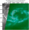
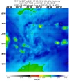
From the CPHC:Invest 97E is now Invest 90C as it has moved across 140W and into the Central Pacific basin. It is at 50%/60% now according to the CPHC.
ZCZC HFOTWOCP ALL
TTAA00 PHFO DDHHMM
Tropical Weather Outlook
NWS Central Pacific Hurricane Center Honolulu HI
Issued by NWS National Hurricane Center Miami FL
200 PM HST Fri Jul 25 2025
For the central North Pacific...between 140W and 180W:
1. Eastern portion of Central Pacific (CP90):
An area of low pressure located well southeast of the Hawaiian
Islands is producing a large area of showers and thunderstorms.
Some gradual development of this system is possible, and a tropical
depression could form this weekend or early next week as it moves
generally westward at 10 to 15 mph across the Central Pacific basin.
* Formation chance through 48 hours...medium...50 percent
* Formation chance through 7 days...medium...60 percent
- Thread starter
- #747
- Thread starter
- #748
Kds86z
Member
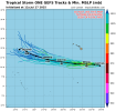
oh wow climo stats first since 2015Invest 90C became Tropical Depression One-C overnight. It is the first CPAC storm to form in July since 2015. Current forecast calls for a 50 kt peak. Next name on the list is Iona.
- Thread starter
- #750
2015 had the most active CPAC on record (including EPAC crossovers into the basin from the east)oh wow climo stats first since 2015
The Central Pacific Hurricane season in 2015 started with Tropical Depression Four-E forming just east of 140W on July 8th. 04E moved westwards into the CPAC on July 9th and received the name Ela.
A monsoon trough breakdown caused the formations of Tropical Storm Halola (which later crossed 180 a.k.a the IDL and became a Typhoon in the WPAC) and Tropical Storm Iune between the 10th and the 12th of July.
- Thread starter
- #751
- Thread starter
- #752
- Thread starter
- #753
- Thread starter
- #754
Kds86z
Member
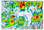
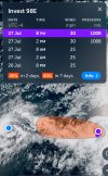
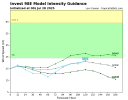
We also have Invest 98E newly designated behind 01C/Iona:
View attachment 45491
And the disturbance off of Mexico is up to 10/70 now.
Meanwhile 98E here is up to 40/40
What does faded letters mean?
- Thread starter
- #756
Faded letters? Where?What does faded letters mean?
- Thread starter
- #757
And here it is:
655
WTPA41 PHFO 280231
TCDCP1
Tropical Storm Iona Discussion Number 4
NWS Central Pacific Hurricane Center Honolulu HI CP012025
Issued by NWS National Hurricane Center Miami FL
500 PM HST Sun Jul 27 2025
A strong burst of deep convection with very cold cloud tops below
-80C developed over the low-level center of the tropical cyclone
well southeast of the Hawaiian Islands earlier this morning into the
early afternoon. This activity has recently subsided, but the
satellite presentation has improved since the previous advisory,
with well-defined banding structures now evident. The latest
subjective Dvorak intensity estimates from PHFO, SAB, and JTWC all
came in at 2.5/35 knots, while the objective intensity estimates
ranged from 35 to 42 knots. Taking a blend of these data, the
initial intensity for this advisory has been raised to, perhaps a
conservative 35 knots, making Iona the first named storm of the
season in the central Pacific.
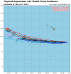
Tropical Storm Iona is moving westward at 270/9 knots. This general
westward motion is expected to continue during the next couple of
days as the system moves along the southern periphery of a
subtropical ridge to the north. By Tuesday night or Wednesday, Iona
is expected to increase its forward speed due to a strengthening
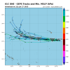
low-to-mid-level ridge north of the system. The track forecast
closely follows a blend of the FSSE and HCCA consensus guidance and
is very close to the track from the previous advisory. Confidence
remains high that Iona will stay well to the south of the Hawaiian
Islands.
The environment appears conducive to further intensification over
the next day or so, as Iona remains over warm waters around 28C,
with adequate mid-level moisture and very light vertical wind shear.
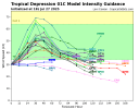
As a result, the intensity forecast calls for steady strengthening,
with the cyclone expected to near hurricane strength by Monday night
or Tuesday. However, by Tuesday night, Iona will begin to move over
slightly cooler waters, begin to feel the influence of increasing
westerly vertical wind shear, and start to entrain drier mid-level
air. This is expected to result in steady weakening, with the
cyclone likely becoming a post-tropical remnant low by Day 5 and
potentially weakening into a trough by that time. The intensity
forecast has been raised from the previous advisory, following the
latest trends in the intensity guidance, and is best aligned with
the FSSE and HCCA consensus guidance.
FORECAST POSITIONS AND MAX WINDS
INIT 28/0300Z 10.9N 148.3W 35 KT 40 MPH
12H 28/1200Z 11.0N 149.7W 45 KT 50 MPH
24H 29/0000Z 11.0N 151.7W 55 KT 65 MPH
36H 29/1200Z 11.0N 153.8W 60 KT 70 MPH
48H 30/0000Z 11.1N 156.4W 60 KT 70 MPH
60H 30/1200Z 11.5N 159.4W 50 KT 60 MPH
72H 31/0000Z 12.1N 162.9W 45 KT 50 MPH
96H 01/0000Z 13.0N 170.4W 35 KT 40 MPH
120H 02/0000Z 14.4N 177.4W 30 KT 35 MPH...POST-TROP/REMNT LOW
$$
Forecaster Jelsema (CPHC)
Kds86z
Member
Oh wow.
Last edited:
Last Central Pacific Hurricane was Hone on August 25th, 2024.
Last Central Pacific Major was Walaka on October 2nd, 2018.
There has not been a July hurricane that has originated in the Central Pacific on record.
The two storms above originated in the Central Pacific itself not from the Eastern Pacific and moved across.
Last Central Pacific Major was Walaka on October 2nd, 2018.
There has not been a July hurricane that has originated in the Central Pacific on record.
The two storms above originated in the Central Pacific itself not from the Eastern Pacific and moved across.

