- Thread starter
- #761
Navigation
Install the app
How to install the app on iOS
Follow along with the video below to see how to install our site as a web app on your home screen.
Note: This feature may not be available in some browsers.
More options
-
Welcome to TalkWeather! We see you lurking around TalkWeather! Take the extra step and join us today to view attachments, see less ads and maybe even join the discussion. CLICK TO JOIN TALKWEATHER
You are using an out of date browser. It may not display this or other websites correctly.
You should upgrade or use an alternative browser.
You should upgrade or use an alternative browser.
2025 Global Tropical Cyclone Season Discussion
- Thread starter Atlantic
- Start date
- Thread starter
- #762
Kds86z
Member

- Thread starter
- #764
This is quite rare to see two storms form in the Central Pacific. Last time we had at least two CPAC homebrew (non-EPAC origin) storms was 2015. 2019 used two names, the first one went to a EPAC depression that crossed over 140W and moved into the basin.
Kds86z
Member
Oh wow dang @Atlantic. Yeah I’m no expert but seemed a bit unusual for July.This is quite rare to see two storms form in the Central Pacific. Last time we had at least two CPAC homebrew (non-EPAC origin) storms was 2015. 2019 used two names, the first one went to a EPAC depression that crossed over 140W and moved into the basin.
- Thread starter
- #766
A CPHC named hurricane hasn’t happened before… until now with Hurricane Iona.Oh wow dang @Atlantic. Yeah I’m no expert but seemed a bit unusual for July.
- Thread starter
- #767
I meant to clarify that it hasn’t happened before in JULY, sorry, @Kds86zA CPHC named hurricane hasn’t happened before… until now with Hurricane Iona.
KakashiHatake2000
Member
- Thread starter
- #770
The depression is Tropical Storm Keli now, but the point still stands.
KakashiHatake2000
Member
gotcha hurricane expert atlanticThe depression is Tropical Storm Keli now, but the point still stands.
- Thread starter
- #774
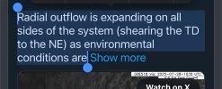
The post said that Iona was blasting wind shear at the depression to the NE, and that depression is now TS Keli, but like I said, the point still stands.Wym?
- Thread starter
- #775
- Thread starter
- #777
WTPA41 PHFO 290255
TCDCP1
Hurricane Iona Discussion Number 8
NWS Central Pacific Hurricane Center Honolulu HI CP012025
Issued by NWS National Hurricane Center Miami FL
500 PM HST Mon Jul 28 2025
The satellite presentation of Iona has improved since earlier today,
with very cold cloud tops ranging from -70°C to -80°C surrounding a
developing eye that is becoming increasingly well-defined.
Subjective Dvorak current intensity estimates came in at 4.0/65
knots from PHFO, 4.0/65 knots from SAB, and 4.5/77 knots from JTWC.
Objective estimates from ADT, AiDT, and SATCON have ranged between
65 and 82 knots over the past several hours. Based on a blend of
these data, the initial intensity for this advisory has been
increased to 75 knots.
Hurricane Iona is moving due west, or 270 degrees at 11 knots. This
general motion, along with a gradual increase in forward speed, is
expected to continue over the next several days as the cyclone moves
along the southern periphery of a subtropical ridge to the north. A
turn toward the west-northwest is anticipated by late in the week as
the system is influenced by a weakness in the mid-level ridge,
created by a developing upper-level low west of the International
Date Line. The official track forecast remains near the center of
the guidance envelope and is nearly identical to the previous
advisory. Confidence remains high that Iona will stay well south of
the Hawaiian Islands.
Environmental conditions appear primed for further intensification
during the next 24 hours. Iona will remain over warm sea surface
temperatures near 28C, with sufficient mid-level moisture and
minimal vertical wind shear. The latest ECMWF SHIPS guidance
indicates a greater than a 40 percent probability of a 30-knot
intensity increase within 24 hours. Given the improving structure
and conducive environment, the intensity forecast explicitly calls
for rapid intensification during the next 24 hours, with Iona
expected to become a major hurricane on Tuesday. Steady weakening
is forecast to begin Tuesday night or Wednesday as the system moves
over slightly cooler waters, encounters increasing westerly vertical
wind shear, and begins to entrain drier mid-level air. Iona is
expected to weaken to tropical depression status by day 5, and it is
possible the system could become a post-tropical remnant low by that
time. The intensity forecast has been adjusted slightly upward from
the previous advisory, reflecting the latest trends in the intensity
guidance. This aligns well with regional hurricane models through
day 2 and then closely follows the HCCA consensus guidance
thereafter.
FORECAST POSITIONS AND MAX WINDS
INIT 29/0300Z 10.9N 152.2W 75 KT 85 MPH
12H 29/1200Z 10.9N 153.8W 95 KT 110 MPH
24H 30/0000Z 10.9N 156.3W 105 KT 120 MPH
36H 30/1200Z 10.9N 159.3W 95 KT 110 MPH
48H 31/0000Z 11.2N 162.9W 75 KT 85 MPH
60H 31/1200Z 11.5N 166.7W 60 KT 70 MPH
72H 01/0000Z 12.1N 170.4W 50 KT 60 MPH
96H 02/0000Z 13.7N 178.0W 40 KT 45 MPH
120H 03/0000Z 15.9N 176.5E 35 KT 40 MPH
$$
Forecaster Jelsema (CPHC)
Interestingly enough, the Eastern Pacific has had 8 total tropical systems thus far. In 2018, up to this point, the Eastern Pacific had 9 total tropical systems.
2025 Typhoon Season: 14 total systems
2018 Typhoon Season: 19 total systems
A difference of just 5.
2025 Typhoon Season: 14 total systems
2018 Typhoon Season: 19 total systems
A difference of just 5.
- Thread starter
- #779
This year has been favoring the Pacific like an El Niño though we don’t have an El Niño active atmosphericly or in the ocean at the moment.Interestingly enough, the Eastern Pacific has had 8 total tropical systems thus far. In 2018, up to this point, the Eastern Pacific had 9 total tropical systems.
2025 Typhoon Season: 14 total systems
2018 Typhoon Season: 19 total systems
A difference of just 5.
Why is the MJO lagging over the Pacific so far this season?
Last edited:
I'm not sure, but the Atlantic is playing out the same way it did in 2018 as well. You've had 3 tropical systems thus far and in 2018, the Atlantic had 3 tropical systems by now. Of course, to note, 2 of them were hurricanes.This year has been favoring the Pacific like an El Niño though we don’t have an El Niño active atmosphericly or in the ocean at the moment.
Why is the MJO lagging over the Pacific so far this season?


