• Welcome to TalkWeather!
    We see you lurking around TalkWeather! Take the extra step and join us today to view attachments, see less ads and maybe even join the discussion.
    CLICK TO JOIN TALKWEATHER

2025 Global Tropical Cyclone Season Discussion

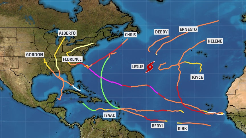
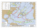
I'm not sure, but the Atlantic is playing out the same way it did in 2018 as well. You've had 3 tropical systems thus far and in 2018, the Atlantic had 3 tropical systems by now. Of course, to note, 2 of them were hurricanes.
Though the difference between 2018 and now is that 2018 became an El Niño year, and this year is shaping up to possibly become a La Niña year later on this year. The environment seems to be neutral to cool neutral ENSO right now to me.
 
Invest 98E (soon to be Invest 92C) for Tropical Depression Three-C or Tropical Storm Lala anyone?

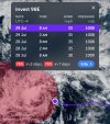
98E redeveloped convection overnight and though the this morning into now. NHC/CPHC tags it at 70/70 in chances right now and say this:
IMG_0857.jpeg
IMG_0856.jpeg
 

Attachments

  • tracks-at-2018.png
    tracks-at-2018.png
    1.5 MB · Views: 0
If this thing Walakas its way to C5 then so help me
It appears to be weakening now, but I don’t know. It is expected to cross the international dateline and move into the Western Pacific as a tropical storm according to the forecast right now.
 
This current Pacific outbreak of hurricanes highlights an important point that should be routinely addressed in forecasting at an amateur level, especially longer ranged forecasts like how a tornado season will go - just because things appear unfavorable from a large-scale standpoint, such as an unfavorable MJO or ENSO pattern, it doesn't mean the season will be the way said signal suggests. It is more likely to be the case from a forecasting perspective, but its not a guarantee. This season is extremely similar to 2018 so far despite the extremely apparent differences in the ENSO patterns between the years - I'm not saying that 2018 and 2025 are completely different, as they did share some similarities from other standpoints, but ENSO by itself is enough of a difference maker for me to discuss this. Analogs are great and all, but Earth's atmosphere is a shell of gas that holds ~10^19 kg of matter, corresponding to over 10^43 molecules. Good luck predicting the long-range behavior of this system with only macroscopic patterns. It's fine for the medium range forecasts (< ~1 - 2 weeks), but trying to forecast specifics beyond that is iffy at best.

Look at Trey Greenwood, for example. He's an incredible forecaster and meteorologist, and he's right probably about 95% of the time. But, this year, he predicted an average to below-average tornado season based on the macroscopic patterns like ENSO, and was incorrect about that part of his forecast. Was his forecast based on things that aren't helpful in diagnosing an active season? Of course not, it was a very rational prediction, the reasons he gave were very valid. But hindsight is 20/20 and the Earth's atmosphere doesn't care what we think supports an active season versus what we think doesn't. This season's spring was every bit as active as 2024's was.

I have a feeling that meteorology is a field that will greatly benefit from an increase in analogs we can call back to. There's probably some really large scale patterns meteorology hasn't been around long enough for yet that influence how a hurricane or tornado season will pan out, and we are going to find them if they exist. It just needs more time.
 
WTPA41 PHFO 300250
TCDCP1

Hurricane Iona Discussion Number 12
NWS Central Pacific Hurricane Center Honolulu HI CP012025
Issued by NWS National Hurricane Center Miami FL
500 PM HST Tue Jul 29 2025

Iona likely reached peak intensity earlier today, with satellite
images now showing the eye obscured by a central dense overcast.
The cyclone has begun to weaken as it feels the influence of
increasing westerly vertical wind shear while also moving over
cooler sea surface temperatures below 27C, as depicted by the
Real-time, Global, Sea Surface Temperature Analysis. The latest
subjective Dvorak current intensity estimates from PHFO and JTWC
were 5.5/102 knots, while SAB was a somewhat lower 4.5/77 knots.
Meanwhile, the latest objective intensity estimates range from 85 to
96 knots. Given that the system has just recently begun to weaken,
the initial intensity will be lowered to 100 knots for this
advisory.

Iona is moving due west, or 270 degrees, at 15 knots. This general
motion is expected to continue during the next couple of days as the
cyclone moves along the southern periphery of a subtropical ridge to
the north. A turn toward the west-northwest and a gradual decrease
in forward speed is expected late in the week and over the weekend,
as the system is steered into a weakness in the mid-level ridge to
the north. The official track forecast remains near the center of
the tightly clustered guidance envelope and is nearly identical to
the previous advisory. Confidence remains high that Iona will stay
well south of the Hawaiian Islands.

The cyclone is expected to undergo rapid weakening tonight and
Wednesday as it experiences increasing westerly vertical wind shear
while also moving over cooler sea surface temperatures of 26.5 to
27C. A slower rate of weakening is then forecast Wednesday night
and Thursday. By Friday, the shear begins to relax, sea surface
temperatures begin to increase to 28C or above, and the mid-levels
begin to moisten. The spread among the intensity guidance is
considerable, and the cyclone’s intensity will likely depend on how
intact the system remains after moving through the hostile
environment over the next couple of days. The official forecast
shows the intensity leveling off after 48 hours, but confidence in
this is low. Overall, the intensity forecast lies pretty close to
the middle of the intensity guidance envelope.


FORECAST POSITIONS AND MAX WINDS

INIT 30/0300Z 11.0N 157.1W 100 KT 115 MPH
12H 30/1200Z 11.1N 159.5W 85 KT 100 MPH
24H 31/0000Z 11.3N 162.6W 70 KT 80 MPH
36H 31/1200Z 11.6N 166.0W 65 KT 75 MPH
48H 01/0000Z 12.1N 169.5W 60 KT 70 MPH
60H 01/1200Z 12.8N 172.7W 55 KT 65 MPH
72H 02/0000Z 13.7N 175.7W 55 KT 65 MPH
96H 03/0000Z 15.9N 179.2E 55 KT 65 MPH
120H 04/0000Z 17.9N 174.1E 50 KT 60 MPH

$$
Forecaster Jelsema (CPHC)
 
Adios Keli!

TTAA00 PHFO DDHHMM

Remnants Of Keli Discussion Number 10
NWS Central Pacific Hurricane Center Honolulu HI CP022025
Issued by NWS National Hurricane Center Miami FL
1100 AM HST Wed Jul 30 2025

Convection associated with Keli has largely collapsed. Based on
the geostationary visible imagery, it appears the low-level
circulation has opened into a trough on the northern side of Iona.
The remnants of Keli are moving westward at around 15 kt within
the northeastern circulation of Iona and this motion is expected
to continue for the next day or so.

This will be the last advisory issued for Keli. For additional
information, see the High Seas Forecasts issued by the National
Weather Service under WMO header FZPN02 KWBC and AWIPS header
NFDHSFEPI.

FORECAST POSITIONS AND MAX WINDS

INIT 30/2100Z 13.9N 156.6W 30 KT 35 MPH
12H 31/0600Z...DISSIPATED

$$
Forecaster Bucci

NNNN

 
Back
Top