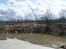
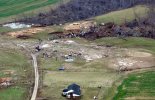
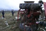
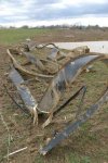
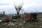
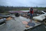
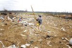
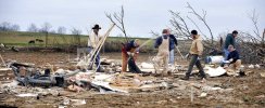
Amos, KY EF3, apart of the Super Tuesday outbreak from 2008, I'm very skeptical of the EF3 rating, I'm not an engineer but the Stephens farm home (image 1) has very close spaced anchoring with nuts + washers, including a bent anchor where there is a ripped away sillplate, obviously more goes into a rating than just anchoring but still. They also had an anchored utility shed parallel to the home (image 2), the entire Tracy Lane area was absolutely devastated with substantial windrowing of the structures (image 3), farming vehicles and trucks were thrown and flipped, mobile home frames were twisted like pretzels and some broken apart, trees were stripped and the ground seems to have been scoured, or at least plastered in mud. There are a few sources saying this tornado was rated EF4/175, though by the NWS it is officially EF3.