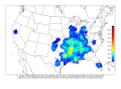
Yeah wensday looks interesting, in a sense that event primes the atmosphere some before Friday.And also don't sleep on Wednesday. SPC is now hinting at a possible threat on Wednesday too.
Navigation
Install the app
How to install the app on iOS
Follow along with the video below to see how to install our site as a web app on your home screen.
Note: This feature may not be available in some browsers.
More options
-
Welcome to TalkWeather! We see you lurking around TalkWeather! Take the extra step and join us today to view attachments, see less ads and maybe even join the discussion. CLICK TO JOIN TALKWEATHER
You are using an out of date browser. It may not display this or other websites correctly.
You should upgrade or use an alternative browser.
You should upgrade or use an alternative browser.
Severe Weather 2025
- Thread starter KevinH
- Start date
- Moderator
- #782
12z GFS Takeaways:
1. Surface Based Cape is not as impressive as yesterday's 18z run, but that's to be expected.
2. How low can you go? 12z GFS now has a 968mbar low over Kansas by Friday.
3. 500mb level looks very potent by next Friday.
4. 12z depicting 120kt bulk shear value over Northeast MS by Sunday. By far the highest bulk shear I've seen in these parts in a while.
Summary:
Tight pressure gradient leading to Wind Advisories/High Wind Watches/Warnings over a widespread area. Just like with the most recent system. Multiple rounds of storms leading to flash flooding and severe weather/tornado outbreak.
I don't like the fact there will high gradient winds like last time that led to multiple power outages. Power outages plus tornado outbreak...yeah, sick feeling is back.
Yeah, cape values aside and it’s only one model run… but seeing potential surface based instability all the way up into northern Iowa and as far east as Central Indiana Friday afternoon is pretty interesting. Could be a sneaky setup up there, especially around the triple point.12z GFS Takeaways:
1. Surface Based Cape is not as impressive as yesterday's 18z run, but that's to be expected.
2. How low can you go? 12z GFS now has a 968mbar low over Kansas by Friday.
3. 500mb level looks very potent by next Friday.
4. 12z depicting 120kt bulk shear value over Northeast MS by Sunday. By far the highest bulk shear I've seen in these parts in a while.
And you have the 500 MB jet start to overspread directly over that area.
Exactly! Plus communicating that plus damaging winds associated with the severe storms is quite a challengeI don't like the fact there will high gradient winds like last time that led to multiple power outages. Power outages plus tornado outbreak...yeah, sick feeling is back.
I'll be upping my wording about this going forward. 12z Euro is going be interesting.CSU is now thoroughly picking up on this threat. CIPS putting out some impressively widespread severe analog probabilities. Verbatim, 12Z GFS would be a multi-day severe weather event.
View attachment 34740
View attachment 34741View attachment 34742View attachment 34743
tennessee storm chaser
Member
- Messages
- 1,613
- Reaction score
- 3,019
- Location
- jackson tennessee
- Special Affiliations
- SKYWARN® Volunteer
No doubt. Even the euro is a big event. Though gfs is more bullish …. We see how 12z euro comes in real soonI'll be upping my wording about this going forward. 12z Euro is going be interesting.
cincywx
Member
the overall expanse here is mind-boggling, and it's only a three day period.
Cyclonic Paracosm
Member
the fact that legit, all models atp have this is alarming
tornado examiner
Member
I think this could be it.
tennessee storm chaser
Member
- Messages
- 1,613
- Reaction score
- 3,019
- Location
- jackson tennessee
- Special Affiliations
- SKYWARN® Volunteer
Anxious start seeing ukiethe fact that legit, all models atp have this is alarming
Cyclonic Paracosm
Member
yeaaah, when I saw UKMET my heart skipped a beatAnxious start seeing ukie
Cyclonic Paracosm
Member
tennessee storm chaser
Member
- Messages
- 1,613
- Reaction score
- 3,019
- Location
- jackson tennessee
- Special Affiliations
- SKYWARN® Volunteer
Jesus. WowView attachment 34744
a sounding posted in a server, p sure with piv + but heres UKMET!!!
Cyclonic Paracosm
Member
yhuppJesus. Wow
Pretty to look at, but I don’t trust the Ukmet at all this far outView attachment 34744
a sounding posted in a server, p sure with piv + but heres UKMET!!!
tennessee storm chaser
Member
- Messages
- 1,613
- Reaction score
- 3,019
- Location
- jackson tennessee
- Special Affiliations
- SKYWARN® Volunteer
Just bout time event …. But it’s more ominous than 0z even12z Euro doesn’t really draw in moisture into Dixie Proper until overnight Friday.
It’s in the weird 7 day range, but timing can make or break an event. I agree though, some of the setups being portrayed could possibly yield significant severe weather.Just bout time event …. But it’s more ominous than 0z even


