CheeselandSkies
Member
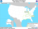
Down to marginal at 01Z. No reports have come in today.
Follow along with the video below to see how to install our site as a web app on your home screen.
Note: This feature may not be available in some browsers.
Yep. No doubtNext week we get up into the mid 70s. I expect some sort of system to take advantage of these crazy early Feb temperatures.
The Monroe County curseO just wait. Something will happen when it hits the Monroe County line.
LiterallyThe Monroe County curse
I would not be surprised at all if a potent severe weather setup comes into play given how warm the Southern areas of the United States are. It is never a good thing when it’s in the 80s as the high in Houston in February.SPC is giving subtle hints at a threat evolving during the current Day 4-8 Outlook the last few days and again this morning:
"Uncertainty remains high in the medium-range period, in terms of
both pattern evolution, and attendant potential for severe weather.
Models agree in general that early in the period, a quasi-zonal
pattern aloft will prevail across the U.S., and a roughly
west-to-east surface baroclinic zone will be in place from the
central/southern Plains vicinity eastward to the Carolinas.
Initially, any convective potential should remain limited, and
largely confined to the cool side of the surface front. However,
emerging model differences become evident, even early in the period,
in terms of the eastward advance of various short-wave disturbances
through the background westerlies. This progression of short-wave
energy -- varying in degree from model to model -- results in
correspondingly varying degrees of amplification of the flow field
aloft, and also correspondingly, varying levels of mass response at
the surface.
Within the generally more amplified ECMWF, even early in the period
but particularly through the middle and later stages of the
forecast, likelihood for greater northward transport of higher
theta-e air would exist, meaning greater potential for
destabilization, and -- given flow aloft more than sufficient for
organized convection -- greater potential for severe weather.
With all of that said, given what appears to be a pattern of
inherently low predictability, delineating areas of severe-weather
potential would appear imprudent at this time, at the medium-range
time frames."
yeaaah, that should be watchedI would not be surprised at all if a potent severe weather setup comes into play given how warm the Southern areas of the United States are. It is never a good thing when it’s in the 80s as the high in Houston in February.
ooh ok, is svr wx comin backGlobal models are suggesting that we are about to shift to a high-amplitude trough pattern in a few weeks.
Save the cape for may/june when I go out chasing in the westHow much Cape do you want?
Australia: All of It