- Moderator
- #1
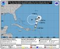
Euro & GFS show some interesting solutions in the long range. 12z GFS & 00z ECMWF have north motion until this weekend, then a westward shift towards the CONUS. GFS shows gradual weakening with time and the Euro has it strengthening into a hurricane & nearing or entering the GOM around the beginning of October.