KevinH
Member
SPC has highlighted these days with risk areas. People on the main 2024 thread also seem to think there is potential for this event to be a bigger dal than currently anticipated.
Discuss…. lol
Discuss…. lol
Follow along with the video below to see how to install our site as a web app on your home screen.
Note: This feature may not be available in some browsers.
Im disappointed in you Kevin. You know how these events turn out never make a thread until the day of. Smh hahaSPC has highlighted these days with risk areas. People on the main 2024 thread also seem to think there is potential for this event to be a bigger dal than currently anticipated.
Discuss…. lol
I was bored *shrug*Im disappointed in you Kevin. You know how these events turn out never make a thread until the day of. Smh haha
")
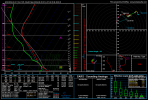
For the Monday to Thursday periods...focus will be on
the weather system in the early part of the week followed by a cool
down and more seasonal conditions with a warmup as we approach later
week.
In a general sense, the system for early week is similar in that
it's a large scale long wave trough with embedded waves. It's these
embedded waves that are driving some of the uncertainty and a bit of
change that we are seeing in the guidance. I mention change in that
there's been a slower shift in the global guidance with the GFS/GEFS
leading the way. The notable feature driving this is the lead wave
lifting more NW/N and thus riding across the SE have a greater
influence. However, the next wave will be close on the heels and
quickly moving through the Big Bend region of S Tx. With more of the
two wave solution, you ultimately slow the frontal progression later
on Monday and help produce a surface wave feature later along the
nearly stalled front which will then allow a more progressive
eastward push of the front later Monday night into the morning hours
Tuesday. Any slower solution would also allow more quality moisture
to make it into the area ahead of the front. This quality moisture
return was a limitation in prev model solutions. Additionally, more
quality moisture will result in higher instability. Overall, this
system has poor lapse rates so there's a low ceiling for any decent
instability. However, having sbcape of 0 to 300 or sbcape of 200-700
will make a difference and with a slower evolution being the
trend...opportunity for the sbcape of 200-700 is more of a
probability than before. Speaking of wind shear and forcing, this
system will have plenty of that so it's really about getting
sufficient instability.


[eyes emoji]A secondary low like that would spell trouble, as it would induce a mass response and enhance the low-level shear closer to the moisture source. The overall setup looked a lot less impressive when it just appeared to be the main low petering out way north over Lake Superior at that timeframe.

Still one of the scariest tornadoes I’ve chased. I got the video on my tik tokThis event will be almost a year to the date of the rolling fork tornado
I wouldn't write this one off man lol you might be surprised.If I was a betting man, I would suggest everyone focus on April moving forward.
Sunday is a highly anomalous setup in the Plains. While moisture will almost certainly be on the lower end due to the prior frontal passage in the Gulf, there are very strong height falls on the order of 60-90 meters in 6 hrs between 18z and 00z. In addition, the actual 500 mb heights are nudging into the 540s in KS/N OK with 500 mb temperatures at or below -20˚C. That is extremely cold for a warm sector with any meaningful destabilization.
Would caution to trust traditional wisdom regarding thermodynamics with this setup, assuming there is anywhere near sufficient CAPE to support robust convection in the strong wind fields.