
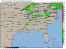
It's merely because the analog-based algorithms used to determine those threat contours are dependent upon model data (updated twice per day), causing them to differ, sometimes drastically, from the overall geometry of SPC outlook areas.I'm currently a 1st year meteorology student. Is there any reason as to why CSU has drastically different risk areas from the SPC?
Navigation
Install the app
How to install the app on iOS
Follow along with the video below to see how to install our site as a web app on your home screen.
Note: This feature may not be available in some browsers.
More options
-
Welcome to TalkWeather! We see you lurking around TalkWeather! Take the extra step and join us today to view attachments, see less ads and maybe even join the discussion. CLICK TO JOIN TALKWEATHER
You are using an out of date browser. It may not display this or other websites correctly.
You should upgrade or use an alternative browser.
You should upgrade or use an alternative browser.
Svr Wx threat April 1-April 2 2024
- Thread starter KevinH
- Start date
Supercell printer at it again lolMeanwhile the 12z RRFS has supercells moving through yours truly's backyard on Tuesday. To be honest, it does show my concern.
Something rather ominous about having a potential significant severe event in the Ohio Valley on the day before the 50th anniversary of the 1974 Super Outbreak.
F
Former Member 1430
Guest
I had the exact same thought. I’ll be curious to see how models pan out over the next 24 hoursSomething rather ominous about having a potential significant severe event in the Ohio Valley on the day before the 50th anniversary of the 1974 Super Outbreak.
cincywx
Member
it would be nice if this doesn't age poorly. the environment in the cincinnati area is gradually growing more concerning and a shift of only a few hours could bring us firmly into play.while i suspect most of the threat on tuesday will occur east of cincinnati, it's certainly got my ears perked up
Tomcats Forever!
Member
Do you have an image of the ref composite that shows the Ohio Valley?Meanwhile the 12z RRFS has supercells moving through yours truly's backyard on Tuesday. To be honest, it does show my concern.


Tomcats Forever!
Member
I know it's the supercell printer, but that looks mean
Yeah and it might not be far off on that idea given that you'll have a warm front positioned in that general area.I know it's the supercell printer, but that looks mean


Tomcats Forever!
Member
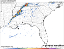
You know something's up when the models bullseye east Kentucky21Z SREF with a large 60% SigTor Ingredients contour at 21Z Tuesday.
View attachment 24561
That and based on other models I've seen today warrant either expansion of the Level 2 risk and/or upgrade to Level 3 (particularly Northeast MS into North AL)Sounding from near Columbus, MS, ahead of a QLCS on Tuesday. Could certainly support a tornado threat.
View attachment 24563
Timhsv
Member
Tuesday/ NAM/ 21Z

The way the structure of the supercells reminds me so much of what the RRFS looked probably of the 4/28/2014 high risk outbreak. Nasty.Meanwhile the 12z RRFS has supercells moving through yours truly's backyard on Tuesday. To be honest, it does show my concern.
06Z runs of CAMs show a concerning increase in the favorability of wind fields for tornadoes across AL and GA, with more curved hodos out ahead of convection. If that trend holds, could mean a more substantial tornado threat for the South.
Edit: Likewise, 03Z SREF guidance trended more favorable for tornadoes across Alabama and Georgia.
Edit: Likewise, 03Z SREF guidance trended more favorable for tornadoes across Alabama and Georgia.
David in SW Blount
Member
Well that escalated quickly! 
- Moderator
- #100
Anyone else not quite in agreement with the Day 2?