Severe WX Southern Severe Weather Threat: 3/9-3/10

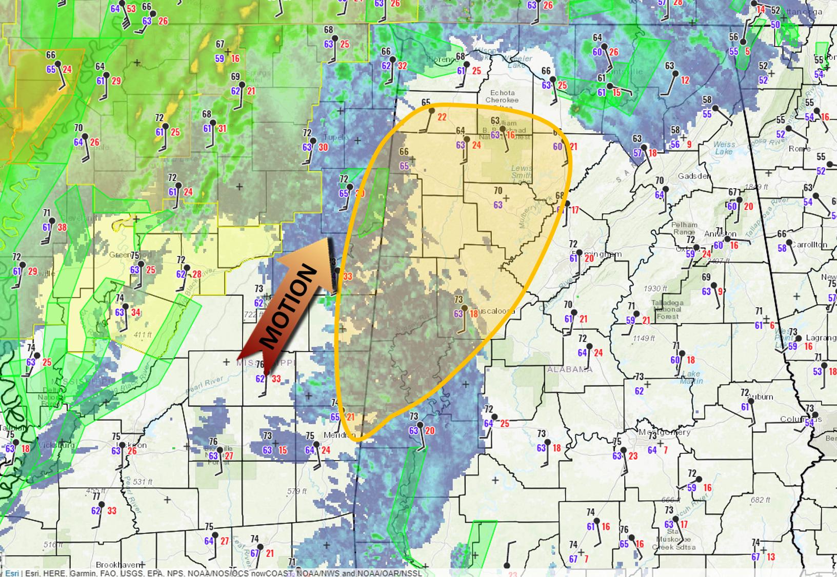
4pm Walker County Alabama Hrrr
hrrr_2019030917_005_33.81--87.42.png
 
Because of course Walker County would have a PDS TOR plot on HRRR, lol. Sirens here sure get a workout in tornado season.
 
Lot of junk over North Mississippi. southern most cells could do something eventually but north of Oxford to Kentucky getting worked. Anything that can pop north of I20 ahead of the line will need to be watched.
 
Hard to tell what that once was, but from the amount of insulation scattered into the trees, looks like it could have been a mobile home that was "relocated" from its cinder block "foundation." Not good.

Well, hopefully no one was in it at the time, or if they were, then they made it out OK. *Knocks on wood*
 
Line's definitely reforming in MS, but the question is, will we get anything discrete out ahead of it
 
a Forecast Discussion
National Weather Service Birmingham AL
1228 PM CST Sat Mar 9 2019

.UPDATE...
MESOSCALE UPDATE.

&&

.SHORT TERM...

We continue to monitor a negatively tilted trough across eastern
Kansas into southwest Missouri and northwest Arkansas. Vigorous
deep convection is ongoing across much of eastern Arkansas into
far northwest Mississippi and into west-central Tennessee at this
hour.

Our 09/12Z and recently launched 09/18Z special Vortex-SE
soundings continue to indicate a capping inversion that has become
more pronounced and this is limiting shower activity across the
area late this morning up to the current time. The cap is allowing
low-level instability to build without being released and this
energy will be available when a lifting mechanism/forcing breaks
it later today. At 18Z the available surface-based convective
available potential energy (CAPE) was nearly 300 J/kg and this
value is expected to continue to increase through the early to mid
afternoon hours.
 
Back
Top