• Welcome to TalkWeather!
    We see you lurking around TalkWeather! Take the extra step and join us today to view attachments, see less ads and maybe even join the discussion.
    CLICK TO JOIN TALKWEATHER
Logo 468x120
Messages
2,157
Reaction score
2,712
Location
Missouri
Moshannon? It's hard to say just because there were so few manmade structures in the path. It definitely did violent damage in the Winterburn/Penfield area, which is pretty impressive since that was only a few miles after touchdown. That was before it exploded in size though, and after that point I actually wasn't able to find any substantial, well-built structures that it struck directly. It damaged a bunch of camps and hunting cabins and totally demolished some of them, but they weren't exactly the sturdiest of buildings from what I can tell.

I didn't find a ton of evidence of debarking, ground scouring, etc. but I'm not sure you'd even expect to see that in such thickly forested areas. One thing that does seem fairly impressive to me is that it passed through a few areas of old-growth hardwood forest with very large, mature trees and still managed to virtually clear-cut them. I spoke with a man who did some surveys for the state DCNR after the tornado and he said there was an area in Clinton County in particular where, to paraphrase, there was nothing left standing above roughly head height in a large grove of old-growth hemlock. That takes some pretty serious power.

..Which I guess is all a very long-winded way of saying that I haven't come across anything to suggest it was extremely violent, but I'm not entirely certain I would have even if it was. My own personal opinion is that it probably was capable of producing a huge swath of strong damage and likely spotty areas of violent, but its peak intensity wasn't really what made it so remarkable. I'd say there were likely a half-dozen other tornadoes that day that were more violent based on the evidence that's available.
Perhaps you'll answer this in your article, but do you know the most reliable estimate for how many trees this thing downed? Grazulis says 88,000 but I don't think that's right given that this thing went through nothing but dense forest for ~70 miles and the 1987 Yellowstone tornado had a path length of only 24 miles but managed to down a million trees or so.

This article claims the tornado devastated 10,024 acres and caused 5 million in timber damage, and also claims it demolished 76 miles of trails and closed 22 miles of state roads. Perhaps the 76 is a typo but the rest of the statistics seem accurate, not entirely sure.


TH2002

Member
Sustaining Member
Messages
3,116
Reaction score
4,677
Location
California, United States
Special Affiliations
  1. SKYWARN® Volunteer
Some Cullman-Arab damage photos I found

This aerial of downtown Cullman speaks for itself:
1200x0.jpg


Cullman-damage-gas-station.JPG
Gas station destroyed. The building on the property was leveled, the sign was twisted off its base and gas pumps were ripped from the ground and remained missing at the time of the survey.

Cullman-trailer.JPG
Trailer left in pretty bad shape after being tossed for 100 yards

Arab_AL_tornado_damage_20110427-71.jpg

Some possible ground scouring? Or maybe the site where a mobile home stood or just vehicle tracks. I am not sure what to make of this one.

Another photo that shows something similar
Arab_AL_tornado_damage_20110427-73.jpg


Supposedly this tornado did in fact sweep away at least one well-bolted home in the Arab-Ruth area (not to be confused with that one home), but without photographic evidence I have to chalk it up to a rumor. If it did happen I really hope someone has some photos to share.
 

andyhb

Member
Messages
1,033
Reaction score
2,689
Location
Norman, OK
Cullman had a surprisingly (well, maybe not so surprisingly given the video) intense path through the core of the city regarding degree of damage. A lot of larger structures were very heavily damaged or completely destroyed. Certainly a tier above other similar cases such as West Liberty KY in 2012.
 

Austin Dawg

Member
Sustaining Member
Messages
852
Reaction score
1,299
Location
Leander, Texas
The thermal boundary those supercells (Hackleburg, Smithville, as well as Cullman) were riding made an environment already primed for several violent/long tracked tornadoes even more unprecedented. Truly a nightmare set up.
View attachment 10418
So that Hackleburg storm came out of Monroe County MS too? There was another tornado warned storm after these two that went right by the doppler radar site. I think looking at this that all three formed along that bend of the line but I will have to go back and look at the radar loop to confirm. I think there may have been another that started there but it might help explain why that storm put down a long track F5 starting in that area.
 

TH2002

Member
Sustaining Member
Messages
3,116
Reaction score
4,677
Location
California, United States
Special Affiliations
  1. SKYWARN® Volunteer
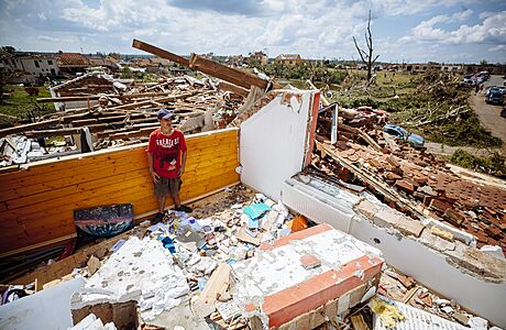
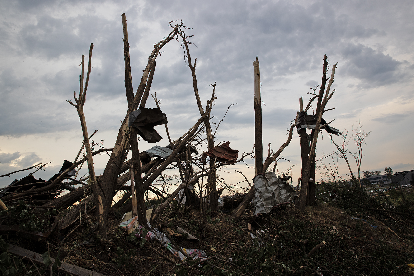
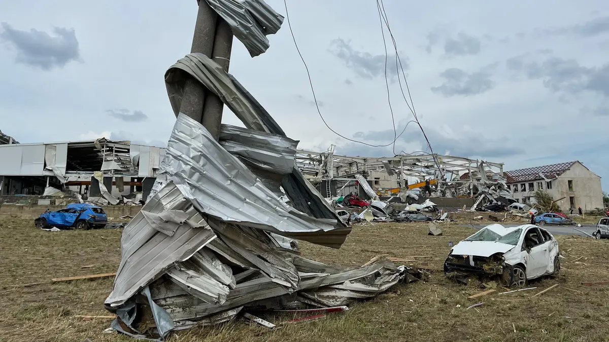
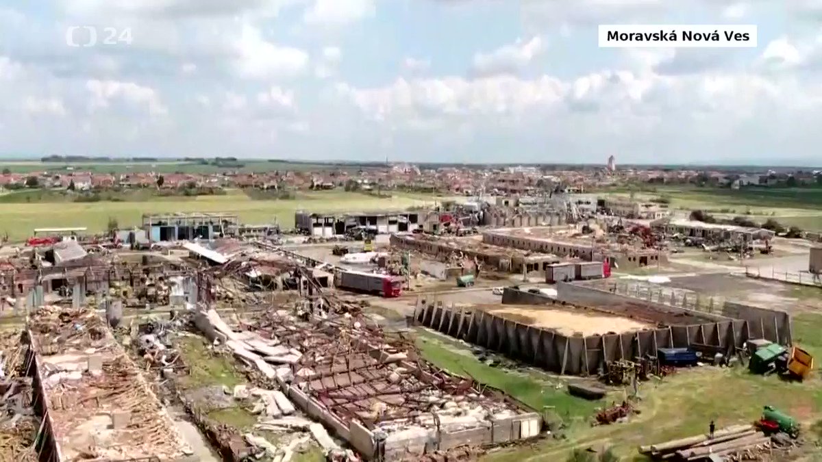
The Hodonin tornado from this year was just insane. (Some cleanup might have taken place in some of the photos)
w.png


hodonin-czech-republic-27th-june-2021-debris-after-a-tornado-storm-passed-through-the-hodonin-panov-.png


206976409_3067975443438659_8252427875852749526_n.jpg

207128138_3067975496771987_6952983809283267461_n.jpg

206461591_3067975400105330_41778330588628094_n.jpg

207290029_10218882604680455_8237842458534150619_n.jpg

208413352_3623525647873244_7665861245449962159_n.jpg

208400131_2879418312324928_1648093727544622435_n.jpg

208345599_10159730008340110_6890230771928441874_n.jpg

VAG8c4e8d_120029_16458313.jpg

mtor43.jpeg

208574556_10217085096233616_7437283730946908543_n.jpg

209046212_10217244208651249_3910592989583771009_n.jpg

The photo of the slabbed homes was taken on June 27, three days after the tornado, so there's a fair chance those homes were actually swept away by the tornado and not clean-up crews.
 

buckeye05

Member
Messages
3,121
Reaction score
4,581
Location
Colorado
This one was actually initially rated EF2 and was later upgraded. Ridiculous, I know. But these photos should be used as a reference for what EF4+ tree damage looks like. It doesn’t get any more textbook that.

Any time someone says that this type of debarking is consistent with EF3 damage (less prevelant these days thankfully), I challenge them to find a photo of this type of tree damage immediately next to genuine EF3 structure damage with walls still standing (ie not default EF3 in which the structure is leveled and higher winds potentially could have occurred). You know how many examples of this I’ve been provided? Zero. Nobody has been able to produce such a thing, because it doesn’t happen. 85-90% debarking is a phenomenon that is absolutely unique to violent tornadoes. The scale needs to be adjusted to account for this.
 

buckeye05

Member
Messages
3,121
Reaction score
4,581
Location
Colorado
The photo of the slabbed homes was taken on June 27, three days after the tornado, so there's a fair chance those homes were actually swept away by the tornado and not clean-up crews.
Looks almost too clean though, and I see wheelbarrows and evidence of debris removal. The full flyover the damage path on YouTube doesn’t show any clean sweeps either. I suspect this may have been taken in Panov near the end of the path, where some homes were leveled and the debris was quickly cleaned up, leaving bare slabs just a day or two after the tornado.

Could totally wrong about that though.
 

TH2002

Member
Sustaining Member
Messages
3,116
Reaction score
4,677
Location
California, United States
Special Affiliations
  1. SKYWARN® Volunteer
Looks almost too clean though, and I see wheelbarrows and evidence of debris removal. The full flyover the damage path on YouTube doesn’t show any clean sweeps either. I suspect this may have been taken in Panov near the end of the path, where some homes were leveled and the debris was quickly cleaned up, leaving bare slabs just a day or two after the tornado.

Could totally wrong about that though.
I just did some more research - the photo is from Pánov. So you appear to be correct.

On another note, here is a tractor left in pretty bad shape after the tornado in Pánov:
P%C3%A1nov_%28Hodon%C3%ADn%29_after_2021_South_Moravia_tornado_strike_%2820%29.jpg
 

MNTornadoGuy

Member
Messages
1,612
Reaction score
2,568
Location
Apple Valley, MN
The 5/14/2021 China tornado outbreak is well known but there was a second potentially larger part of the outbreak the day after. According to our weather enthusiasts from China who are on this forum, there were 7-13 tornadoes with at least one possible significant tornado that struck the city of Yueyang, where brick homes were damaged and destroyed.
getInterUrl


TH2002

Member
Sustaining Member
Messages
3,116
Reaction score
4,677
Location
California, United States
Special Affiliations
  1. SKYWARN® Volunteer
The Joplin tornado 2011 was pretty bad
As EXTREME as Joplin was I think it gets an unfair reputation among some people for the abysmal excuse for a survey conducted by NIST and ASCE. See some previous posts on it:
 

ARCC

Member
Messages
503
Reaction score
309
Location
Coosa county
Stellar video of Hackleburg-Phil Campbell that was removed from YouTube and I didn't want to see get lost to the sands of time


(note: may have to download the video cause Google Drive sucks)


The more videos I watch of it the more I realize what the people in the Tri-state tornado saw before it hit them. How fast that mile wide tornado moves is insane. By the time you realized that you were looking at a tornado it was too late even if it was a few miles off.
 
Back
Top