- Staff
- #1,421
Thank you!!According to Storm Data, the Tuscaloosa-Birmingham tornado was the largest at a max width of 2600 yards.
Follow along with the video below to see how to install our site as a web app on your home screen.
Note: This feature may not be available in some browsers.
Thank you!!According to Storm Data, the Tuscaloosa-Birmingham tornado was the largest at a max width of 2600 yards.
During the 2011 Outbreak, which tornado was the biggest in width?
I’d like to see an aerial of the rowing that took place when the Hackleburg/Phil Campbell got at it’s strongest in the rural town of Oak Grove...

 extremeplanet.wordpress.com
These are some good finds, there really isn't a lot of documentation on this tornado given its intensity. Pretty extreme tree damage in all of those images.One underrated tornado from the 4/27/11 Super Outbreak is the New Harmony TN EF4. This high-end EF4 (190 mph) completely leveled well-built, debarked and shredded trees, mangled mobile homes frames, threw vehicles hundreds of yards and produced ground scouring.


I remember reading some of the local news articles about this particular tornado. One of them described the tornado to have "twin funnels" with it. I mapped part of this tornado's track on Google Earth, and initially it had a very discontinuous path with random increases in damage, before the damage path became concentrated, and a very convergent zone of damage was noted as the tornado approached the auto shop, which was the first building to be destroyed by the tornado at it's full intensity.These are some good finds, there really isn't a lot of documentation on this tornado given its intensity. Pretty extreme tree damage in all of those images.


As the tornado progressed further to the northeast, it downed hundreds of trees, leaving a very visible scar on satellite imagery. The tornado then impacted a camping trailer, which was not located in the area of maximum intensity. A man, his wife, and her sister were inside. The camper was knocked over and rolled a long distance, killing the wife and her sister. The man was severely injured. The tornado continued to knock down hundreds of trees before it entered the New Harmony area, where the worst damage occurred. The photos MNTornadoGuy posted above were taken in this area. A mobile home frame was mutilated and torn around debarked trees. A cinder-block foundation home literally vanished. Two people were killed when their mobile home disappeared. They were found holding hands on the other side of the street. Pieces of insulation were grinded into tiny pieces and thrown at high speed into nearby trees, along with some other small debris. Little, if anything was recovered from homes in the EF4+ damage contour in this area.I remember reading some of the local news articles about this particular tornado. One of them described the tornado to have "twin funnels" with it. I mapped part of this tornado's track on Google Earth, and initially it had a very discontinuous path with random increases in damage, before the damage path became concentrated, and a very convergent zone of damage was noted as the tornado approached the auto shop, which was the first building to be destroyed by the tornado at it's full intensity.
(THIS IS NOT OFFICIAL)
View attachment 5583
View attachment 5584
View attachment 5585
The tree damage right before the tornado entered the valley where the automotive repair shop was located, which is no more than a mile northeast of here.
View attachment 5586
This is the auto shop I'm talking about. It's called Kizzar Automotive Company. After the tornado, it was never rebuilt. The owners were inside when the tornado hit, and heard debris hitting the structure. They ran for cover, and a wooden wall partially fell on top of them. This saved their lives, as the structure was obliterated around them.
Mrs. Julia Kizzar, the co-owner of Kizzar Automotive points to where she and her husband hid, and somehow survived during the tornado.
View attachment 5590
The shop was completely destroyed after the tornado
View attachment 5587
Now, the business is still in operation, but no building exists.
View attachment 5588
Recovered debris in a pile the year after from Kizzar Automotive. View attachment 5589


The tornado continued to the northeast and moved through mainly a wooded area, producing very significant tree damage before weakening significantly. By the time the tornado came out of the forest areas in Rhea County, it had weakened to a point where it was too weak to leave a scar on satellite imagery before dissipating near Spring City. The only damage I could find in this area was from the Storm Events Database, which stated that the tornado downed power lines, snapped trees, and produced some structural damage before dissipating.As the tornado progressed further to the northeast, it downed hundreds of trees, leaving a very visible scar on satellite imagery. The tornado then impacted a camping trailer, which was not located in the area of maximum intensity. A man, his wife, and her sister were inside. The camper was knocked over and rolled a long distance, killing the wife and her sister. The man was severely injured. The tornado continued to knock down hundreds of trees before it entered the New Harmony area, where the worst damage occurred. The photos MNTornadoGuy posted above were taken in this area. A mobile home frame was mutilated and torn around debarked trees. A cinder-block foundation home literally vanished. Two people were killed when their mobile home disappeared. They were found holding hands on the other side of the street. Pieces of insulation were grinded into tiny pieces and thrown at high speed into nearby trees, along with some other small debris. Little, if anything was recovered from homes in the EF4+ damage contour in this area.
The cinder block foundation that disappeared with almost nothing found of it. Note how trees in the background are not disturbed at all, and the significant lack of debris in this area.
View attachment 5593
View attachment 5592
View attachment 5598
View attachment 5597
Mobile home frame that was mutilated
View attachment 5594
Another view of the worst damage
View attachment 5595
View attachment 5591
Insulation grinded into small pieces and thrown into trees nearby
View attachment 5596


Surprised I hadn't heard of this event before, definitely an underrated one from 4/27/11.The tornado continued to the northeast and moved through mainly a wooded area, producing very significant tree damage before weakening significantly. By the time the tornado came out of the forest areas in Rhea County, it had weakened to a point where it was too weak to leave a scar on satellite imagery before dissipating near Spring City. The only damage I could find in this area was from the Storm Events Database, which stated that the tornado downed power lines, snapped trees, and produced some structural damage before dissipating.
The tornado's scar on satellite imagery
View attachment 5599
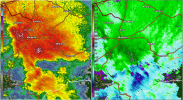
Radar shot from KMRX at 01:25 UTC I believe. It was the only good shot of the couplet. It's worthy to note how the tornado appears to be located at the bottom left portion of it's parent supercell, like a Harrisburg, IL type situation. However, since KHTX went down (which would have given a much better view of the parent supercell), we will never know.View attachment 5600
Surprised I hadn't heard of this event before, definitely an underrated one from 4/27/11.
Another tornado from that day that doesn't get a lot of attention was the mile-wide EF4 that touched down at Chilhowee Lake, TN and went through the Great Smoky Mountain National Park, downing thousands of trees before lifting. It had a rather short path length for a violent Dixie event (less than 15 miles) but did some impressive damage. In addition to downing lots of trees it took down a TVA transmission tower, tearing it from its concrete supports.
Links below:
1. https://www.ncdc.noaa.gov/stormevents/eventdetails.jsp?id=300456
2. https://web.archive.org/web/20141108184531/http://www.srh.noaa.gov/mrx/?n=blountsmokiesef3
3. http://stewart-photography.blogspot.com/2011/05/chilhowee-lake-tornado-damage-5172011.html
4.


The Harrisburg Tornado seemed to come from an embedded supercell, as an individual updraft could be made out on the echo tops product. I find it very interesting how narrow this tornado was, and if the conservation of angular momentum played a part in it's devastating massive intensity. The tornado occurred in an environment with forced initiation along the cold front interacting with 700-800 SRH in a skinny CAPE profile environment. The very high wind shear values managed to force the inefficient updrafts to drop significant tornadoes, including this one. The tornado moved so quickly that one doctor (who lived in an apartment complex on the eastern side of Harrisburg that got hit) was woken up by the tornado's roar. He went to go to shelter, but by the time he got out of bed, the tornado had already gone. He quickly got dressed, knew what he needed to do, and got right to work at the hospital, saving some lives.Speaking of Harrisburg, IL, was that an embedded semi-discrete supercell type situation, or an unusually intense QLCS tornado that went nuts? I’ve looked at a lot of radar imagery from that event, and it seems like an argument could be made for either or.


This is a video of Smithville I've never seen before and appears to be little-viewed on YouTube:
.png")
.png")
.png")
.png")
.png")
.png")
.png")
.png")

Yeah San Justo is probably the most intense tornado damage I've seen outside of the United States, this thing was a definite F5.
Some information on it that I may have previously posted but oh well:
1. The best collection of damage photos of the San Justo tornado I've been able to find. Yeah, this thing was definitely an F5, and this is probably the most violent tornado damage I've seen outside of the United States.
2.
This article is interesting when read in English translation, as apparently this was the only F5 tornado not just in South America but the entire southern hemisphere. Not sure of the accuracy of that, but interesting nonetheless:
Interesting thing on Spanish Wikipedia. The first is Spanish translation of their article on "tornado corridors". Apparently South America has its own tornado alley. The second is an English translation of their article on the 1973 San Justo tornado:
1. https://translate.google.com/transl....org/wiki/Pasillo_de_los_Tornados&prev=search
2. https://translate.google.com/transl...wiki/Tornado_de_San_Justo_en_1973&prev=search
3. 2 videos on it:
Video 1:
Video 2:
A paper on some pretty intense looking tornado tracks found via satellite in South America: https://www.asprs.org/wp-content/uploads/pers/1988journal/oct/1988_oct_1429-1435.pdf
Other stuff on South American tornadoes:
This is a translation from English, but it does appear that South America as it's own 'Tornado Alley': https://translate.google.com/transl...i/Pasillo_de_los_Tornados&prev=search&pto=aue
Information on the Encarnación, Paraguay tornado of 1926 that supposedly killed 300 people. This a Spanish forum with some pics of damage: http://foro.gustfront.com.ar/viewtopic.php?t=1556
Video of aftermath: