• Welcome to TalkWeather!
    We see you lurking around TalkWeather! Take the extra step and join us today to view attachments, see less ads and maybe even join the discussion.
    CLICK TO JOIN TALKWEATHER

Significant Tornado Events

I've always heard that Macksville in particular was violent and I honestly don't know; there really isn't much to go off with.
Assuming you’re referring to the 4th and final wedge from the Greensburg supercell, I think that one was actually probably the weakest of the bunch.

Hopewell and Macksville get mixed up occasionally, but both Hopewell and Trousdale were almost certainly EF5-strength tornadoes. I haven’t seen anything yet from Macksville that would indicate clear EF4+ intensity, though tree damage in some spots early in its life did appear pretty high-end.
 
both Hopewell and Trousdale were almost certainly EF5-strength tornadoes.
Interesting. I've looked a lot into Greensburg specifically and have delved a bit into the other EF3s but please do correct me if I'm wrong - didn't Tim Marshall say something about Trousdale producing very significant ground scouring/damage that wasn't photographed?
 
Interesting. I've looked a lot into Greensburg specifically and have delved a bit into the other EF3s but please do correct me if I'm wrong - didn't Tim Marshall say something about Trousdale producing very significant ground scouring/damage that wasn't photographed?
Yep, I made a post about it going into detail here:

I really wish he would’ve photographed that segment of the path he flew over, even if it wasn’t relevant to the Greensburg survey. Based on aerial imagery I’ve analyzed the damage it inflicted to trees and shrubbery was very intense, with some large trees being lofted 15-20 yards. I wonder had it occurred with the current state of the scale if the vegetation damage alone would’ve warranted an EF4 rating.

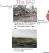
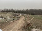
But yeah, it did produce some pretty significant ground scouring, and in a large swath as well. Here’s a ground photo in a rural area between Greensburg and Trousdale that shows it well. In the background you can see the flattened grass and scouring in the brown streaks on the hillside. It looks like it was similar to Greensburg’s scouring in that extremely intense subvortices more-so gouged out deep swaths in the ground, rather than a consistent streak of scouring.
IMG_7177.jpeg
 
Assuming you’re referring to the 4th and final wedge from the Greensburg supercell, I think that one was actually probably the weakest of the bunch.

Hopewell and Macksville get mixed up occasionally, but both Hopewell and Trousdale were almost certainly EF5-strength tornadoes. I haven’t seen anything yet from Macksville that would indicate clear EF4+ intensity, though tree damage in some spots early in its life did appear pretty high-end.

That corner of Kansas has seen so many EF5 strength tornadoes it's honestly kinda insane. Even the valleys of the northern deep south haven't seen that level of consistency. The only thing that really separates Greensburg from a lot of other tornadoes in that region is that it actually hit the town.
 
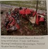
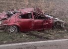
Here's a Chevy Blazer it tossed 3/4 of a mile:

View attachment 54892

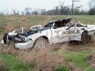
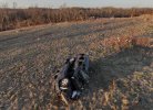
And here's a police cruiser it tossed 1/4 of a mile, killing the officer inside:

View attachment 54891
The Blazer was from the Hopewell EF3 rather than Macksville. Speaking of that, I found a colorized photo with much better quality of it in a book I bought (I’m blanking on the name of it at the moment) and some additional photos from Hopewell that came from a PDF online.
IMG_7184.jpeg
IMG_7185.jpeg
The PDF was published by Dan McCarthy, and in it he says the Blazer was thrown 2 miles, which to my knowledge would be a record for distance a vehicle has been transported by a tornado, although officially in Storm Data it’s 3/4 mile. I believe 3/4 mile is the more likely distance traveled as it would align with a farm that was destroyed to the southwest, but still interesting regardless.


That corner of Kansas has seen so many EF5 strength tornadoes it's honestly kinda insane. Even the valleys of the northern deep south haven't seen that level of consistency. The only thing that really separates Greensburg from a lot of other tornadoes in that region is that it actually hit the town.
Yeah, I am genuinely curious if there is something geographically significant about the area that makes it such a hotbed for massive, violent wedges. May 7, 2002, May 4-5, 2007 and May 23, 2008 all saw multiple very large and likely violent tornadoes in this area specifically. Then of course April 14, 2012 and May 18th last year again saw more 1 mile+ wide likely violent wedges all from prolific cyclical supercells. It’s debatable how many of these could’ve reached EF5 intensity, but it’s probable it’s around a half dozen.

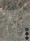
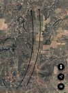
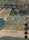
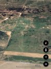
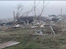
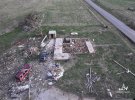
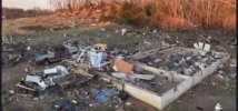
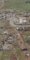
The Buttermilk and Hopewell EF3’s both from May 23, 2008 likely reached EF5 strength based on aerial imagery taken 2 months later. Buttermilk left a pretty gnarly ground scar and inflicted extreme damage to numerous trees, while Hopewell did pretty much the same with a scouring pattern similar to Greensburg. What’s impressive is how visible these scars are even 2 months after the fact.
First photos are from Buttermilk while the others are from Hopewell.
IMG_7180.jpeg
IMG_7181.jpeg

IMG_7182.jpeg
IMG_7183.jpeg
I’d have to do more research, but off the top of my head in just 2007-2008 alone there were 4 tornadoes that approached or exceeded 2 miles in width in the region. Some of these widths aren’t officially recorded as such, but based on personal research that’s the most accurate number. I’d imagine that has to be a record of some sort. I’m curious what the number is for tornadoes that have exceeded 1 mile in width since 2000 in this area, but if I were to guess it’s likely a dozen or more.
Makes you wonder if there are certain factors at play that make a relatively small zone in western Kansas so prone to 1.) remarkably prolific cyclical supercells, and 2.) incredibly large and intense wedge tornadoes.
 
The Blazer was from the Hopewell EF3 rather than Macksville. Speaking of that, I found a colorized photo with much better quality of it in a book I bought (I’m blanking on the name of it at the moment) and some additional photos from Hopewell that came from a PDF online.
View attachment 54911
View attachment 54912
The PDF was published by Dan McCarthy, and in it he says the Blazer was thrown 2 miles, which to my knowledge would be a record for distance a vehicle has been transported by a tornado, although officially in Storm Data it’s 3/4 mile. I believe 3/4 mile is the more likely distance traveled as it would align with a farm that was destroyed to the southwest, but still interesting regardless.


Yeah, I am genuinely curious if there is something geographically significant about the area that makes it such a hotbed for massive, violent wedges. May 7, 2002, May 4-5, 2007 and May 23, 2008 all saw multiple very large and likely violent tornadoes in this area specifically. Then of course April 14, 2012 and May 18th last year again saw more 1 mile+ wide likely violent wedges all from prolific cyclical supercells. It’s debatable how many of these could’ve reached EF5 intensity, but it’s probable it’s around a half dozen.

The Buttermilk and Hopewell EF3’s both from May 23, 2008 likely reached EF5 strength based on aerial imagery taken 2 months later. Buttermilk left a pretty gnarly ground scar and inflicted extreme damage to numerous trees, while Hopewell did pretty much the same with a scouring pattern similar to Greensburg. What’s impressive is how visible these scars are even 2 months after the fact.
First photos are from Buttermilk while the others are from Hopewell.
View attachment 54913
View attachment 54914

View attachment 54915
View attachment 54916
I’d have to do more research, but off the top of my head in just 2007-2008 alone there were 4 tornadoes that approached or exceeded 2 miles in width in the region. Some of these widths aren’t officially recorded as such, but based on personal research that’s the most accurate number. I’d imagine that has to be a record of some sort. I’m curious what the number is for tornadoes that have exceeded 1 mile in width since 2000 in this area, but if I were to guess it’s likely a dozen or more.
Makes you wonder if there are certain factors at play that make a relatively small zone in western Kansas so prone to 1.) remarkably prolific cyclical supercells, and 2.) incredibly large and intense wedge tornadoes.
Udall was likely 2+ miles wide at points too.

The Texas panhandle has a history of massive wedges 2+ miles as well (Glazier-Higgins-Woodward, Allison, Gruver, to name a few) and lots of these outbreaks and supercells it seems like the whole mesocyclone is on the ground. Not sure if geography, topography or storm patterns or all 3 play a role in that. Maybe certain supercells are more prone to allowing entire mesocyclones to touch the ground? Who knows?
 
The Blazer was from the Hopewell EF3 rather than Macksville. Speaking of that, I found a colorized photo with much better quality of it in a book I bought (I’m blanking on the name of it at the moment) and some additional photos from Hopewell that came from a PDF online.
View attachment 54911
View attachment 54912
The PDF was published by Dan McCarthy, and in it he says the Blazer was thrown 2 miles, which to my knowledge would be a record for distance a vehicle has been transported by a tornado, although officially in Storm Data it’s 3/4 mile. I believe 3/4 mile is the more likely distance traveled as it would align with a farm that was destroyed to the southwest, but still interesting regardless.


Yeah, I am genuinely curious if there is something geographically significant about the area that makes it such a hotbed for massive, violent wedges. May 7, 2002, May 4-5, 2007 and May 23, 2008 all saw multiple very large and likely violent tornadoes in this area specifically. Then of course April 14, 2012 and May 18th last year again saw more 1 mile+ wide likely violent wedges all from prolific cyclical supercells. It’s debatable how many of these could’ve reached EF5 intensity, but it’s probable it’s around a half dozen.

The Buttermilk and Hopewell EF3’s both from May 23, 2008 likely reached EF5 strength based on aerial imagery taken 2 months later. Buttermilk left a pretty gnarly ground scar and inflicted extreme damage to numerous trees, while Hopewell did pretty much the same with a scouring pattern similar to Greensburg. What’s impressive is how visible these scars are even 2 months after the fact.
First photos are from Buttermilk while the others are from Hopewell.
View attachment 54913
View attachment 54914

View attachment 54915
View attachment 54916
I’d have to do more research, but off the top of my head in just 2007-2008 alone there were 4 tornadoes that approached or exceeded 2 miles in width in the region. Some of these widths aren’t officially recorded as such, but based on personal research that’s the most accurate number. I’d imagine that has to be a record of some sort. I’m curious what the number is for tornadoes that have exceeded 1 mile in width since 2000 in this area, but if I were to guess it’s likely a dozen or more.
Makes you wonder if there are certain factors at play that make a relatively small zone in western Kansas so prone to 1.) remarkably prolific cyclical supercells, and 2.) incredibly large and intense wedge tornadoes.
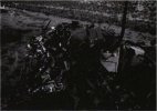
That vehicle damage shown above is among the most violent I think I’ve ever seen. You can barely tell it was a vehicle at all since it’s completely shredded.
 
Well, the majority of events listed seem to match NE moving supercells in a fast 50+ kt jet. SW KS is rather flat so I'd assume the translation speed may add to a tornado's intensity given the general lack of anything out there save for that viotor corridor. It's true though. That area has had it very hard.
 
Rainsville, as seen hidden in the back of a random Lyza study:
View attachment 54925
In a separate study is this photo of HPC damage somewhere near the Browns Ferry plant:
1789084374411.png
Google Scholar really does pull up random niche stuff sometimes.
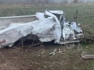
 
That vehicle damage shown above is among the most violent I think I’ve ever seen. You can barely tell it was a vehicle at all since it’s completely shredded.
Yeah, it reminds me of Stratton, NE 1990 in terms of turning vehicles into mere pieces essentially. In this case, the vehicle appeared to have been separated into several parts, with the largest piece being the dash and steering column that was photographed. Just remarkable stuff.

To add onto the discussion of the Greensburg tornado family, I’ve had this damage points map that I made (and continue to add on to) from the 4 major tornadoes from that night. It’s made largely using satellite imagery, ground reports/photos, and survey information shared with me. In total, the official survey from NWS DDC has 132 points, while my personal research has added an additional ~500 points of damage. Here’s a few photos of it in Google Earth:
IMG_7191.jpeg
IMG_7192.jpegIMG_7193.jpegIMG_7194.jpeg

It’s quite difficult distinguishing points of damage from the May 4th Greensburg tornado family to those from other significant tornadoes on May 5th that affected the same areas. Some paths are less detailed because of this.
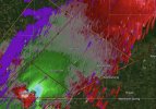
On top of a damage points map, I also created a separate damage indicator map with corresponding EF ratings for each DI. Basically what Greensburg would look like if it was on the Damage Assessment Toolkit. This was created using literally thousands of ground and aerial photographs, as well as survey data from Tim Marshall and NWS DDC.

It’s largely from my own opinion and something I made from personal/educated research, so this is in no way an official map or piece of work. That being said, in total there are ~1300 damage indicators from the Greensburg tornado. Here are additional photos of this map:
IMG_7195.jpegIMG_7204.jpegIMG_7202.jpeg
IMG_7205.jpeg
IMG_7206.jpeg
 
Back
Top