• Welcome to TalkWeather!
    We see you lurking around TalkWeather! Take the extra step and join us today to view attachments, see less ads and maybe even join the discussion.
    CLICK TO JOIN TALKWEATHER

Significant Tornado Events

Sure, and that’s fair. There are offices like MEG that have a bad track record even well before 2011, and they just don’t seem to really care. Those are the ones that are going to continue to cause problems. More forward thinking offices like Norman and Jackson though will probably adopt new data and new techniques with open arms.
If we ever end up having a high end tornado in one of those controversial offices even after all these changes rolled out, and they hypothetically decide a questionable rating, it would probably just get people right back up in uproar, although admittedly this is genuinely a very weak argument because the chances of such happening are extremely low. feel like a lot of offices have wanted to be forward thinking even in this "rating depression" as i like to call it, but have been restricted due to the absurd process to get a EF5 rating. We will just have to see.
 
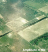
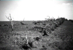
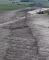
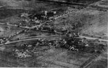
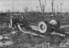
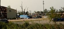
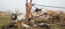
After years of searching, i finally found new ground photos of the 1995 Kellerville F5's infamous treeline.

This is an example of one of the only photos we previously had. Until now, we only had aerials and descriptions

1786800980640.png

From 46:04 to 46:12 in this linked video is an example of what the treeline looked like before the tornado hit:


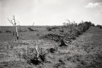
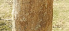
This is the new image I have found, along with an AI upscaled version.

1786801163865.png1786801187270.png

The source also contained these descriptions:

"Trees in a shelterbelt were snapped off slightly below the ground and removed from the area. This degree of tree damage is more intense than any we can recollect from viewing paths of F4 and F5 tornadoes in photographs and in person. "

"four rows of trees. In the middle of the photo, the trees were almost completely removed from the area"

"Surface photo along shelterbelt showing parts of root systems, one stump, and a few completely debarked branches. Tree damage gradually lessens in the distance"
 
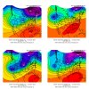
Palm Sunday 1965 had a very unique trough geometry.
For one, it was a positive tilt, which isn’t exactly what you would expect for a borderline super outbreak.

The trough in question had two main parts to it, the back edge was in the process of becoming a cut off low, this was due to anomalously strong ridging that rapidly built in behind the trough, which made it into a high amplitude type.

The leading edge of the trough that was ahead of the ridge progressed onwards, eventually, you have this sprawling, elongated trough that’s in the process of getting split apart, (which it eventually did after the outbreak).

You really only see this during strong La-Niñas and in the winter (where you almost always have a crashing cold front spilling down the central US), not in the spring, which is what really made this day unique. You can also see a very strong ridge over the gulf, another classic La-Niña feature.

The pressure gradient between this southeastern ridge and the Jet stream which was constructively interfering with the subtropical jet, plus the elongated geometry of the tough, resulted in one of the strongest OWS jet streaks on record.
View attachment 54593
The leading short wave trough, predictably bombed out with a central surface pressure in the 980mb range, this combined with the 130+knot jet streak over head, resulted in a expansive LLJ of 50+knots over the entire north end of the OWS.
Thanks to this trough unique orientation, the LLJ, (which usually is always way out ahead of the dry line/cold front and highest instability, was largely behind the front and right in the area of highest instability.
View attachment 54594
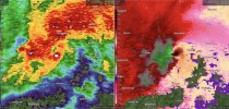
Wonder why there weren't more tornadoes in central Illinois
 
Back
Top