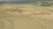
Speaking of opposing viewpoints and debates, I present this absolute monstrosity:
View attachment 48324
I know, it looks stupid, but there are a few signs that a weak ground circulation may have been pushed west by the derecho before the EF2 was confirmed. Check this out:
View attachment 48325
This is 0.96 miles from the Enderlin tornado's path. I've already verified that no other properties in the vicinity (including one 0.23 miles away) sustained this degree of damage, and thus I don't believe this was caused by the derecho that followed. This damage does not appear on any other historical imagery. This is the single most solid piece of evidence to suggest they may have been one tornado, imo.
View attachment 48326View attachment 48329
There's also this damage, 0.18 to 0.26 miles from the EF2's path and technically within the Enderlin tornado's damage contour, although trees to the north are completely untouched.
View attachment 48331
Also this, although I'm not certain whether this is tornadic.
View attachment 48332
Note that I'm still trying to locate potential damage in this corridor. I'll analyze radar shortly to see if anything matches up.
Thoughts are welcome, but please don't murder me. I’m still working to get more solid evidence that this may have looped back around in the way I showed above.