• Welcome to TalkWeather!
    We see you lurking around TalkWeather! Take the extra step and join us today to view attachments, see less ads and maybe even join the discussion.
    CLICK TO JOIN TALKWEATHER

Significant Tornado Events

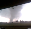
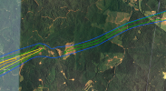
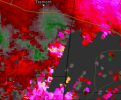
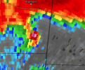
Another overlooked tornado from that outbreak was the long track Bethel Springs TN EF3. Tracked for almost 90 miles and was caught on Tennessee Valley Weather’s camera network live while @Fred Gossage and team covered the event.

View attachment 46603
Is there a photo of the tornado on the live cameras? Might be able to use them for something.
 
"If it's not public it doesn't count". I don't have Discord for multiple reasons. You could do worse than to copy the information either here or into a PM.

Furthermore, he would have to engage with the very small but very important literature about how the marks are created.


Ground deposition markings don't require suction vortices.
yes i know that , seems like dodge city 2016 is a example of a cycloidal scouring made by non suction vortices , however some are made by suction vortices , like el reno 2013 , Smithville 2011.

talking about suction vortices i am not sure if Rainsville 2011 has cycloidal marks, but if it does it would be by suction vortices as well , there are some videos of the moment its doing the EF5 damage , it was clearly done by strong roaring suction vortices.


1758826664382.png

still frame of the moment.
 
yes, an academic peer reviewed paper. he doesn't have much of a background, so i understand the skepticism, but all the results ive seen seem to align perfectly with the EF scale (his 3 sec wind gust estimates always match nearby EF scale damage).

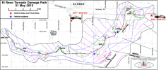
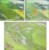
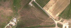
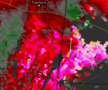
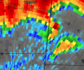
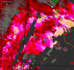
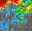
His work also aligns with mobile radar. While El Reno didn't have any calculable cycloidals, it did have ground markings that resemble the beginning of a cycloidal. I believe he worked backwards with the translation speed and tangential velocity on mobile radar to create what a cycloidal would have looked like if el reno produced one. this hypothetical cycloidal nearly perfectly aligned with the ground marking. (see below)

View attachment 46655View attachment 46656

anyway, im not trying to flood this entire thread with cycloid stuff, so ill stop after this msg lol
el reno 2013 had one big cycloidal mark, it wasn't a full one , but it was there.
there are also some smaller other marks , like near the start of the path , and south of the airport
1758826894220.png
(where it states suction vortex)
1758826936123.png
main big suction vortex path.
 
Image credit to Saltical of course. he also discovered that Smithville was actually 2 tornadoes.
Which @joshoctober16 seems to have disproven earlier in this thread, showing blowdown across the alleged gap:
View attachment 45545
in this spot there is some trees down.

This anonymous unqualified person sounds like a strong enthusiast but one who seeks evidence to fit his ideas, rather than letting it shape his ideas. I certainly don't see anything that indicates he's read that thesis I linked.

If you're not going to post any of the fundamental basis - like formulae and mechanisms - as to how he's coming to these conclusions, then I'm not going to give them much credence.
 
Last edited:
Which @joshoctober16 seems to have disproven earlier in this thread, showing blowdown across the alleged gap
I believe there was also blowdown between New Wren and Smithville, which were definitely seperate tornadoes. blowdown isn't always tornadic. There is lots of proof that Smithville was 2 tornadoes.

"Using radar data I can confirm the time and location of the couplet at multiple points throughout the life cycle of the supercell. And using this data I can determine the forward speeds of the tornadoes between those radar scans. By using this info, I noticed an anomaly in the forward speeds The forward speed of the supposed single Smithville tornado averaged 50-70 mph throughout scans, except for at one location There is a 0.41mi gap in the damage path present before the stateline. The couplet travelled >2000m in 40s, in order to do so the Smithville tornado would've had to move at speeds up to 139 mph to cover that ground in the given time. The only logical solution is that a handoff occured with the new circulation developing further east out in front of the old circulation which is now dissipating at this point"

also, i believe the area of the cycle has a very strange deviation, almost like a Z. this type of movement would be very unlikely from a fast moving tornado like Smithville.
 
I'm going to need to see a lot more hard evidence before I believe that a) Robinson was a stronger tornado than Smithville and b) that a 0.41 mile "gap" in damage is representative of two distinct tornadoes with a storm moving 65+ mph.
 
I'm going to need to see a lot more hard evidence before I believe that a) Robinson was a stronger tornado than Smithville and b) that a 0.41 mile "gap" in damage is representative of two distinct tornadoes with a storm moving 65+ mph.
I wrote Robinson’s Wikipedia article and in my research I can 100% say it was not stronger than Smithville. Incredibly strong? Yes. Smithville strong? Absolutely not. As for Smithville, I personally believe they were one tornado but it’s debatable.
 
Re: the two tornadoes thing, a 0.41 mile damage "gap" with an odd pattern could easily just mean separate multiple vortices within the same tornadic circulation, especially one that is fast moving.
 
Which @joshoctober16 seems to have disproven earlier in this thread, showing blowdown across the alleged gap:


This anonymous unqualified person sounds like a strong enthusiast but one who seeks evidence to fit his ideas, rather than letting it shape his ideas. I certainly don't see anything that indicates he's read that thesis I linked.

If you're not going to post any of the fundamental basis - like formulae and mechanisms - as to how he's coming to these conclusions, then I'm not going to give them much credence.
im very 50/50 on smithville being 2 tornadoes.

its either
1:the smithville tornado weaken going north and then died, had a replacement tornado form almost where the last one was and made no true gap, the second tornado very likely was EF5 if true.
2:the smithville tornado weaken going north , then made a loop as a EF0 , and later on turned back into a wedge with very likely EF5 winds

would need to see a radar velocity of this moment to see what happend.

one thing to note that could both be sneaky to make seem like it was or wasnt 2 tornadoes is...

there are signs of strong EF0 damage in this apparently gap , however it is to note.

1:it could of been a microburst , or the second tornado touched down going south for a few seconds.

2:it is the same tornado and weak to mid EF0 damage can not be seen on sat images (visible tornado tree damage starts at strong EF0)

a example of a tornado appearing to die but didnt and a tornado that did cycle but isnt listed as cycled are...

Pilger EF4 2014 (the one that hit the town) hit the town of Pilger as a very strong EF4 , weakened and almost did a loop , appeared to rope out , but was infact still on the ground , just invisible, and was at a weak EF1 stage , then restraighten to a strong EF4 (the famous double wedge image is during this)
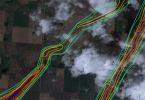
1758910227883.png

Shawnee EF4 2013 (day before the Moore EF5) was infact 2 tornadoes but isn't listed as 2,

the main EF4 (likely was a EF5 at this moment) started to moved north , appeared to start doing a loop , and died.

a second tornado going south for a few seconds then turned to go north east over the highway.
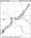
1758909845668.png

pretty much Smithville did one of these 2 options , but at a faster 60+ mph forward speed.
 
  • Like
Reactions: AJS
I believe there was also blowdown between New Wren and Smithville, which were definitely seperate tornadoes. blowdown isn't always tornadic. There is lots of proof that Smithville was 2 tornadoes.

"Using radar data I can confirm the time and location of the couplet at multiple points throughout the life cycle of the supercell. And using this data I can determine the forward speeds of the tornadoes between those radar scans. By using this info, I noticed an anomaly in the forward speeds The forward speed of the supposed single Smithville tornado averaged 50-70 mph throughout scans, except for at one location There is a 0.41mi gap in the damage path present before the stateline. The couplet travelled >2000m in 40s, in order to do so the Smithville tornado would've had to move at speeds up to 139 mph to cover that ground in the given time. The only logical solution is that a handoff occured with the new circulation developing further east out in front of the old circulation which is now dissipating at this point"

also, i believe the area of the cycle has a very strange deviation, almost like a Z. this type of movement would be very unlikely from a fast moving tornado like Smithville.
i think your talking about the wrong part of its life , there is a other loop / possible cycle AFTER it hit Smithville.

it was before it entered Alabama
1758910557217.png

zoom in in the loop or gap

1758910598749.png
 
  • Like
Reactions: AJS
I wrote Robinson’s Wikipedia article and in my research I can 100% say it was not stronger than Smithville. Incredibly strong? Yes. Smithville strong? Absolutely not. As for Smithville, I personally believe they were one tornado but it’s debatable.
i could see multiple reasons for Robinson to have a higher cycloidal rating.

1:smithville had true suction vortices while Robinson didn't had true vortices.
2:the Smithville cycloidal mark wasn't during one of the most impressive moments (however it was close to some)
3:robinson could of had a stronger 0 meter 3 second gust, while Smithville had stronger winds in 1 to 5 meters?
4:smithville could of had a stronger upward wind speed compared to its horizontal wind speed.
5:smithville could of had a stronger 1 second wind gust.
6:robinson could of had barely any vertical wind speed.
7:smithville could of had more debris to cause more damage compared to Robinson that only hit one house right before the impressive cycloidal marks.

we also need to remember when a cycloidal mark is by a suction vortex , it cant really calculate the wind speed of the sub vortex.
it cant calculate the 1-10 meter winds.
i don't think it can calculate the upwards wind speed of the tornado, some tornadoes barely have any upward velocity while some have super strong upward velocity.
Cullman 2011 is a good example of a tornado that had a stronger upward velocity then horizontal velocity.
 
  • Like
Reactions: AJS
Back
Top