Navigation
Install the app
How to install the app on iOS
Follow along with the video below to see how to install our site as a web app on your home screen.
Note: This feature may not be available in some browsers.
More options
-
Welcome to TalkWeather! We see you lurking around TalkWeather! Take the extra step and join us today to view attachments, see less ads and maybe even join the discussion. CLICK TO JOIN TALKWEATHER
You are using an out of date browser. It may not display this or other websites correctly.
You should upgrade or use an alternative browser.
You should upgrade or use an alternative browser.
Significant Tornado Events
- Thread starter locomusic01
- Start date
AJS
Member
Strongly believe that this was the 2nd strongest of the outbreak.
Kds86z
Member
Oh really? More then muhall(sp)?Strongly believe that this was the 2nd strongest of the outbreak.
Aaron Rider
Member
I LOVE Wisconsin lolHey, now don'tcha be makin' fun of our Sconnie accent, okee doke?
Fortunately (relatively speaking), it actually didn't go through downtown Stoughton, but through subdivisions north and northeast of the town (including the one where I lived, and my parents still do).
And I wish I could find the video. The motion was incredible!
Central Ohio Wx
Member
That’s what I was going to say… Mulhall was likely very violent.Oh really? More then muhall(sp)?
Lake Martin EF4
Member
Post from 2021. Explains why it still misattributes the photo.
For the record, I conclusively proved that all the Satkus/Payne photos were of the Geary F3 that preceded the Dover F4, based off their chase log. The Dover tornado itself seems to have been unphotographed.
Kds86z
Member
Yeah i didn’t recognize this because years ago i saw a photo of Dover tornado by a chaser and it didn’t look like this. Haven’t tracked it down yet,Post from 2021. Explains why it still misattributes the photo.
For the record, I conclusively proved that all the Satkus/Payne photos were of the Geary F3 that preceded the Dover F4, based off their chase log. The Dover tornado itself seems to have been unphotographed.
Lake Martin EF4
Member
What did it look like, then?Yeah i didn’t recognize this because years ago i saw a photo of Dover tornado by a chaser and it didn’t look like this. Haven’t tracked it down yet,
Kds86z
Member
It was smaller and lighter colorWhat did it look like, then?
CheeselandSkies
Member
I LOVE Wisconsin lol
And I wish I could find the video. The motion was incredible!
Possibly at 2:40ish in this upload from the TV show "Full Force Nature"?
The tornado was a lot closer to those people on Lake Kegonsa than they realized, since it actually tracked along the south shore of the lake, about 1/2 to 1 mile closer than "downtown" Stoughton from their perspective.
Minus the F-bomb, but perhaps you were getting that mixed up with another video taken further down the tornado's path (actually when it was pretty close to my house), which contains a close-up of a building coming apart (in similar fashion to the famous video from the Attica tornado the previous year)? The videographer/narrator was screaming profanities the whole time. "LOOK HOW BIG THAT F___ER IS! THERE'S A HOUSE! THERE'S A WHOLE F___ING HOUSE!!" etc.
That sequence is also in this compilation, begins around the 4:05 mark (profanities muted of course since it was for TV).
Last edited:
Central Ohio Wx
Member
Lake Martin EF4
Member
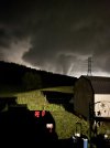
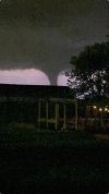
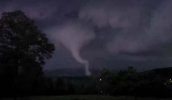
Holy crap, that first photo could've passed as a daytime photo had it not been for the obvious flash in the foreground. This thing has a kinda terrifying wispy-ish appearance, although I am of the opinion that the one photo of Lake Martin 4/27/11 I found was scarier.The London EF4 will forever be one of the scariest tornadoes in the 21st century, imo. Easily the deadliest tornado I tracked live on radar and the most impactful.
View attachment 46211View attachment 46212
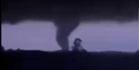
View attachment 46213
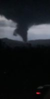
View attachment 46214
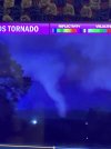
View attachment 46215
View attachment 46216
The only other nocturnal tornadoes since 2000 that scare me more are Ringgold, Greensburg and Western KY.
CheeselandSkies
Member
The London EF4 will forever be one of the scariest tornadoes in the 21st century, imo. Easily the deadliest tornado I tracked live on radar and the most impactful.
View attachment 46211View attachment 46212
View attachment 46213
View attachment 46214
View attachment 46215
View attachment 46216
The only other nocturnal tornadoes since 2000 that scare me more are Ringgold, Greensburg and Western KY.
The Diaz EF4 from this March was right up there, too. There was this one video of it where the wind was making this unearthly howl that sounded almost demonic.
Then there was Rolling Fork with its mysterious airborne points of light that may or may not have been the headlights of a lofted vehicle (was that ever settled?).
Kds86z
Member
Thansk for sharing @Central Ohio Wx . I followed with everyone here that insane event.The London EF4 will forever be one of the scariest tornadoes in the 21st century, imo. Easily the deadliest tornado I tracked live on radar and the most impactful.
View attachment 46211View attachment 46212
View attachment 46213
View attachment 46214
View attachment 46215
View attachment 46216
The only other nocturnal tornadoes since 2000 that scare me more are Ringgold, Greensburg and Western KY.
Lake Martin EF4
Member
We've got a thousand points of lightpoints of light
For the homeless man
We've got a kinder, gentler machine gun hand...
(For the record, though, I do think it was settled as being a vehicle with the exception of a member on here who thought it was a wormhole of all things.)
Central Ohio Wx
Member
The thing about that photo is that it’s so invisible that it isn’t really scary. It’s hard to see what’s going on in that image, while with the London tornado it’s very clear there’s a violent tornado in the shadows.Holy crap, that first photo could've passed as a daytime photo had it not been for the obvious flash in the foreground. This thing has a kinda terrifying wispy-ish appearance, although I am of the opinion that the one photo of Lake Martin 4/27/11 I found was scarier.
3/14 had some monsters that night. Definetly over-performed expectation wise vs the next day. A real “day before the day” scenario. Looking back at the obs and mesoanalysis on the SPC event review page for both of those days, it’s easy to see why.The Diaz EF4 from this March was right up there, too. There was this one video of it where the wind was making this unearthly howl that sounded almost demonic.
Then there was Rolling Fork with its mysterious airborne points of light that may or may not have been the headlights of a lofted vehicle (was that ever settled?).
Central Ohio Wx
Member
If someone’s calculations were correct, it would’ve verified a 60#.3/14 had some monsters that night. Definetly over-performed expectation wise vs the next day. A real “day before the day” scenario. Looking back at the obs and mesoanalysis on the SPC event review page for both of those days, it’s easy to see why.
It would’ve easily verified a high risk. Even with that lead wave pushing the moisture south temporarily, that deep SLP still pulled 60s dew points all the way up into north eastern Arkansas and south eastern Missouri.If someone’s calculations were correct, it would’ve verified a 60#.
NewFoundWeatherNerd
Member
My friend working on OMEGA verification agrees with a 45% SIG verification for 3/14If someone’s calculations were correct, it would’ve verified a 60#.

