Lake Martin EF4
Member
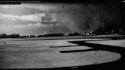
Behold, the best damn tornado recreations I've ever seen:
He also has a behind the scenes video that shows how he made them:
He also has a behind the scenes video that shows how he made them:
Follow along with the video below to see how to install our site as a web app on your home screen.
Note: This feature may not be available in some browsers.


This is probably heresy, but I was pretty disappointed in the book tbh. Maybe I had unrealistic expectations because I'd always heard about how amazing it was, but I quickly regretted spending so much money on it lolOh it is the 40th anniversary, isn't it?
The May 1987 issue of Reader's Digest featured an excerpt from the book "Tornado Watch #211" under the title "Day of the Killer Tornadoes" (a moniker I've also seen used for the '74 Super Outbreak). Since I would have been 16 months old at the time, I probably found it 7-8 years later in my maternal grandparents' collection of back issues.
View attachment 43507
Any new medias from Tionesta F4 yet so far?Some aerial shots from the Albion F4. First two are along Knapp Rd, where the first victims (Lydia Taylor and Debbie Sherman) were killed:
Not 100% sure where this is off-hand tbh:
And this is the streak of tree damage immediately after the failed occlusion W of Keepville Rd (just S of Albion):
Also a few photos from the Elimsport F3+ taken near the end of the path around Watsontown:
I'll post some more 5/31/85 stuff later, but for now, a few photos from the East Kane area - more specifically S Settlement Rd. in Rocky Ridge. Sadly, this is the home in which the final two victims (Travis Johnson and Dawn Ardabell) were killed.
Also an aerial shot of the Tionesta Scenic Area, the place near the beginning of the path (very obvious in the satellite view) where a Forest Service official called it "the most complete destruction of forestland" he'd ever seen.
Quite possibly the area where the tornado was at its peak intensity, although it remained strong to violent throughout much of its path. You can see a narrower but similarly intense swath of forest damage east of town, beginning almost immediately after the tornado destroyed the property above.


Squeeze Bottom... What a funny name lolAlso from the 3/16/42 outbreak, the delightfully named Squeeze Bottom, TN F3:


I did the (very rough) math back when I was writing my article and IIRC 90,000 trees would be like.. less than a square mile of forest. I could be remembering that wrong, though. Anyway, the swath of extreme forest damage here was something like 3 miles long and at least half a mile wide on average (being extremely conservative), so 90k trees is totally reasonable IMO. I've seen a wide range of estimates for Moshannon (like, from less than 100k to multiple millions) and I have no idea if any of them are close to correct, but I'd wager it's closer to the high end.Interesting detail: the article states that an estimated 90,000 trees were downed in this area; Grazulis mentions 90,000 trees being toppled by Moshannon State Forest but not Kane; I'm wondering if he mixed these up or a typo in the publication process.
Not really besides these, which I think @Juliett Bravo Kilo has already posted a while ago?Any new medias from Tionesta F4 yet so far?
I did the (very rough) math back when I was writing my article and IIRC 90,000 trees would be like.. less than a square mile of forest. I could be remembering that wrong, though. Anyway, the swath of extreme forest damage here was something like 3 miles long and at least half a mile wide on average (being extremely conservative), so 90k trees is totally reasonable IMO. I've seen a wide range of estimates for Moshannon (like, from less than 100k to multiple millions) and I have no idea if any of them are close to correct, but I'd wager it's closer to the high end.
(Preemptive edit: Also notable that this study pointed out the Tionesta Scenic Area was one of the densest mature forests studied on the East Coast, and also among the most severe windthrow events documented in a study. They found basically 2% of the existing forest biomass remained after the tornado.)
Not really besides these, which I think @Juliett Bravo Kilo has already posted a while ago?


 www.wtae.com


Shoot, thanks for the heads up. I set it to private for a few minutes while I was experimenting with something and forgot to revert it back. Should be up again now.Uh, @locomusic01, where did the New Richmond article go?