• Welcome to TalkWeather!
    We see you lurking around TalkWeather! Take the extra step and join us today to view attachments, see less ads and maybe even join the discussion.
    CLICK TO JOIN TALKWEATHER

Significant Tornado Events

Another short series of photos taken from a 7/11 on Gage Blvd:

michael-setnor-taken-from-7-11-on-gage-blvd-1.jpg


michael-setnor-taken-from-7-11-on-gage-blvd-2.jpg


michael-setnor-taken-from-7-11-on-gage-blvd-3.jpg


michael-setnor-taken-from-7-11-on-gage-blvd-4.jpg


A couple other shots:

crossing-burnetts-mound.jpg


linn-elementary-area-looking-NW-jarred-white.jpg


And one of my favorite tornado photos ever:

00357971.jpg
 
Man, that wind rowing is incredible. Looks like some scouring and debarking too, plus anchor bolted homes reduced to basements. Overall pretty impressive to say the least.
Yeah, most of the damage photos you see come from downtown areas where the tornado was quite a bit weaker, so I think it gets overlooked a bit. At peak intensity, it was really nasty.
 
It's kinda strange that Topeka has gone from one of the biggest/most well-known tornadoes of its time to sort of an afterthought today. I think maybe people forget how intense it was, especially in the SW and (to a lesser extent) E parts of town.

aerial-13.jpg


aerial-14.jpg


aerial-15.jpg


SW-Twilight-Dr-30th-Terrace-Looking-W.jpg


sw-19th-st-looking-W-past-Atwood.jpg


mangled-59-chevy-Jan-Leuenberger.jpg


00622962.jpg


13346160-10209112641520900-5922800376630346643-o.jpg


13403345-10209112670121615-4430755971373738583-o.jpg


19660608-TOPEKA13.jpg


61987654-10157097780938376-454024712301838336-n.jpg


448004043-10231327471517766-4540231065903650484-n.jpg


448031194-10231327470797748-6922095821480443832-n.jpg


24596938734-0b18d1eda2-3k.jpg


25109427912-c1342a5f7e-3k.jpg


aerial-gage-blvd-apartments.jpg


aerial-f5-damage.png


dead-horses-at-farm.jpg


twilight-dr-anchor-bolts.jpg


gage-blvd-behind-huntington-apts.jpg
I'm not sure if the first three pics were from Topeka because I noted the school in third pic which was one of the school hit by Ruskin Height tornado 1957.
SAVE_20240609_100714.jpgSAVE_20240609_100732.jpg
 
I'm not sure if the first three pics were from Topeka because I noted the school in third pic which was one of the school hit by Ruskin Height tornado 1957.
View attachment 28563View attachment 28564
Ah crap, good catch. I don't know how they got in my Topeka folder - they're Ruskin Way in Ruskin Heights and Belmont St. in Hickman Mills, respectively.

Edit: Make that Belmont Ave.
 
I found that image, along with these two other photos that I can I can identify as from the 1925 storm while looking through google images. Found a website, forgot the name that had these mislabeled from 1910.

View attachment 28543
From that same website I think I can identify a couple others from the Tri-state tornado.

1717933540204.jpeg
Logan School.

1717933674403.jpeg
what appears to be the ruins of the M&O railyard shops.
 
Worchester F4 has also turned 71. The outbreak that spawned the Flint and Worchester twisters is known as the Atomic Tornado Outbreak since it occurred during the nuke tests that happened the same year.


Worcester: proving that tornadoes were being underrated before tornadoes were even being rated.

299217547-369234118729916-8429358716308453234-n.jpg


299309560-370445781942083-136782675849918764-n.jpg


299743820-369901808663147-4373813630541352569-n.jpg


commonwealth-p2677f191-image-primary-colorize1.jpg


commonwealth-x346dz695-image-primary-resize-colorized.jpg


commonwealth-x346f001w-image-resize.jpg


john-johnson-s-car-2.jpg


brentwood-in-holden.jpg


298907132-368615892125072-3875655563073791732-n.jpg


298684950-368615588791769-6810662908456465772-n.jpg


299779838-369234522063209-6341848309789088627-n.jpg


299809646-369901945329800-4764834292208160651-n.jpg


299834654-369901831996478-2287074551764727256-n.jpg


299844845-369901668663161-3015527566956102611-n.jpg


299845186-369901788663149-4903849957071697368-n.jpg


rutland-damage2.jpg


This extremely debarked little sapling thing always makes me chuckle:

commonwealth-x346dz538-image-resize.jpg
 
In today's episode of fossilised data that's probably wrong, the official length of the second Tanner tornado from the Super Outbreak is 83.3 miles. This seems to based off Fujita's initial interpretation of the tracks (left), which did not seperate the tornado that went over Tims Ford Lake that actually preceded it and formed from the cell that produced the first Tanner tornado, as seen at right. The older map also seems to combine the first and second tornadoes (do note the numbering is different, the original map only has 93 tornadoes).

Screen Shot 2024-06-09 at 9.56.05 pm.png Screen Shot 2024-06-09 at 9.54.18 pm.png

The other thing is that on Fujita's final map and in Abbey and Fujita 1981 ('Tornadoes as represented by the tornado outbreak of April 3-4 1974' in Thunderstorms: The Thunderstorm in human affairs) the lengths of the first and second Tanner tornadoes are given as 51 and 50 miles respectively, but the actually plotted path of the first tornado is very obviously shorter and going off where Tornado Archive has drawn it, is about 43 miles unless you include the dotted portion.

We can compare with a map that Wikipedia and US tornadoes got from the NOAA (havn't tracked down the original) and with Tornado Archive, which uses the final version. They're quite different in that area.

Screen Shot 2024-06-10 at 12.27.02 pm.png Screen Shot 2024-06-10 at 12.31.17 pm.png

I would note that Grazulis 1990 agrees with the latter. The final map and Grazulis also give the length of the Frankfort tornado as 36 miles against the 'offical' path of 79.4 miles, which explains the visual discordance. I can't find a source that actually plots a 79 mile path for the Frankfort tornado.
 
Last edited:
Okay, the final map for the New Richmond sequence is done for real this time, including all of the deaths that I could verify (although I think five of them are unnamed):


There were 116 confirmable deaths in New Richmond itself and four southwest of town. The Stanton-Deer Park tornado also killed one person, the Clear Lake-Arland tornado killed two and Barron-Cameron killed one more. The Homer-Salix tornado killed five on 6/11, and the final death toll for Herman on 6/13 (whose track is delightfully weird btw) is 11.

The longest single path is Clear Lake-Arland at 19.6 miles. It was probably also the widest (possibly ~1.25 mi at its max) but it's hard to say because there may have actually been multiple tornadoes in that area, so I went pretty conservative at ~0.75 mi. That's about the same max width as New Richmond.
 
Surely not? That can’t be right.

I suspect the "mangled vehicle" in the third photo is actually a small flatbed trailer, but still impressive. That, combined with the structural damage and debarking is clearly not inconsistent with a tornado of EF3 intensity.

Some footage of the thing. It was rain-wrapped for most of its life, but was sometimes visible through the rain as a rather stout tornado.


Well, got my New Richmond article done in the nick of time lol. It'll be posted in the morning. Always feels kinda weird after you finish something you've spent so much time on, and there's a part of me that feels like I should already be working on something else. Anywho, figured I'd post the photos I didn't end up using (the interesting ones anyway) - I'm sure I've posted a lot of them already, but I can't be bothered to check.

First a couple crappy ones from the Herman, NE F4 (I love the guy popping up like a gopher in the first one btw):

s-l1600-1.jpg


shay-goddard-s-corner.jpg


sim-leslies-weekly-1899-07-06-89-2286-0004-2.jpg


storm-left-the-cellar.jpg


And on to New Richmond, this was taken near the corner of 1st & Minnesota. It's sort of near the edge of the damage path, but I still have no explanation for how this random shack was left standing while everything around it was leveled:

1st-st-minnesota-looking-SE.jpg


Part of 1st Street east of the Nicollet Hotel:

1st-st-trees-stripped-bare-6.jpg


A look down 2nd Street toward the business district:

2nd-st-looking-across-town.jpg


One of many, many debarked & denuded trees (in this case on 2nd Street just east of Main):

2nd-st-looking-NW-near-main.jpg


A section of Main Street near the Manufacturers' Bank:

2nd-st-west-near-corner-of-alley-between-minnesota-knowles-j-a-gifford-livery-looking-ENE-toward-man.jpg


Near as I can tell, this is somewhere around the Farmers' Hotel just south of the main business district:

5cfca79b-f33c-4313-bd3f-ab4bb519b167-New-Richmond-GMTI-photoj1998q2m06t04h11295700.jpg


A few random shots that lack identifiable features:

ACCAUFTEWNOWCQ8-N-M-limited-7bc6b.jpg


62a8f7f82b5a6-image.jpg


62a8f7f859d43-image.jpg


In the background is the remnants of a hotel, a farm machinery shop, a gun store and a bicycle shop:

andrew-tobias-farm-implements-farmers-hotel-bentleys-gun-bicycle-shop.jpg


Basically nothing left of this neighborhood along Arch Ave (granted, fire finished off a few of the houses, but they were already obliterated):

arch-ave-looking-NW-1.jpg


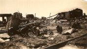
Pretty much looks like Hiroshima:

debris-and-supplies.jpg


demolished-buildings.jpg


Crowds of people swarm over what used to be the Farmers' Hotel (where at least five people died):

farmers-hotel-looking-E.jpg


farmers-hotel-looking-NW.jpg
 
Back
Top