
The wildest thing about 2011 to me is it had the biggest outbreak, highest death toll (in 60 years), and strongest tornado (Piedmont) all during different events, and all In completely seperate areas of the country. It's even more fascinating because we have almost no clue what climatological factors caused 2011 to be so much worse than other years. It wasn't just the worst tornado season, it was the worst by orders of magnitude.
Navigation
Install the app
How to install the app on iOS
Follow along with the video below to see how to install our site as a web app on your home screen.
Note: This feature may not be available in some browsers.
More options
-
Welcome to TalkWeather! We see you lurking around TalkWeather! Take the extra step and join us today to view attachments, see less ads and maybe even join the discussion. CLICK TO JOIN TALKWEATHER
You are using an out of date browser. It may not display this or other websites correctly.
You should upgrade or use an alternative browser.
You should upgrade or use an alternative browser.
Significant Tornado Events
- Thread starter locomusic01
- Start date
Tomcats Forever!
Member
April 2012 was in the running, I believe.I've been thinking, on the subject of busts - what are some Super Outbreaks that never were? Basically, events where model guidance and (usually) the SPC seriously suggested a Super Outbreak or similar event as a good possibility or even a probable outcome, but then flies in the ointment prevented them from reaching their ceiling. Not every Super Outbreak That Never Was had to Forecasted Convective Amplification Deficiency entirely, they just failed (with one exception that is listed here) to reach Super Outbreak status.
Events I am aware of that meet the criteria:
April 27, 2011 (the northern risk)
May 20, 2019
March 17, 2021
March 25, 2021 (maybe?)
May 25, 2024 (maybe?)
March 14, 2025
March 15, 2025
Am I missing any?
Christopher Robert
Member
Rolling Fork MS, December 29 2021 at 1:10 PM
Town was leveled by an EF4 wedge on March 24 2023.
I didn't know it at the time but I felt somewhat uneasy vibes back in 2021 when I drove thru there. That area is very flat and doesn't seem like Mississippi.
Town was leveled by an EF4 wedge on March 24 2023.
I didn't know it at the time but I felt somewhat uneasy vibes back in 2021 when I drove thru there. That area is very flat and doesn't seem like Mississippi.
Attachments
CheeselandSkies
Member
The wildest thing about 2011 to me is it had the biggest outbreak, highest death toll (in 60 years), and strongest tornado (Piedmont) all during different events, and all In completely seperate areas of the country. It's even more fascinating because we have almost no clue what climatological factors caused 2011 to be so much worse than other years. It wasn't just the worst tornado season, it was the worst by orders of magnitude.
Yes, there was just something different in the atmosphere that year that no one seems to be able to put their finger on as far as a "smoking gun" goes. Likely, as with individual Super Outbreaks themselves it was just a rare combination of the regular seasonal factors (MJO, ENSO, Gulf temperatures, EML source drought, etc).
The one thing that doesn't satisfactorily explain to me though is how; even after that 3-week lull that followed the Super Outbreak system, the season came roaring right back in late May with another spate of extraordinarily violent tornadoes.
CheeselandSkies
Member
I'm not too sure about the March of '21 events being hyped as potential super outbreaks because I didn't follow weather very closely back then. So admittedly, I don't know about those two events.
Outside of those two, though, none of the events listed there outside of 4/27/11 were genuinely expected to be super outbreaks (and 4/27/11 was only expected to be a super outbreak on the day-of based on how that day was beginning to pan out), and IMO only two were considered to have potential to hit the ceiling of a super outbreak, which were 3/15/25 and 5/20/19. Every other outbreak was definitely not seen as a potential super outbreak contender. The only times I consider that to be so is when you have veteran meteorologists calling for comparisons to other extremely high end events in forecasts, like how James Spann began ringing alarm bells pretty far out in advance of 3/15 this year. You simply don't see that very often.
Days like 4/27/11 still potentially could have had flies in the ointment that only would have become apparent on the day of. When the satellite presentation of an extreme event became clear in the morning hours of that day, meteorologists really began going hard on the alarms. A great example of this is on the 100 API radio show with Jim Stefkovich.
However, days like 5/20/19 and 3/15/25 were talked about as being potential super outbreaks, but as those events began to unfold, it became very clear that they were not going to hit the ceiling. I don't know if 5/20 was being talked about as a super outbreak up until it lined out, but I do know for a fact that when we woke up and saw the messy satellite presentation on 3/15 we knew it wasn't going to hit the ceiling. Not that it didn't verify as a high risk, it just wasn't what it could have been.
5/20/19 it seems the general consensus the real problem was slightly warmer than expected 700mb temps, which were just enough to keep a lid on the extensive open warm sector supercell initiation portrayed by CAMs (most notably the infamous 10Z HRRR run).
Due to certain climate and geographical factors in the Southern Plains, it's actually considerably less likely to get "Super" caliber (by the standards of the two events often described as such) outbreaks there compared to east of the MS Valley. The absolute ceiling is probably something on the order of 5/3/99 (which ironically was a slight risk the morning of), and it was definitely thought that 5/20/19 had that potential.
Highly recommended viewing if you haven't already:
Exactly! Plains set ups are always so mercurial. They’re essentially next door to the EML source region and if trough ejection timing is ever so slightly off, it can throw off the entire event. Even 5/3/99 had the cap build back in ever so slightly as the day went on.
I was only 6 when the May 3rd event happened, but later seeing the storm stories episode, as well as the Discovery Channel documentaries, on the event really cemented my love for severe weather. May 3rd is almost mystical to me, especially when I actually studied up on the meteorological set up. Dual Dry Line, Cirrus canopies, model mishandling, numerous possible flies in the ointment, and one of the most notorious tornados of all time being spawned from a supercell that likely initiated off a horizontal convective roll. Maybe it’s just my childhood nostalgia and it’s special place in my heart, but I could talk about May 3rd all day.
I would argue 5/3/99 and probably 4/26/91 are your “max ceiling” plains events. Even though 5/3/99 featured more action in the OWS vs Dry line initiated. Probably a few others from the 20th century I’m glossing over. As you noted, over here East of the MS valley, we can get these very large and wide geographical North/South warm sectors with such easy access to gulf moisture. Stouter EMLs can actually play better over this way in aiding larger outbreaks vs the Plains since we are so far away from the EML source region and more dry air just helps tamp down crapvection. Those huge continental troughs and their associated jet streaks are more likely to be fully mature when impacting East of the MS Valley with those 100+ knot jet isotachs. Not saying it’s impossible, but there does seem to be a ceiling to Plains events relative to some of the bigger ones we have seen over here.
I’ll have to go back and reread their posts so I may be misremembering, but didn’t Fred & Matt G. identify that specific MJO signature that correlated with high end tornadic events and was active on 4/27 actually circled back around and was active around the plains during the back half of May 2011?The one thing that doesn't satisfactorily explain to me though is how; even after that 3-week lull that followed the Super Outbreak system, the season came roaring right back in late May with another spate of extraordinarily violent tornadoes.
CheeselandSkies
Member
I’ll have to go back and reread their posts so I may be misremembering, but didn’t Fred & Matt G. identify that specific MJO signature that correlated with high end tornadic events and was active on 4/27 actually circled back around and was active around the plains during the back half of May 2011?
That might very well have had something to do with it; I had forgotten about that.
Tomcats Forever!
Member
Most people argue the gravel base beneath the slab disqualifies it because it was easier for wind to get underneath and displace it, but this ignores the fact the slab was poured into a filled, reinforced CMU perimeter. I think the only way it could've been lifted the way it was is if it was still attached to the house and everything was lofted at once. This theory is supported by the fact the CMU perimeter is still attached in many places to the slab. If the house wasn't securely attached to the slab, I believe the slab would've been left behind. It's less a question of what winds were required to topple the home, and more what winds were required to loft it as one large compact object.
The home being lofted whole with the slab still attached is the most extreme possible DI. It's more impressive than if it left behind a bare slab with sill plates and anchor bolts. I'm 100% convinced if the house was built on rebar reinforced stem walls, those would've been broken. A typical slab with anchor bolts would've been scoured like homes from BCM or Smithville. However, when it comes to surveying tornadoes the default is and will always be "different construction=worse construction", so this house will never get a fair analysis.
View attachment 49448
View attachment 49450
View attachment 49451
The remains of that slab look pretty standard thickness to me.
Interesting post. My takes are about both the March 2021 risks:I've been thinking, on the subject of busts - what are some Super Outbreaks that never were? Basically, events where model guidance and (usually) the SPC seriously suggested a Super Outbreak or similar event as a good possibility or even a probable outcome, but then flies in the ointment prevented them from reaching their ceiling. Not every Super Outbreak That Never Was had to Forecasted Convective Amplification Deficiency entirely, they just failed (with one exception that is listed here) to reach Super Outbreak status.
Events I am aware of that meet the criteria:
April 27, 2011 (the northern risk)
May 20, 2019
March 17, 2021
March 25, 2021 (maybe?)
May 25, 2024 (maybe?)
March 14, 2025
March 15, 2025
Am I missing any?
To this day, I think the 45% on March 17th 2021 was one of the weirdest SPC decisions of all time. Even ignoring hindsight, when I look back at the models for March 17th on the HREF archive, I am puzzled that anything higher than 15% was considered for the tornado forecast. This was certainly a case where an event being spotted early and seemingly initially impressive built hype that led to over forecasting at Day 1.
The kinematics were just unimpressive... the trough was not moving overly quickly and the 500mb flow was just 50-60kts over the warm sector during the event. Dixie in early spring heavily relies on powerful LLJs, and across AL the LLJ on the day was in some spots lower than 40kts. The most favourable environment was further West in MS - where sustained discrete convection struggled (and was modelled to do so). The model signal was for copious discrete storms to develop early across AL in the Eastern half of the warm sector (which happened) but as stated the environment was not close to high-risk level and so the strongest tornado was EF2. Had the trough ejection occurred earlier near peak heating the story would be different, imo. But given the lack of CAM signal coinciding with the impressive environment, the 45% let alone 30% seem very out of character for the often conservative SPC.
I think March 25th 2021 was almost the opposite. Admittedly, I have only been tracking setups in detail since about 2019 which is not that long in the grand scheme of weather but that day was and still is the most impressive setup I can recall happening to be honest. The agreement for an extremely high end environment across N MS/AL was literally unlike anything I can remember... literally of the charts.

What was even more ridiculous was for literally all CAMS to have a very strong signal for multiple robust, discrete supercells through that environment. Almost every CAM's simref looked basically like 4/27. Even the NAM which notoriously favoured linear modes over anything at that time had a line of discrete cells. I think the SPC was well within their right to go 45% or even higher, and I say this with hindsight. I truly think the only reason the 45% wasn't issued was the failure of the one the previous week to verify. The way the initial round of storms was more significant than expected and managed to save MS/AL from storms utilising the peak parameter space a couple hours later I still think about often. Even then - the event managed to produce multiple intense tornadoes that were destructive. That event was driven by a quick moving shortwave rather than the larger scale troughs you tend to see with major outbreaks (which is what made 3/15 this year look so scary until D1 when timing seemed a bit off).
Lake Martin EF4
Member
Ah.Interesting post. My takes are about both the March 2021 risks:
To this day, I think the 45% on March 17th 2021 was one of the weirdest SPC decisions of all time. Even ignoring hindsight, when I look back at the models for March 17th on the HREF archive, I am puzzled that anything higher than 15% was considered for the tornado forecast. This was certainly a case where an event being spotted early and seemingly initially impressive built hype that led to over forecasting at Day 1.
The kinematics were just unimpressive... the trough was not moving overly quickly and the 500mb flow was just 50-60kts over the warm sector during the event. Dixie in early spring heavily relies on powerful LLJs, and across AL the LLJ on the day was in some spots lower than 40kts. The most favourable environment was further West in MS - where sustained discrete convection struggled (and was modelled to do so). The model signal was for copious discrete storms to develop early across AL in the Eastern half of the warm sector (which happened) but as stated the environment was not close to high-risk level and so the strongest tornado was EF2. Had the trough ejection occurred earlier near peak heating the story would be different, imo. But given the lack of CAM signal coinciding with the impressive environment, the 45% let alone 30% seem very out of character for the often conservative SPC.
I think March 25th 2021 was almost the opposite. Admittedly, I have only been tracking setups in detail since about 2019 which is not that long in the grand scheme of weather but that day was and still is the most impressive setup I can recall happening to be honest. The agreement for an extremely high end environment across N MS/AL was literally unlike anything I can remember... literally of the charts.
View attachment 49484
What was even more ridiculous was for literally all CAMS to have a very strong signal for multiple robust, discrete supercells through that environment. Almost every CAM's simref looked basically like 4/27. Even the NAM which notoriously favoured linear modes over anything at that time had a line of discrete cells. I think the SPC was well within their right to go 45% or even higher, and I say this with hindsight. I truly think the only reason the 45% wasn't issued was the failure of the one the previous week to verify. The way the initial round of storms was more significant than expected and managed to save MS/AL from storms utilising the peak parameter space a couple hours later I still think about often. Even then - the event managed to produce multiple intense tornadoes that were destructive. That event was driven by a quick moving shortwave rather than the larger scale troughs you tend to see with major outbreaks (which is what made 3/15 this year look so scary until D1 when timing seemed a bit off).
I always thought 3/17 was the "Super Outbreak That Wasn't" of 2021. I was wrong.
Looks like I can slot 3/25/21 in with 5/20/19 and 3/15/25!
CheeselandSkies
Member
Interesting post. My takes are about both the March 2021 risks:
To this day, I think the 45% on March 17th 2021 was one of the weirdest SPC decisions of all time. Even ignoring hindsight, when I look back at the models for March 17th on the HREF archive, I am puzzled that anything higher than 15% was considered for the tornado forecast. This was certainly a case where an event being spotted early and seemingly initially impressive built hype that led to over forecasting at Day 1.
The kinematics were just unimpressive... the trough was not moving overly quickly and the 500mb flow was just 50-60kts over the warm sector during the event. Dixie in early spring heavily relies on powerful LLJs, and across AL the LLJ on the day was in some spots lower than 40kts. The most favourable environment was further West in MS - where sustained discrete convection struggled (and was modelled to do so). The model signal was for copious discrete storms to develop early across AL in the Eastern half of the warm sector (which happened) but as stated the environment was not close to high-risk level and so the strongest tornado was EF2. Had the trough ejection occurred earlier near peak heating the story would be different, imo. But given the lack of CAM signal coinciding with the impressive environment, the 45% let alone 30% seem very out of character for the often conservative SPC.
I think March 25th 2021 was almost the opposite. Admittedly, I have only been tracking setups in detail since about 2019 which is not that long in the grand scheme of weather but that day was and still is the most impressive setup I can recall happening to be honest. The agreement for an extremely high end environment across N MS/AL was literally unlike anything I can remember... literally of the charts.
View attachment 49484
What was even more ridiculous was for literally all CAMS to have a very strong signal for multiple robust, discrete supercells through that environment. Almost every CAM's simref looked basically like 4/27. Even the NAM which notoriously favoured linear modes over anything at that time had a line of discrete cells. I think the SPC was well within their right to go 45% or even higher, and I say this with hindsight. I truly think the only reason the 45% wasn't issued was the failure of the one the previous week to verify. The way the initial round of storms was more significant than expected and managed to save MS/AL from storms utilising the peak parameter space a couple hours later I still think about often. Even then - the event managed to produce multiple intense tornadoes that were destructive. That event was driven by a quick moving shortwave rather than the larger scale troughs you tend to see with major outbreaks (which is what made 3/15 this year look so scary until D1 when timing seemed a bit off).
Very much worth noting where the official "strongest" tornado of that event, Newnan, occurred. HREF mean STP isn't everything (even though some of the Alabama tornadoes, specifically Centreville, were of at least EF4 intensity, IMO).
SweptSlab5
Member
Last post of 2025, so happy new year! I would like to mention, would you guys categorize Palm Sunday 1965 as a super outbreak? I do, and I feel like it only flies under the radar for the public because the F5s were robbed of their ratings, making it seem to the press and the general public that the event was less that it truly was.
Lake Martin EF4
Member
Happy New Year!Last post of 2025, so happy new year! I would like to mention, would you guys categorize Palm Sunday 1965 as a super outbreak? I do, and I feel like it only flies under the radar for the public because the F5s were robbed of their ratings, making it seem to the press and the general public that the event was less that it truly was.
I agree. I've always thought the only reason Palm Sunday isn't considered a Super Outbreak is lack of F5s + the (relatively) small tornado count.
Yes good point - though in this case it did pick up nicely on the EF3+ environment shifting East into Georgia overnight. Although STP does have obvious limits for every single CAM to agree on such a high parameter space across the area was extreme... in the forecast neither thermodynamics nor shear was a clear limiting factor, whatsoever.Very much worth noting where the official "strongest" tornado of that event, Newnan, occurred. HREF mean STP isn't everything (even though some of the Alabama tornadoes, specifically Centreville, were of at least EF4 intensity, IMO).

The only time I recall a similar signal was for the northern warm sector on the Easter Outbreak 2020, which ended up being not actually in the warm sector at all by the time the tornadic QLCS moved to the south of it, making the actual WS smaller and focused further south (where Bassfield eventually developed).
That being said, when you go look at the SPC mesoanalysis for 3/25, the STP composite charts were impressive but a mark short of the STP 9-10 HREF suggested. Now was this because the environment itself down trended, or because the early round uptrend utilised the warm sector so that when peak CAPE and Shear would have coincided, nothing happened? I'm not too sure.
Kds86z
Member
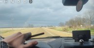
Pretty insane synchronized video of the Rochelle-Fairdale tornado, including the moment the Clem Schultz house impact happens.
tornadowatch211
Member
Tri State in Illinois complete

Give me feedback if I need it
Give me feedback if I need it
Western_KS_Wx
Member
(Lengthy post ahead)
I’ve mentioned in a few of my older posts I made about the Greensburg tornado that, while combing through ground and aerial damage photos, I noticed multiple large steel tanks that had landed within the town. I meticulously combed through every available photo I had at the time, as well as satellite imagery, to try and determine what the origin point of these tanks were. Even after receiving hundreds more photos and getting into contact with those who surveyed the event, I was still left stumped on the matter.
Well, after reviewing numerous available sources, images, and videos, I firmly believe I’ve now uncovered where these tanks originated from. What I found is honestly still hard to believe, but after going over every other possibility more times than I can count, it seems like the following is the only plausible explanation as to what happened here.
For starters, here’s some photos of the tanks that I was able to locate, along with a photo showing their locations that I plotted in Google Earth. After combing over thousands of ground and aerial photos I have in and around Greensburg, I found at least 7 tanks within the city limits.


You’ll notice that all of the tanks are similar in size and appearance, which to me suggested they likely were grouped together somewhere. As is quite clear, they are extensively mangled and crushed, with some actually being ripped open from being thrown significant distances. I was able to narrow down a few possible locations, but it was just educated guess work at that point.
Eventually I got a lead from a book I bought in which a farmer along Highway 183 described “great gouges” and oil spills in the land around his property from “oil tanks tumbling past.” There are several oil tanks and two natural gas substations in the area around the highway, but I didn’t think it was very likely at all that the tanks found in town originated there.
During my research into the event, I came across an old YouTube video posted by Dick McGowan, who had actually befriended the farmer from the book after he helped him out immediately following the tornado. In the video, him and the farmer met up a few months after in Greensburg and were driving around town. There’s a good deal of information in the video, but at one point the farmer pointed out the location where the tank in the last photo I shared had came to rest and said someone had spray-painted on the side of it “came from 7 miles south.” He went into more detail about the tanks that tumbled past his property and also mentioned the substation to the south, which had a collection of oil tanks.
Skip to 3:35 in the video to hear the point in the video mentioned above. The clip goes until 4:20.
My first thought after seeing this video was that it was locals spreading exaggerated and over-sensationalized information, as it’s not uncommon for that to happen after devastating disasters. On top of that, I honestly just didn’t believe an object of that size and weight could be carried that far—let alone at least 7 of them. Nonetheless, I continued researching to see what I could find.
After contacting some people and looking online, I learned that the tanks were almost certainly oil storage tanks. Tanks like those in the photos weigh anywhere from a little over one ton to perhaps several tons. Using satellite imagery, I noticed there is no other location impacted by the tornado that has a collection of oil tanks, other than the area along Highway 183, which is 7 miles south of town. Here’s a photo of the two natural gas substations, including the southernmost one with the oil tanks.


On top of that, I found a video that pretty much confirmed to me that the tanks came from that location. In the video, the videographer is traveling south along Highway 183 and remarks about the gouges in the field, which can be seen clearly, along with black streaks indicating spilled oil. He then comes across the two substations, with the last one being the site with the collection of oil tanks. As becomes quite apparent, there are no more tanks at the site or anywhere near the area.
Skip to 4:27 and 5:19 to see the gouges, 4:35 for the first substation, and 5:23 for the substation with the tanks. Also of note, at 5:35 you can see a large oil spill near the treeline and around the 6:00 mark another (mostly intact) tank is visible which came from a separate collection of tanks south of the substations.
Both locations were impacted by the centerline of the tornado and subject to winds that were almost certainly of EF5 intensity, with extreme damage to the substations noted in other ground photos. To add to the video above, here’s a screengrab facing directly north toward the southernmost substation where the tanks were once located. (Bit of a disclaimer, there are deceased cattle visible in this photo)

I also meticulously looked over the available aerial imagery south of town after the tornado and was unable to find any sort of tanks or large objects (except 1, which could be a topic for later) anywhere in the rural areas affected by the tornado. This further adds on to the possibility that the missing tanks were blown all the way to Greensburg and not deposited in nearby creeks, etc.
To wrap this very long post up, it is worth mentioning that to my knowledge this is an extremely anomalous feat of damage in documented tornado history. A tornado transporting several, likely multi-ton tanks (that were full at the time) upwards of 7 miles is still hard to believe, and an indication of exceptional intensity in my opinion. It’s also worth mentioning that this is technically still my personal speculation and unofficial findings, as nothing has been definitively confirmed by any official sources to my knowledge, and I’m using available evidence I’ve located to come to this conclusion.
I’ve mentioned in a few of my older posts I made about the Greensburg tornado that, while combing through ground and aerial damage photos, I noticed multiple large steel tanks that had landed within the town. I meticulously combed through every available photo I had at the time, as well as satellite imagery, to try and determine what the origin point of these tanks were. Even after receiving hundreds more photos and getting into contact with those who surveyed the event, I was still left stumped on the matter.
Well, after reviewing numerous available sources, images, and videos, I firmly believe I’ve now uncovered where these tanks originated from. What I found is honestly still hard to believe, but after going over every other possibility more times than I can count, it seems like the following is the only plausible explanation as to what happened here.
For starters, here’s some photos of the tanks that I was able to locate, along with a photo showing their locations that I plotted in Google Earth. After combing over thousands of ground and aerial photos I have in and around Greensburg, I found at least 7 tanks within the city limits.
You’ll notice that all of the tanks are similar in size and appearance, which to me suggested they likely were grouped together somewhere. As is quite clear, they are extensively mangled and crushed, with some actually being ripped open from being thrown significant distances. I was able to narrow down a few possible locations, but it was just educated guess work at that point.
Eventually I got a lead from a book I bought in which a farmer along Highway 183 described “great gouges” and oil spills in the land around his property from “oil tanks tumbling past.” There are several oil tanks and two natural gas substations in the area around the highway, but I didn’t think it was very likely at all that the tanks found in town originated there.
During my research into the event, I came across an old YouTube video posted by Dick McGowan, who had actually befriended the farmer from the book after he helped him out immediately following the tornado. In the video, him and the farmer met up a few months after in Greensburg and were driving around town. There’s a good deal of information in the video, but at one point the farmer pointed out the location where the tank in the last photo I shared had came to rest and said someone had spray-painted on the side of it “came from 7 miles south.” He went into more detail about the tanks that tumbled past his property and also mentioned the substation to the south, which had a collection of oil tanks.
Skip to 3:35 in the video to hear the point in the video mentioned above. The clip goes until 4:20.
My first thought after seeing this video was that it was locals spreading exaggerated and over-sensationalized information, as it’s not uncommon for that to happen after devastating disasters. On top of that, I honestly just didn’t believe an object of that size and weight could be carried that far—let alone at least 7 of them. Nonetheless, I continued researching to see what I could find.
After contacting some people and looking online, I learned that the tanks were almost certainly oil storage tanks. Tanks like those in the photos weigh anywhere from a little over one ton to perhaps several tons. Using satellite imagery, I noticed there is no other location impacted by the tornado that has a collection of oil tanks, other than the area along Highway 183, which is 7 miles south of town. Here’s a photo of the two natural gas substations, including the southernmost one with the oil tanks.
On top of that, I found a video that pretty much confirmed to me that the tanks came from that location. In the video, the videographer is traveling south along Highway 183 and remarks about the gouges in the field, which can be seen clearly, along with black streaks indicating spilled oil. He then comes across the two substations, with the last one being the site with the collection of oil tanks. As becomes quite apparent, there are no more tanks at the site or anywhere near the area.
Skip to 4:27 and 5:19 to see the gouges, 4:35 for the first substation, and 5:23 for the substation with the tanks. Also of note, at 5:35 you can see a large oil spill near the treeline and around the 6:00 mark another (mostly intact) tank is visible which came from a separate collection of tanks south of the substations.
Both locations were impacted by the centerline of the tornado and subject to winds that were almost certainly of EF5 intensity, with extreme damage to the substations noted in other ground photos. To add to the video above, here’s a screengrab facing directly north toward the southernmost substation where the tanks were once located. (Bit of a disclaimer, there are deceased cattle visible in this photo)
I also meticulously looked over the available aerial imagery south of town after the tornado and was unable to find any sort of tanks or large objects (except 1, which could be a topic for later) anywhere in the rural areas affected by the tornado. This further adds on to the possibility that the missing tanks were blown all the way to Greensburg and not deposited in nearby creeks, etc.
To wrap this very long post up, it is worth mentioning that to my knowledge this is an extremely anomalous feat of damage in documented tornado history. A tornado transporting several, likely multi-ton tanks (that were full at the time) upwards of 7 miles is still hard to believe, and an indication of exceptional intensity in my opinion. It’s also worth mentioning that this is technically still my personal speculation and unofficial findings, as nothing has been definitively confirmed by any official sources to my knowledge, and I’m using available evidence I’ve located to come to this conclusion.
speedbump305
Member
(Lengthy post ahead)
I’ve mentioned in a few of my older posts I made about the Greensburg tornado that, while combing through ground and aerial damage photos, I noticed multiple large steel tanks that had landed within the town. I meticulously combed through every available photo I had at the time, as well as satellite imagery, to try and determine what the origin point of these tanks were. Even after receiving hundreds more photos and getting into contact with those who surveyed the event, I was still left stumped on the matter.
Well, after reviewing numerous available sources, images, and videos, I firmly believe I’ve now uncovered where these tanks originated from. What I found is honestly still hard to believe, but after going over every other possibility more times than I can count, it seems like the following is the only plausible explanation as to what happened here.
For starters, here’s some photos of the tanks that I was able to locate, along with a photo showing their locations that I plotted in Google Earth. After combing over thousands of ground and aerial photos I have in and around Greensburg, I found at least 7 tanks within the city limits.
View attachment 49496View attachment 49499View attachment 49500View attachment 49501View attachment 49502
You’ll notice that all of the tanks are similar in size and appearance, which to me suggested they likely were grouped together somewhere. As is quite clear, they are extensively mangled and crushed, with some actually being ripped open from being thrown significant distances. I was able to narrow down a few possible locations, but it was just educated guess work at that point.
Eventually I got a lead from a book I bought in which a farmer along Highway 183 described “great gouges” and oil spills in the land around his property from “oil tanks tumbling past.” There are several oil tanks and two natural gas substations in the area around the highway, but I didn’t think it was very likely at all that the tanks found in town originated there.
During my research into the event, I came across an old YouTube video posted by Dick McGowan, who had actually befriended the farmer from the book after he helped him out immediately following the tornado. In the video, him and the farmer met up a few months after in Greensburg and were driving around town. There’s a good deal of information in the video, but at one point the farmer pointed out the location where the tank in the last photo I shared had came to rest and said someone had spray-painted on the side of it “came from 7 miles south.” He went into more detail about the tanks that tumbled past his property and also mentioned the substation to the south, which had a collection of oil tanks.
Skip to 3:35 in the video to hear the point in the video mentioned above. The clip goes until 4:20.
My first thought after seeing this video was that it was locals spreading exaggerated and over-sensationalized information, as it’s not uncommon for that to happen after devastating disasters. On top of that, I honestly just didn’t believe an object of that size and weight could be carried that far—let alone at least 7 of them. Nonetheless, I continued researching to see what I could find.
After contacting some people and looking online, I learned that the tanks were almost certainly oil storage tanks. Tanks like those in the photos weigh anywhere from a little over one ton to perhaps several tons. Using satellite imagery, I noticed there is no other location impacted by the tornado that has a collection of oil tanks, other than the area along Highway 183, which is 7 miles south of town. Here’s a photo of the two natural gas substations, including the southernmost one with the oil tanks.
View attachment 49503View attachment 49504
On top of that, I found a video that pretty much confirmed to me that the tanks came from that location. In the video, the videographer is traveling south along Highway 183 and remarks about the gouges in the field, which can be seen clearly, along with black streaks indicating spilled oil. He then comes across the two substations, with the last one being the site with the collection of oil tanks. As becomes quite apparent, there are no more tanks at the site or anywhere near the area.
Skip to 4:27 and 5:19 to see the gouges, 4:35 for the first substation, and 5:23 for the substation with the tanks. Also of note, at 5:35 you can see a large oil spill near the treeline and around the 6:00 mark another (mostly intact) tank is visible which came from a separate collection of tanks south of the substations.
Both locations were impacted by the centerline of the tornado and subject to winds that were almost certainly of EF5 intensity, with extreme damage to the substations noted in other ground photos. To add to the video above, here’s a screengrab facing directly north toward the southernmost substation where the tanks were once located. (Bit of a disclaimer, there are deceased cattle visible in this photo)
View attachment 49505
I also meticulously looked over the available aerial imagery south of town after the tornado and was unable to find any sort of tanks or large objects (except 1, which could be a topic for later) anywhere in the rural areas affected by the tornado. This further adds on to the possibility that the missing tanks were blown all the way to Greensburg and not deposited in nearby creeks, etc.
To wrap this very long post up, it is worth mentioning that to my knowledge this is an extremely anomalous feat of damage in documented tornado history. A tornado transporting several, likely multi-ton tanks (that were full at the time) upwards of 7 miles is still hard to believe, and an indication of exceptional intensity in my opinion. It’s also worth mentioning that this is technically still my personal speculation and unofficial findings, as nothing has been definitively confirmed by any official sources to my knowledge, and I’m using available evidence I’ve located to come to this conclusion.
This is absolutely incredible. I cannot fathom how well put together this is and how awe inspiring this terrifying feat of damage is. 7 miles… good grief.