
Sorry to fast-forward to current events, but was today's Montebello, California tornado really a landspout? Based on radar imagery and video of the event, to me this absolutely looks like it was mesocyclonic and spawned by a mini-supercell. Sometimes it seems like the term "landspout" is totally misused by NWS meteorologists, especially at WFOs that don't have much experience with tornado activity. I see a hook echo, couplet, and an updraft. Yeah, I just don't buy it....
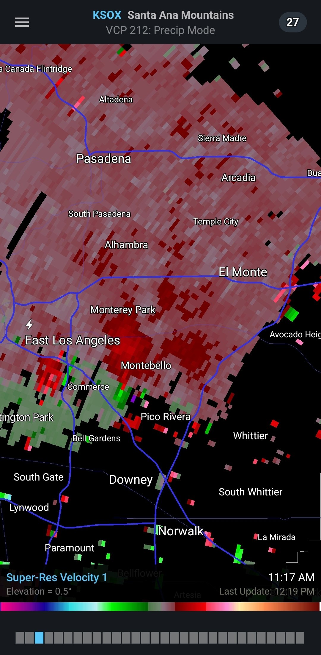


Yeah there is CLEARLY a rotating updraft and occlusion here. NWS mets should know better, regardless of the forecast office.
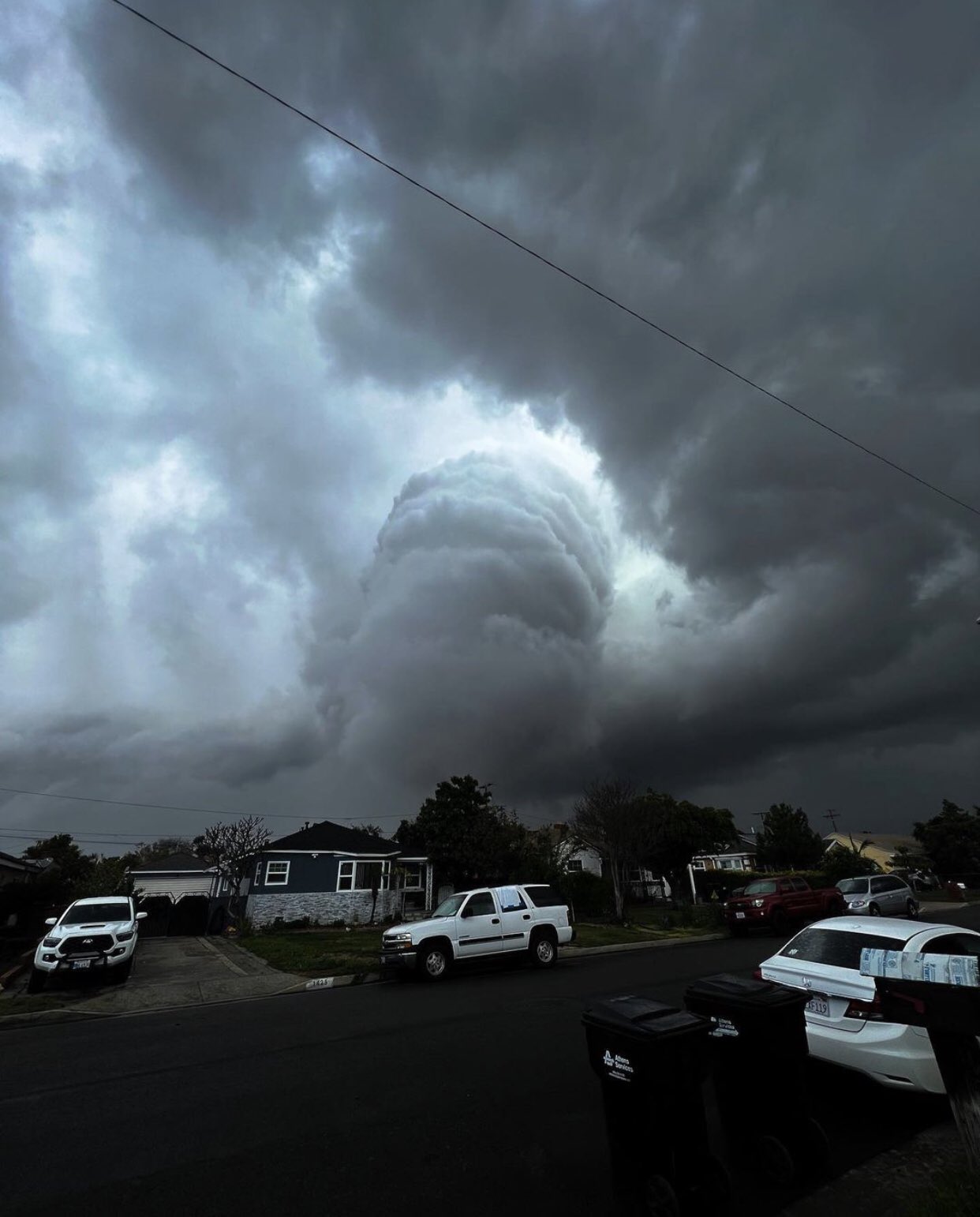
Yeah there is CLEARLY a rotating updraft and occlusion here. NWS mets should know better, regardless of the forecast office.
Last edited:
 _ Twitter.png")
 _ Twitter.png")
 _ Twitter.png")


 — Scaled (65%).png")
.png")
.png")
.png")
.png")
.png")
.png")
.png")


