
IIRC, several NWS offices are doing a bunch of upgrades/updates/etc., and several other offices have had to take over their CWAs until those upgrades are finished and everything's running properly.Did I miss why Peachtree City is issuing warnings for Birmingham?
Navigation
Install the app
How to install the app on iOS
Follow along with the video below to see how to install our site as a web app on your home screen.
Note: This feature may not be available in some browsers.
More options
-
Welcome to TalkWeather! We see you lurking around TalkWeather! Take the extra step and join us today to view attachments, see less ads and maybe even join the discussion. CLICK TO JOIN TALKWEATHER
You are using an out of date browser. It may not display this or other websites correctly.
You should upgrade or use an alternative browser.
You should upgrade or use an alternative browser.
Chris3024
Member
Gotcha, I knew about the computer systems upgrade, but I assumed that would only effect the weather radios
IIRC, several NWS offices are doing a bunch of upgrades/updates/etc., and several other offices have had to take over their CWAs until those upgrades are finished and everything's running properly.
keithGA
Member
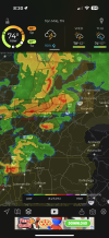
If tradition holds, FFC will slap a TOR warning on every bird fart, or at least a SVR with TOR possible tag.Strong rotation on this storm, which is unfortunately in a radar hole, NW of Pikeville, TN. FFC just issued its first TOR of the day.
View attachment 42872View attachment 42873
They're in the bullseye of favorable parameters.

kcyalater
Member
hytop radar is dead. not good.
Hopefully it's just disconnected from the network, but we'll have to wait for tomorrow's light to be sure.hytop radar is dead. not good.
Sharpy
Member
Glad they trimmed the Tor and wind probabilities back a bit. Agree on hatched area for tornadoes. Carefully monitoring the mini cells popping up below the N AL boundary.


Hopefully it's just disconnected from the network, but we'll have to wait for tomorrow's light to be sure.
Sharpy
Member
Bama Ravens
Member
This is from an article on AlabamaWX.com about the software upgrades:Gotcha, I knew about the computer systems upgrade, but I assumed that would only effect the weather radios
So, in simple terms, it sounds like NWS Birmingham is still writing/issuing the warnings, but they have to be issued through NWS Peachtree City’s system.During this time, NWS Birmingham will maintain operations by remotely accessing a neighboring office’s AWIPS system, with forecasts and warnings issued by the Birmingham team. If needed, full service backup will be provided by NWS Peachtree City (Atlanta) or NWS Huntsville. Radar data from KBMX and KMXX will remain available, routed through other NWS offices, and weather balloon observations will be processed using an alternate method.
Sharpy
Member
Should mention that the cells are somewhat training along the same paths like the N AL cells were. Concerning to say the least, but they are in a bit more area of traffic - almost as if they may congeal soon.We’ve got other action going on besides N AL. Rocky Top (Knoxville) has a lot of action moving towards the city. Couple of TORs but not seeing any reports of any tornadoes OTG.
I think I'm all tired out from this past week, as I'm feeling like my eyelids are heavy (of course, it could also be the pollen in the air as well). Regardless, in any case I'm going to call it a night tonight. In the meantime, I hope things calm down tonight, so that everyone can get a good night's sleep tonight! ")
Kds86z
Member
Otg
Kds86z
Member
Kds86z
Member
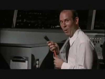
Good lord, he looks like he aged 30 years from the adrenaline.


- Thread starter
- Moderator
- #680
Tornado warning for ne corner of Cullman Co. and Arab in Marshall Co.