Seems like the latest HRR
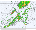
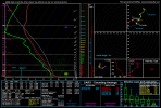
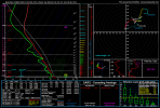
Looks like a little CC Drop, if not still a pretty dangerous couplet.Cell heading for W Monroe LA has a nasty couplet.
Sent from my SM-S901U using Tapatalk