Kds86z
Member
60/40 tornado probs for the Texas watch.
Follow along with the video below to see how to install our site as a web app on your home screen.
Note: This feature may not be available in some browsers.
It looks like storm initiation might be getting started with the first radar blip east of Peru, Il. Unsure if it south of the warm front or not.
Chasers say so. I find watching live chaser YouTube feed is great for real time analysis.Is the lake front actually starting to recede? If so how far and how fast will it?
It's harder for it to go back north than it is for it to continue sinking. Cold air beats warm air due to physics. There will be small balancing acts, but don't expect significant northward movement.Is the lake front actually starting to recede? If so how far and how fast will it?
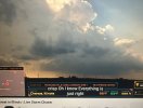
The sun is now breaking out. Guess I just had to comment on the cloud cover for the sun to peak through.It's been just straight cloud cover here near Goshen IN the whole day. I have very little hope for storms here later tonight.
Yeah, Reed is already driving back to Texas to try and catch that event.I doubt the maximum ceiling will be realized now.
Gunna jinx it lolYeah, Reed is already driving back to Texas to try and catch that event.
That's fair, but the potential for a pretty significant event still exists. With so many subtle pieces needing to be in place, there are plenty of reasons to be skeptical. I wouldn't let my guard down, though.I doubt the maximum ceiling will be realized now.
Is he actually lol.Yeah, Reed is already driving back to Texas to try and catch that event.
Regardless, there’s still a pretty big risk and i’m also worried about the risk in Texas.Probably will still be a few cells on the southern end of the moderate that pop off later today though. Anything that crosses the warm front will be a hailer and nothing else and that’s like half of the moderate risk.