• Welcome to TalkWeather!
    We see you lurking around TalkWeather! Take the extra step and join us today to view attachments, see less ads and maybe even join the discussion.
    CLICK TO JOIN TALKWEATHER

Severe Weather 2025

Oh I fully know this account is going bye bye too. This was just to let you all know the direction this site is going in isn’t a good one. Like I said I’ve been here a while, but others have noticed this too.

I'm truly sorry to see you go ColdFront. You were a solid member and brought a lot to this forum. It's sad to see low effort and twitter-copy-paste members flourish while a smart, even-keeled poster, such as you are, get banned. This is a different place than it was a couple years ago.

Shoot me a pm when you find a new landing place.
 
IMG_6270.jpeg
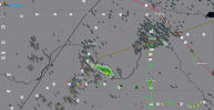
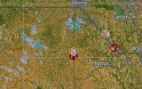
Brandon and Corey’s locations as I screenshots it.
 
I'm truly sorry to see you go ColdFront. You were a solid member and brought a lot to this forum. It's sad to see low effort and twitter-copy-paste members flourish while a smart, even-keeled poster, such as you are, get banned. This is a different place than it was a couple years ago.

Shoot me a pm when you find a new landing place.
Yeah, members like Coldfront are what keeps this place a hub for thoughtful weather discussion and scientific discovery, instead of the combination of Twitter feed and Discord chat it sometimes fringes on devolving into.
 
This little guy looks to growing. I think this is kickoff time.
IMG_6272.jpeg
 
MD 960 graphic
Mesoscale Discussion 0960
NWS Storm Prediction Center Norman OK
0752 PM CDT Sat May 24 2025

Areas affected...Western/central OK...far eastern TX Panhandle

Concerning...Severe potential...Watch likely

Valid 250052Z - 250215Z

Probability of Watch Issuance...80 percent

SUMMARY...Supercell development remains possible this evening. A
threat for tornadoes, very large hail, and damaging winds could
evolve if development occurs.

DISCUSSION...Towering cumulus is noted this evening from the far
northeast TX Panhandle into northwest OK, in the vicinity of a
quasi-stationary front. The thermodynamic environment remains quite
volatile, with 70s F dewpoints beneath steep midlevel lapse rates
(as noted on the 00Z OUN sounding) supporting MLCAPE in excess of
4000 J/kg. Deep-layer shear is sufficient for supercells, and
hodographs will increase with size through the evening in
conjunction with a strengthening low-level jet.

Uncertainty remains regarding the potential for development this
evening, given the presence of warm 700 mb temperatures (14C on the
00Z OUN sounding) and residual capping. The low-level jet should
eventually aid in storm development near/north of the front later
tonight, but any storms that can mature earlier this evening could
evolve into surface-based supercells, with an attendant threat of
tornadoes, very large hail, and isolated severe gusts. Tornado Watch
issuance is likely if storm initiation appears imminent this
evening.

..Dean/Mosier.. 05/25/2025

...Please see www.spc.noaa.gov for graphic product...

ATTN...WFO...OUN...AMA...

LAT...LON 35630042 35840059 36070049 36509959 36429804 36159707
35929677 35519680 35069707 34809724 34749775 34719825
34849902 34999958 35370014 35630042

MOST PROBABLE PEAK TORNADO INTENSITY...100-130 MPH
MOST PROBABLE PEAK WIND GUST...65-80 MPH
MOST PROBABLE PEAK HAIL SIZE...2.00-3.50 IN
 
That little storms is trying;
IMG_6274.jpeg
 
Back
Top