- Thread starter
- #1,641
KevinH
Member
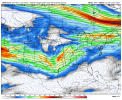
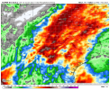
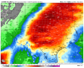
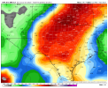
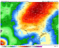
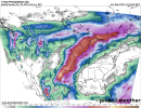
Alrighty…This system has Texas and Oklahoma in its sights. Too far out to make a precise forecast, but it looks to be really, really strong. It's caught my attention even this far away, and I'm already watching it. It cuts off before the system can move further east, but it looks like it's holding together through to Arkansas as it reaches the Mississippi River. The model I was looking at their cuts off at that point, like to see if it shows up again tomorrow.