- Thread starter
- #1,561
KevinH
Member
Right! Especially in DixieThat's usually how it works during El Nino, but that's not always the case.
SMH
Follow along with the video below to see how to install our site as a web app on your home screen.
Note: This feature may not be available in some browsers.
Right! Especially in DixieThat's usually how it works during El Nino, but that's not always the case.
Especially if the SPC highlights an area of risk on the D4-8 tomorrow. We all know how fickle Dixie is soooooooo lolLooks like a threat more confined to South Mississippi and south Alabama. I may make a thread tommorow
Oh look at that.. MS/AL..
SHOCKER! lol
Also:

.jpeg")
Would you mind posting a picture of the run?Legit considering starting the thread just based off the 12z euro look hahahah.
Still not super impressed but the euro is peaking my interest more
I will in a second going to look at the ensembles and some other things some more. I'll probably go ahead and make a thread and post in there in a bitWould you mind posting a picture of the run?
Legit considering starting the thread just based off the 12z euro look hahahah.
Still not super impressed but the euro is peaking my interest more


Lol no worries I'm going to wait, lol. Better for another days worth of data then prematurely start a thread. Although...... Trey has something to say lol. https://x.com/ConvChronicles/status/1710285206781927534?s=20Alright… personally, I would wait another day to see what the models do and SPC says tomorrow. The SPC isn’t sure themselves…. YET.
I say if models continue to come into better agreement, the event is expected to be within a week, and starting the thread would align with the official posting policy, then start it. I don’t know if the policy has changed since @WesL posted it back in February though lol
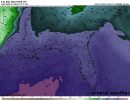
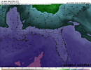
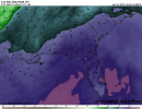
Keep posting these maps please lolI'm going to hold off and give it a few more runs and see if there's more consistency with the ensembles. Here's some maps though @KevinH. 992 mb low in Missouri. Looked up some Sbcape maps and it seems a general level of instability around the Mississippi area and surrounding is showing 500j. This is definitely not a high cape event. If anything we are dealing with low topped supercells that typically coincide our winter events. My hunch is that you'll probably be reaching near 1000j in some areas just a rule of thumb globals tend to underestimate. The low pressure is almost too far northwest to give any good shear for the areas closest to the gulf. May end up with two general areas of higher severe threats. (Immediate vicinity and closer to the gulf.)
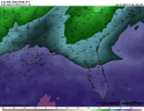
Still lots of time and changes. I'm pretty darn intrigued though, feels like it's been a while lol. View attachment 21760View attachment 21761View attachment 21762
I agree… I want to see more model consistency, but at the same time, I don’t lolLol no worries I'm going to wait, lol. Better for another days worth of data then prematurely start a thread. Although...... Trey has something to say lol. https://x.com/ConvChronicles/status/1710285206781927534?s=20
Something I learned recently…Lol no worries I'm going to wait, lol. Better for another days worth of data then prematurely start a thread. Although...... Trey has something to say lol. https://x.com/ConvChronicles/status/1710285206781927534?s=20
Longwave trough? Yeah you can have some nasty weather off those.Something I learned recently…
Troughs that take up the entire space of the US (I forgot what it’s called) like the one Trey showed in this tweet can be a bad sign. Too early to tell, but again, we will just have to watch and see
Now let’s see if this holds and how the other “ingredients” come together on…All the global model output has substantial DP in the 60s to 70s around the 13th over a very large area.

What about the other models?12Z GFS has a pretty wide warm sector for next Friday. Still depicts minimal to non-existent instability despite upper 50s to 60s dewpoints, but pattern recognition suggests something should happen somewhere in there.
What about the other models?