- Moderator
- #301
Please use the ignore feature if you wish to not see posts from certain forum members.
Follow along with the video below to see how to install our site as a web app on your home screen.
Note: This feature may not be available in some browsers.
Dude, I already said that!Please use the ignore feature if you wish to not see posts from certain forum members.
")
The 70 s seems like it was a very active decade for severe weather . Some large course 74 aprilWhew Lawd, let me see if I can do something to steer this back to topic LOL...
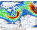
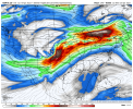
There had been a period in the last week of April that I've had my eye on, especially in the 23rd to 27th timeframe. It was going to be related to the NAO going positive finally, and the MJO cycling through Phases 8 -> 1 -> 2 (the classic severe weather outbreak phases) and even a signal in the Lezak Recurring Cycle for those of you that follow that. However, no matter what happens with the NAO or anything else, we just cannot seem to move away from troughs diving through the Northeast and digging off the East Coast... and causing continental air to get circulated into the eastern half of the Gulf of Mexico and for the upper-level wavelengths to be shortened so that these troughs eject out with the kind of geometry we've seen for the last month. I imagine there will probably be a few more threats of some caliber through the rest of the month, but I don't see anything more serious than what we've already dealt with so far coming down the line anytime in the foreseeable future.
For what it's worth, second-year La Ninas are typically known to be not as violent as their first-year counterparts on average. They can still be active, even hyperactive, but you're much more likely to get large-scale violent events coming out of a first-year episode than a second-year episode. The spring of 1976 would suggest that rare third-year events may behave similarly to first-year episodes in that regard... but we have such a super tiny set of that to look at, that it's not possible to come to a conclusion.


Reed Timmer has video of a brief touchdown; two tornadoes in three Easter Sundays for Bassfield, luckily this one seems weak