TornadoFan
Member
Ryan Scholl reporting a tornado on the Missouri storm.
Follow along with the video below to see how to install our site as a web app on your home screen.
Note: This feature may not be available in some browsers.


It always leaves me so worried seeing intense thunderstorms capable of producing significant hazards pass over areas notorious for having significant disasters.I noticed last few HRRR runs are putting out rotating supercells just ahead of the line around W KY / NW TN in a couple hours.

Is supercell train in the cards?Well, here comes the supercell train.
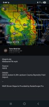
View attachment 37825
Thanks SPC!
Thanks SPC!


Pocahontas is the tornado magnet of Arkansas, it seems.Pocahontas Arkansas storm will probably go tornado warned soon.