WeathermanLeprechaun
Member
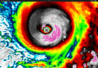
This is the most symmetrical storm I've ever seen, that is absolutely as perfect as you'll get. And this thing still has many hours over water to go SKY HIGH in intensity.
Follow along with the video below to see how to install our site as a web app on your home screen.
Note: This feature may not be available in some browsers.
Very unsettling that we still have 36-48 hours before landfall.This is the most symmetrical storm I've ever seen, that is absolutely as perfect as you'll get. And this thing still has many hours over water to go SKY HIGH in intensity.

Indeed. I'm afraid i can see this thing reaching its ceiling with the MERC done, that is just extra boost. It's like what a nudger does to a supercell, it genuinely boosts itVery unsettling that we still have 36-48 hours before landfall.

Oof. And that's just first pass. What will the winds be?932.4

Jesus....932.4
Yeah I'm thinking they whiffed the eye just a littleOof. And that's just first pass. What will the winds be?
Thinking they missed the eye by a small bit, but even then, 932 and they didn't capture the eye? Yeah, this isn't ideal. Second pass, probably will get a better lookOof. And that's just first pass. What will the winds be?
It's not laminar smooth but those are just mesovorticies.I saw someone say the eye looks a bit ragged, but I'm not seeing any signs of that.
Even just a couple hours ago they had a few reading where winds where near zero.Thinking they missed the eye by a small bit, but even then, 932 and they didn't capture the eye? Yeah, this isn't ideal. Second pass, probably will get a better look