
SmokeEater
Member
And it's TW'd.
Sent from my SM-S901U using Tapatalk
Sent from my SM-S901U using Tapatalk
Follow along with the video below to see how to install our site as a web app on your home screen.
Note: This feature may not be available in some browsers.

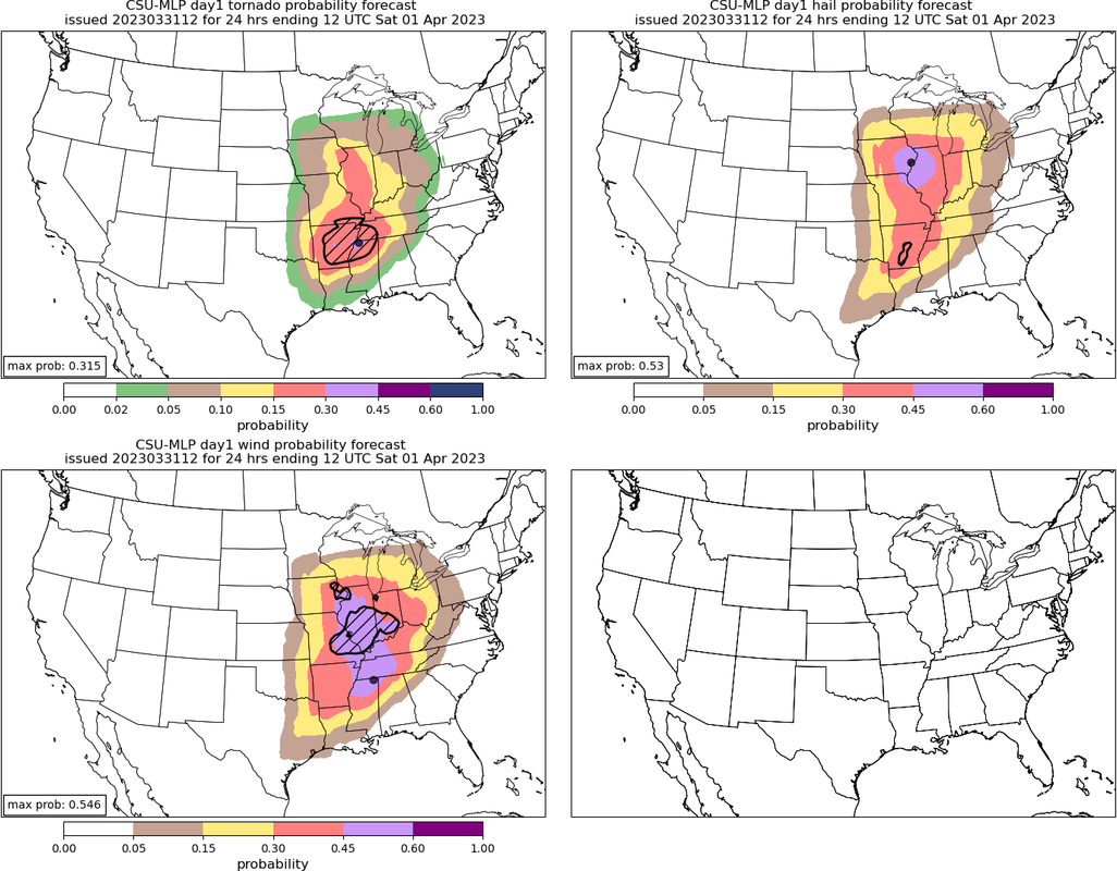

If it holds together, it may go just north, provided there's no wobble, but that's still a very densely-populated area.That Arkansas cell is on a collision course with Little Rock. If that thing puts down a long-tracker this could get ugly really fast.
The soundings I've been looking at don't show as volatile of an atmosphere to work with in NE Miss. Of course, those were just models.I could see that High Risk being expanded eastward to include more of Northeast MS.
