barcncpt44
Member
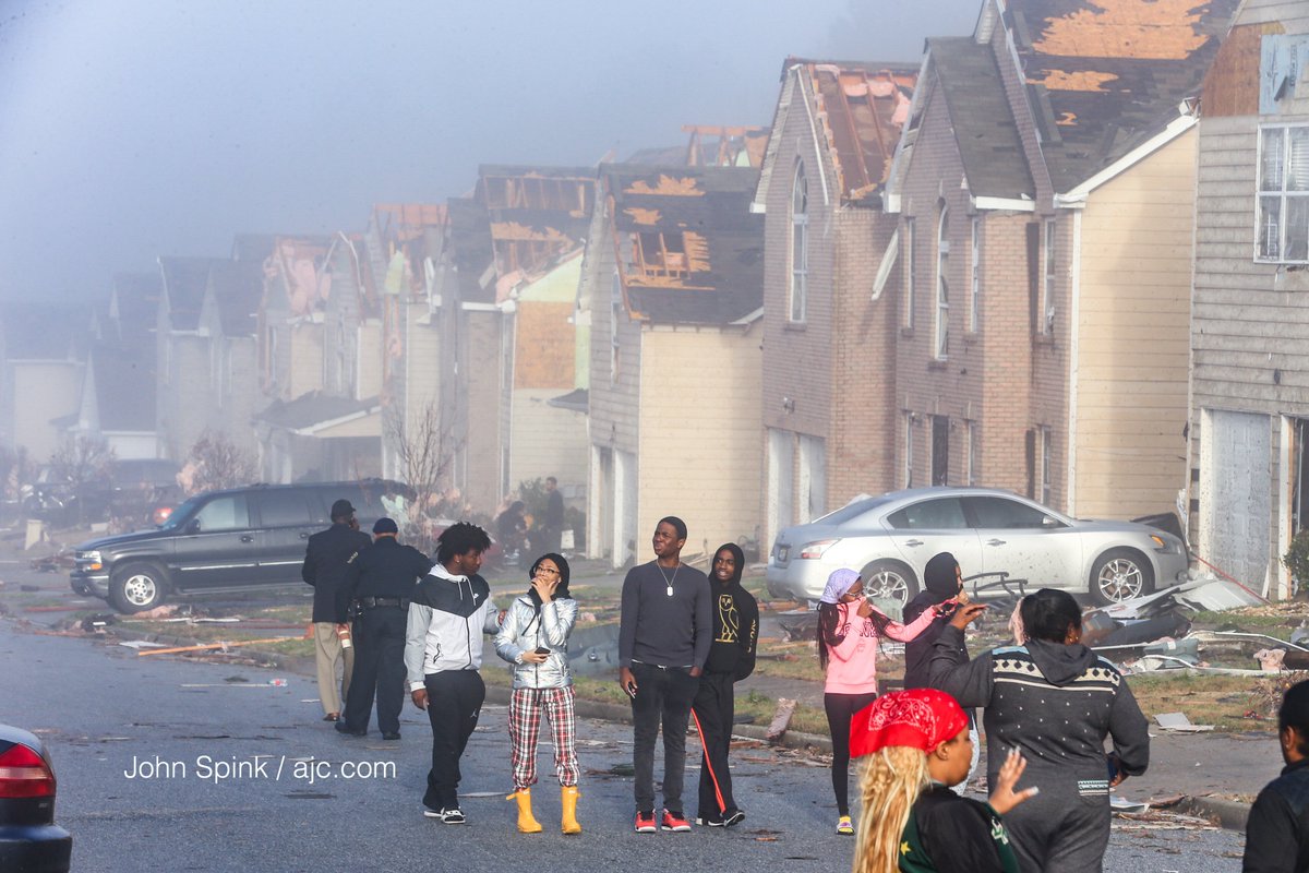
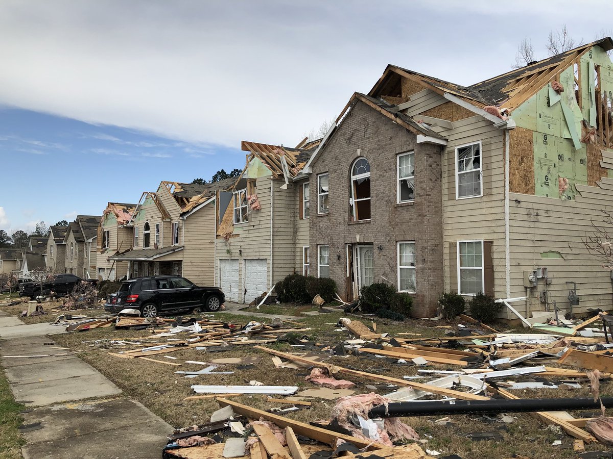
During a press conference, an official from Jacksonville State University said there was major structural damage to several buildings on campus. The entire JSU campus is currently off-limits. Along with a lot of student housing on and off campus severely damaged, it will be interesting to see how JSU finishes the current semester, if at all.
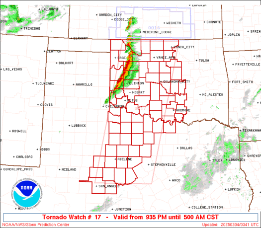
")